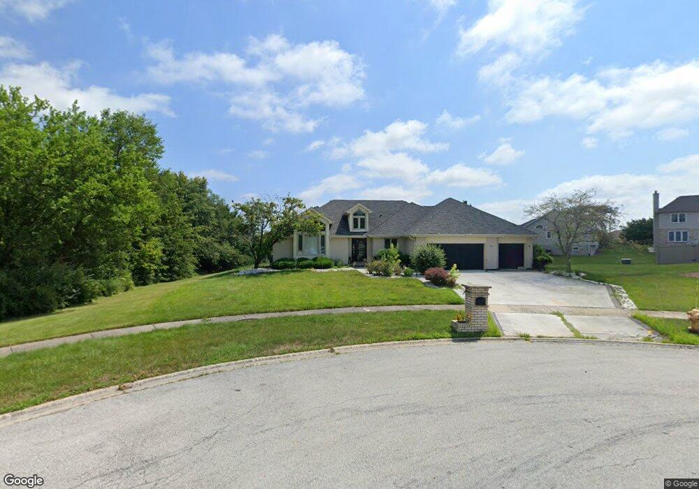
18501 Michael Ct Hazel Crest, IL 60429
Village West NeighborhoodEstimated Value: $482,000 - $605,000
4
Beds
4
Baths
4,480
Sq Ft
$120/Sq Ft
Est. Value
About This Home
This home is located at 18501 Michael Ct, Hazel Crest, IL 60429 and is currently estimated at $538,371, approximately $120 per square foot. 18501 Michael Ct is a home located in Cook County with nearby schools including Flossmoor Hills Elementary School, Parker Junior High School, and Homewood-Flossmoor High School.
Ownership History
Date
Name
Owned For
Owner Type
Purchase Details
Closed on
Dec 22, 2005
Sold by
Dunn Almeda E and Dunn Erwin
Bought by
Chicago Title Land Trust Co and Trust #8002345622
Current Estimated Value
Purchase Details
Closed on
Jan 30, 2004
Sold by
Breckenridge Eva S
Bought by
Wilson Vivian W and Dunn Almeda E
Purchase Details
Closed on
Dec 17, 1999
Sold by
Breckenridge Jackie B and Breckenridge Eva S
Bought by
Breckenridge Jackie B and Breckenridge Eva S
Purchase Details
Closed on
Aug 1, 1994
Sold by
Grand National Bank
Bought by
Breckenridge Jackie B and Breckenridge Eva S
Home Financials for this Owner
Home Financials are based on the most recent Mortgage that was taken out on this home.
Original Mortgage
$302,000
Interest Rate
7.25%
Create a Home Valuation Report for This Property
The Home Valuation Report is an in-depth analysis detailing your home's value as well as a comparison with similar homes in the area
Home Values in the Area
Average Home Value in this Area
Purchase History
| Date | Buyer | Sale Price | Title Company |
|---|---|---|---|
| Chicago Title Land Trust Co | -- | -- | |
| Wilson Vivian W | $500,000 | Atgf Inc | |
| Breckenridge Jackie B | -- | -- | |
| Breckenridge Jackie B | $337,000 | -- |
Source: Public Records
Mortgage History
| Date | Status | Borrower | Loan Amount |
|---|---|---|---|
| Previous Owner | Breckenridge Jackie B | $302,000 |
Source: Public Records
Tax History
| Year | Tax Paid | Tax Assessment Tax Assessment Total Assessment is a certain percentage of the fair market value that is determined by local assessors to be the total taxable value of land and additions on the property. | Land | Improvement |
|---|---|---|---|---|
| 2025 | $24,265 | $46,000 | $13,946 | $32,054 |
| 2024 | $24,265 | $46,000 | $13,946 | $32,054 |
| 2023 | $22,990 | $46,000 | $13,946 | $32,054 |
| 2022 | $22,990 | $31,693 | $12,272 | $19,421 |
| 2021 | $22,714 | $31,693 | $12,272 | $19,421 |
| 2020 | $21,247 | $31,693 | $12,272 | $19,421 |
| 2019 | $25,798 | $37,155 | $11,156 | $25,999 |
| 2018 | $24,804 | $37,155 | $11,156 | $25,999 |
| 2017 | $23,578 | $37,155 | $11,156 | $25,999 |
| 2016 | $18,380 | $29,886 | $10,040 | $19,846 |
| 2015 | $18,113 | $29,886 | $10,040 | $19,846 |
| 2014 | $17,526 | $29,886 | $10,040 | $19,846 |
| 2013 | $10,781 | $25,000 | $10,040 | $14,960 |
Source: Public Records
Map
Nearby Homes
- 3902 Edgewater Dr
- 4445 Provincetown Dr
- 3800 River Rd
- 173 Williamsburg Rd Unit 1
- 3710 Briar Ln
- 4036 W 187th St
- 4521 Provincetown Dr
- 1115 Williamsburg Rd Unit 1
- 1101 Williamsburg Rd Unit 1
- 2295 Windsor Ln
- 2323 Windsor Ln
- 2271 Windsor Ln Unit 2
- 4041 187th Place
- 3712 Beech St
- 18840 Harding Ave
- 3641 Beech St
- 800 Elm St
- 3600 183rd St
- 18600 Village West Dr Unit 310
- 18600 Village West Dr Unit 303
- 3812 Edgewater Dr
- 3814 Edgewater Dr
- 18503 Michael Ct
- 3810 Edgewater Dr
- 3816 Edgewater Dr
- 3817 Carrington Dr
- 3819 Carrington Dr
- 18505 Michael Ct
- 3901 Carrington Dr
- 3818 Edgewater Dr
- 3808 Edgewater Dr
- 3808 Edgewater Dr
- 18507 Michael Ct
- 3815 Carrington Dr
- 3903 Carrington Dr
- 3820 Edgewater Dr
- 3806 Edgewater Dr
- 3806 Edgewater Dr
- 3811 Edgewater Dr
- 3806 Village Dr
Your Personal Tour Guide
Ask me questions while you tour the home.