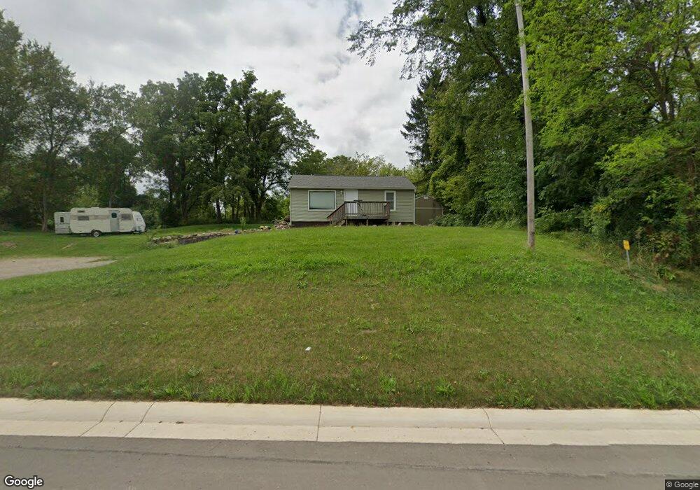
18501 Us Highway 127 Cement City, MI 49233
Estimated Value: $176,000 - $236,000
--
Bed
1
Bath
750
Sq Ft
$261/Sq Ft
Est. Value
About This Home
This home is located at 18501 Us Highway 127, Cement City, MI 49233 and is currently estimated at $195,710, approximately $260 per square foot. 18501 Us Highway 127 is a home located in Lenawee County with nearby schools including Addison Elementary School, Addison Middle School, and Addison High School.
Ownership History
Date
Name
Owned For
Owner Type
Purchase Details
Closed on
Jun 29, 2017
Sold by
Bahlau Daniel Jay and Bahlau Joanne Dorris
Bought by
Fox Leah M
Current Estimated Value
Home Financials for this Owner
Home Financials are based on the most recent Mortgage that was taken out on this home.
Original Mortgage
$95,545
Outstanding Balance
$79,491
Interest Rate
3.94%
Mortgage Type
New Conventional
Estimated Equity
$116,219
Purchase Details
Closed on
Oct 14, 2016
Sold by
Flagstar Bank
Bought by
Bahlau Joanne Dorris and Bahlau Daniel Jay
Purchase Details
Closed on
Feb 14, 2013
Sold by
Myers George P and Myers Michelle L
Bought by
Flagstar Bank Fsb
Purchase Details
Closed on
Feb 15, 2006
Sold by
Wagner Stacy L
Bought by
Myers George P and Myers Michelle L
Create a Home Valuation Report for This Property
The Home Valuation Report is an in-depth analysis detailing your home's value as well as a comparison with similar homes in the area
Home Values in the Area
Average Home Value in this Area
Purchase History
| Date | Buyer | Sale Price | Title Company |
|---|---|---|---|
| Fox Leah M | $98,500 | Prestige Title | |
| Bahlau Joanne Dorris | $24,500 | Vantage Point Title | |
| Flagstar Bank Fsb | -- | None Available | |
| Myers George P | $93,000 | None Available |
Source: Public Records
Mortgage History
| Date | Status | Borrower | Loan Amount |
|---|---|---|---|
| Open | Fox Leah M | $95,545 |
Source: Public Records
Tax History Compared to Growth
Tax History
| Year | Tax Paid | Tax Assessment Tax Assessment Total Assessment is a certain percentage of the fair market value that is determined by local assessors to be the total taxable value of land and additions on the property. | Land | Improvement |
|---|---|---|---|---|
| 2025 | $1,554 | $72,600 | $0 | $0 |
| 2024 | $719 | $67,800 | $0 | $0 |
| 2023 | -- | $60,100 | $0 | $0 |
| 2022 | $1,131 | $54,200 | $0 | $0 |
| 2021 | $1,103 | $51,900 | $0 | $0 |
| 2020 | $1,076 | $42,600 | $0 | $0 |
| 2019 | $133,400 | $42,600 | $0 | $0 |
| 2018 | $1,179 | $0 | $0 | $0 |
| 2017 | $1,942 | $0 | $0 | $0 |
| 2016 | $1,889 | $0 | $0 | $0 |
| 2014 | -- | $0 | $0 | $0 |
Source: Public Records
Map
Nearby Homes
- 14581 Glenbeigh Ln
- 14429 Kildare Ln
- 14408 Kildare Ln
- 14378 Kildare Ln
- 17475 U S 223
- 14391 Killybegs Ln
- V/L E Chicago Rd
- 14601 Brookhurst Dr
- 14750 Hilltop Dr
- 13778 Shannon Dr
- 9010 U S 127
- 19900 Lewis Rd
- 13912 Grandpoint Dr
- 10400 Ferris Ct
- 13832 Grandview Dr
- 506 Lewis Rd
- 10911 Woodbrook Dr
- 10568 Woodbrook Dr
- 10421 E Greenlawn Dr
- 10497 S Jackson Rd
- 18501 Us Highway 127
- 18501 Us Highway 127
- 18557 Us Highway 127
- 18297 U S 127
- 18000 Us Highway 127
- 18000 Us Highway 127 Unit BLK
- 18000 Us Highway 127 Unit BLK
- 18000 Us Highway 127 Unit BLK
- 18000 Us Highway 127 Unit BLK
- 18000 Us-127
- 18000 N Us 127 Block
- 18297 Us Highway 127
- 18301 Us Highway 127
- 17575 U S 223
- 18700 Us Highway 127
- 18511 Us Highway 127
- 17000 U S 223
- 10480 Us Highway 127
- 10400 Briggs Hwy
- 18297 Us 127