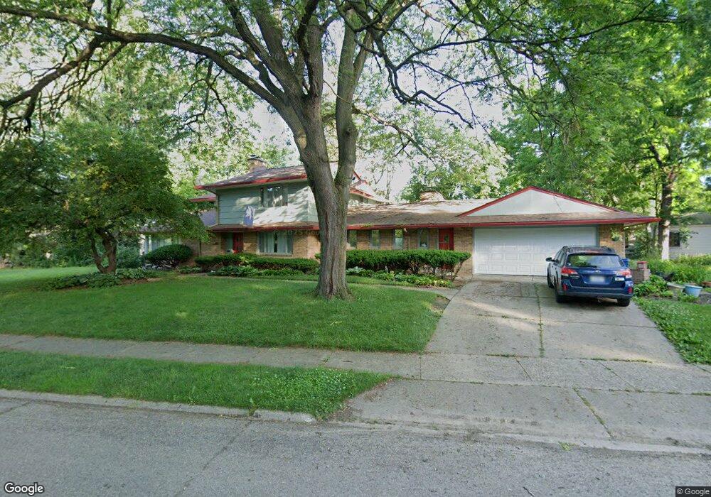
1851 Brookside Dr Flint, MI 48503
College Cultural Neighborhood NeighborhoodEstimated Value: $265,000 - $296,000
4
Beds
3
Baths
3,091
Sq Ft
$92/Sq Ft
Est. Value
About This Home
This home is located at 1851 Brookside Dr, Flint, MI 48503 and is currently estimated at $285,616, approximately $92 per square foot. 1851 Brookside Dr is a home located in Genesee County with nearby schools including Pierce Elementary School, Flint Southwestern Classical Academy, and Flint Cultural Center Academy.
Ownership History
Date
Name
Owned For
Owner Type
Purchase Details
Closed on
Dec 3, 2020
Sold by
Stevens John H and Dalton Brenda L
Bought by
Hutchison Thomas and Hutchison Micah
Current Estimated Value
Create a Home Valuation Report for This Property
The Home Valuation Report is an in-depth analysis detailing your home's value as well as a comparison with similar homes in the area
Home Values in the Area
Average Home Value in this Area
Purchase History
| Date | Buyer | Sale Price | Title Company |
|---|---|---|---|
| Hutchison Thomas | $195,750 | Select Title Company | |
| Stevens Dalton Family Trust | -- | None Available |
Source: Public Records
Tax History
| Year | Tax Paid | Tax Assessment Tax Assessment Total Assessment is a certain percentage of the fair market value that is determined by local assessors to be the total taxable value of land and additions on the property. | Land | Improvement |
|---|---|---|---|---|
| 2025 | $6,707 | $168,800 | $0 | $0 |
| 2024 | $5,877 | $160,100 | $0 | $0 |
| 2023 | $5,657 | $133,000 | $0 | $0 |
| 2022 | $0 | $111,800 | $0 | $0 |
| 2021 | $6,015 | $106,100 | $0 | $0 |
| 2020 | $1,959 | $100,200 | $0 | $0 |
| 2019 | $1,875 | $102,000 | $0 | $0 |
| 2018 | $1,988 | $77,000 | $0 | $0 |
| 2017 | $1,920 | $0 | $0 | $0 |
| 2016 | $1,905 | $0 | $0 | $0 |
| 2015 | -- | $0 | $0 | $0 |
| 2014 | -- | $0 | $0 | $0 |
| 2012 | -- | $45,000 | $0 | $0 |
Source: Public Records
Map
Nearby Homes
- 1510 S Franklin Ave
- 1210 Blanchard Ave
- 2013 E Court St
- 2119 Mountain Ave
- 915 E 8th St
- 1851 Seymour Ave
- 605 S Lynch St
- 1814 Mcphail St
- 1840 Mcphail St
- 915 E Court #206 St Unit 206
- 915 E Court St
- 1720 Park St
- 434 Chalmers St
- 2010 Crocker Ave
- 2033 Seymour Ave
- 1930 Owen St
- 9211 Owen St
- 420 Pingree Ave
- 710 Pierson St
- 2050 Ferris Ave
- 1134 S Franklin Ave
- 1201 Kensington Ave
- 1205 Kensington Ave
- 1137 Kensington Ave
- 1209 Kensington Ave
- 1130 S Franklin Ave
- 1213 Kensington Ave
- 1129 Kensington Ave
- 1126 S Franklin Ave
- 1401 S Franklin Ave
- 1125 Kensington Ave
- 1122 S Franklin Ave
- 1217 Kensington Ave
- 1820 Brookside Dr
- 1121 Kensington Ave
- 1118 S Franklin Ave
- 1138 Kensington Ave
- 1117 Kensington Ave
- 1121 S Franklin Ave
- 1210 Kensington Ave
Your Personal Tour Guide
Ask me questions while you tour the home.