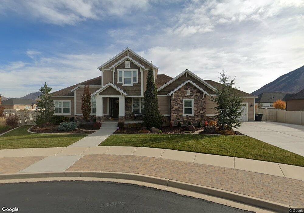
1851 S 1650 E Spanish Fork, UT 84660
Estimated Value: $781,000 - $949,000
4
Beds
3
Baths
4,871
Sq Ft
$176/Sq Ft
Est. Value
About This Home
This home is located at 1851 S 1650 E, Spanish Fork, UT 84660 and is currently estimated at $857,538, approximately $176 per square foot. 1851 S 1650 E is a home located in Utah County with nearby schools including Canyon Elementary School, Spanish Fork Jr High School, and Spanish Fork High School.
Ownership History
Date
Name
Owned For
Owner Type
Purchase Details
Closed on
Apr 27, 2015
Sold by
Altitude Homes Llc
Bought by
Graff Jeff and Graff Marylynne
Current Estimated Value
Home Financials for this Owner
Home Financials are based on the most recent Mortgage that was taken out on this home.
Original Mortgage
$364,800
Outstanding Balance
$282,247
Interest Rate
3.8%
Mortgage Type
New Conventional
Estimated Equity
$575,291
Purchase Details
Closed on
Mar 7, 2014
Sold by
Gardner Pioneer Ridge L C
Bought by
Altitude Homes Llc
Home Financials for this Owner
Home Financials are based on the most recent Mortgage that was taken out on this home.
Original Mortgage
$264,458
Interest Rate
4.29%
Mortgage Type
Purchase Money Mortgage
Create a Home Valuation Report for This Property
The Home Valuation Report is an in-depth analysis detailing your home's value as well as a comparison with similar homes in the area
Home Values in the Area
Average Home Value in this Area
Purchase History
| Date | Buyer | Sale Price | Title Company |
|---|---|---|---|
| Graff Jeff | -- | Keystone Title Ins Agen | |
| Altitude Homes Llc | -- | Cottonwood Title Ins Agency |
Source: Public Records
Mortgage History
| Date | Status | Borrower | Loan Amount |
|---|---|---|---|
| Open | Graff Jeff | $364,800 | |
| Previous Owner | Altitude Homes Llc | $264,458 |
Source: Public Records
Tax History Compared to Growth
Tax History
| Year | Tax Paid | Tax Assessment Tax Assessment Total Assessment is a certain percentage of the fair market value that is determined by local assessors to be the total taxable value of land and additions on the property. | Land | Improvement |
|---|---|---|---|---|
| 2025 | $3,927 | $449,240 | $264,600 | $552,200 |
| 2024 | $3,927 | $404,800 | $0 | $0 |
| 2023 | $4,029 | $415,745 | $0 | $0 |
| 2022 | $3,855 | $390,115 | $0 | $0 |
| 2021 | $3,475 | $562,600 | $179,100 | $383,500 |
| 2020 | $3,229 | $508,300 | $162,800 | $345,500 |
| 2019 | $2,993 | $495,700 | $155,200 | $340,500 |
| 2018 | $2,741 | $438,800 | $132,500 | $306,300 |
| 2017 | $2,564 | $220,605 | $0 | $0 |
| 2016 | $2,495 | $211,805 | $0 | $0 |
| 2015 | $975 | $81,800 | $0 | $0 |
| 2014 | $944 | $79,500 | $0 | $0 |
Source: Public Records
Map
Nearby Homes
- 1907 E 1960 S
- 1341 E 1670 S Unit 819
- 1333 E 1670 S Unit 816
- 1339 E 1670 S Unit 818
- 1334 E 1670 S Unit 822
- 1296 E 1670 S Unit 910
- 1336 E 1670 S Unit 821
- 1337 E 1670 S Unit 817
- 1338 E 1670 S Unit 820
- 1332 E 1670 S Unit 823
- 1298 E 1670 S Unit 909
- 1591 E 1550 S
- 2012 E 1630 S
- 357 E 1460 S Unit 45
- 385 E 1460 S Unit 47
- 379 E 1460 S Unit 46
- 417 E 1460 S Unit 48
- 332 E 1460 S Unit 56
- 1931 E 1400 S
- 1547 S 2120 E
- 1869 S 1650 E Unit 18
- 1831 S 1650 E Unit 16
- 1868 S Vincent Ridge Dr Unit 21
- 1842 S 1650 E Unit 14
- 1842 S 1650 E
- 1834 S 1650 E
- 1868 S Vincent Ridge Dr Unit 21
- 1679 E 1900 S
- 1874 S 1650 E
- 1662 E 1790 S
- 1656 E 1790 S
- 1862 S Vincent Ridge Dr
- 1891 S 1700 E
- 1722 E 1850 S
- 1641 E 1900 S
- 1888 S Vincent Ridge Dr Unit 22
- 1868 E 1900 S Unit 29
- 1560 S 1700 St E
- 1849 S 1600 E Unit 9
- 1888 S Vincent Ridge Dr Unit 22