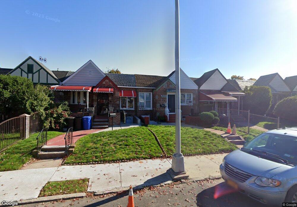
18514 Dunlop Ave Saint Albans, NY 11412
Hollis NeighborhoodEstimated Value: $579,000 - $783,000
--
Bed
--
Bath
968
Sq Ft
$680/Sq Ft
Est. Value
About This Home
This home is located at 18514 Dunlop Ave, Saint Albans, NY 11412 and is currently estimated at $658,515, approximately $680 per square foot. 18514 Dunlop Ave is a home located in Queens County with nearby schools including P.S. 118 Lorraine Hansberry, I.S. 192 The Linden, and Wellspring Elementary & Middle.
Ownership History
Date
Name
Owned For
Owner Type
Purchase Details
Closed on
Mar 7, 1995
Sold by
Havertong Edward
Bought by
Wallace Ashe Lois G
Current Estimated Value
Home Financials for this Owner
Home Financials are based on the most recent Mortgage that was taken out on this home.
Original Mortgage
$109,918
Interest Rate
8.66%
Mortgage Type
FHA
Purchase Details
Closed on
Aug 10, 1994
Sold by
Johnson Cecelia and Forrester Katherine
Bought by
Havertong Edward
Create a Home Valuation Report for This Property
The Home Valuation Report is an in-depth analysis detailing your home's value as well as a comparison with similar homes in the area
Home Values in the Area
Average Home Value in this Area
Purchase History
| Date | Buyer | Sale Price | Title Company |
|---|---|---|---|
| Wallace Ashe Lois G | $110,000 | Chicago Title Insurance Co | |
| Havertong Edward | $70,000 | -- |
Source: Public Records
Mortgage History
| Date | Status | Borrower | Loan Amount |
|---|---|---|---|
| Closed | Wallace Ashe Lois G | $109,918 |
Source: Public Records
Tax History Compared to Growth
Tax History
| Year | Tax Paid | Tax Assessment Tax Assessment Total Assessment is a certain percentage of the fair market value that is determined by local assessors to be the total taxable value of land and additions on the property. | Land | Improvement |
|---|---|---|---|---|
| 2025 | $4,436 | $24,780 | $7,530 | $17,250 |
| 2024 | $4,448 | $23,488 | $7,875 | $15,613 |
| 2023 | $4,379 | $23,201 | $6,640 | $16,561 |
| 2022 | $4,083 | $33,240 | $10,320 | $22,920 |
| 2021 | $4,050 | $27,540 | $10,320 | $17,220 |
| 2020 | $4,075 | $24,720 | $10,320 | $14,400 |
| 2019 | $3,802 | $24,420 | $10,320 | $14,100 |
| 2018 | $3,644 | $19,334 | $7,975 | $11,359 |
| 2017 | $3,419 | $18,240 | $8,191 | $10,049 |
| 2016 | $3,130 | $18,240 | $8,191 | $10,049 |
| 2015 | $1,856 | $17,208 | $10,207 | $7,001 |
| 2014 | $1,856 | $16,311 | $11,247 | $5,064 |
Source: Public Records
Map
Nearby Homes
- 183-67 Dunlop Ave
- 187-23 Brinkerhoff Ave
- 183-29 Brinkerhoff Ave
- 183-09 Dunlop Ave
- 183-12 Elmira Ave
- 104-11 188th St
- 183-34 Fonda Ave
- 186-16 Hilburn Ave
- 10533 Farmers Blvd
- 102-35 187th St
- 188-31 Jordan Ave
- 19027 109th Rd
- 102-13 183rd Place
- 111-06 Farmers Blvd
- 187-44 Jordan Ave
- 10211 187th St
- 10532 192nd St
- 10220 189th St
- 188-25 Mangin Ave
- 18823 Mangin Ave
- 18512 Dunlop Ave
- 18516 Dunlop Ave
- 185-16 Dunlop Ave
- 18510 Dunlop Ave
- 18518 Dunlop Ave
- 18508 Dunlop Ave
- 185-20 Dunlop Ave
- 18508 Dunlop Ave
- 18520 Dunlop Ave
- 185-06 Dunlop Ave
- 18506 Dunlop Ave
- 18524 Dunlop Ave
- 18613 Elmira Ave
- 18617 Elmira Ave
- 18504 Dunlop Ave
- 18609 Elmira Ave
- 18526 Dunlop Ave
- 185-26 Dunlop Ave
- 18621 Elmira Ave
- 18605 Elmira Ave