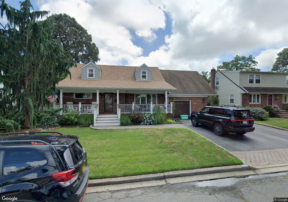
1852 Carroll Ave Merrick, NY 11566
Estimated Value: $956,465 - $1,045,000
--
Bed
2
Baths
2,214
Sq Ft
$452/Sq Ft
Est. Value
About This Home
This home is located at 1852 Carroll Ave, Merrick, NY 11566 and is currently estimated at $1,000,733, approximately $452 per square foot. 1852 Carroll Ave is a home located in Nassau County with nearby schools including Burcham Elementary School, Merrick Avenue Middle School, and Waynoka High School.
Ownership History
Date
Name
Owned For
Owner Type
Purchase Details
Closed on
Mar 24, 2014
Sold by
Okeefe Arthur and Okeefe Susan
Bought by
Sweeney Matthew J and Murphy Sweeney Christine
Current Estimated Value
Home Financials for this Owner
Home Financials are based on the most recent Mortgage that was taken out on this home.
Original Mortgage
$400,000
Outstanding Balance
$303,071
Interest Rate
4.33%
Mortgage Type
Purchase Money Mortgage
Estimated Equity
$697,663
Purchase Details
Closed on
May 12, 2005
Sold by
Okeefe Arthur
Create a Home Valuation Report for This Property
The Home Valuation Report is an in-depth analysis detailing your home's value as well as a comparison with similar homes in the area
Home Values in the Area
Average Home Value in this Area
Purchase History
| Date | Buyer | Sale Price | Title Company |
|---|---|---|---|
| Sweeney Matthew J | $550,000 | Land Bound Services Llc | |
| -- | -- | -- |
Source: Public Records
Mortgage History
| Date | Status | Borrower | Loan Amount |
|---|---|---|---|
| Open | Sweeney Matthew J | $400,000 |
Source: Public Records
Tax History Compared to Growth
Tax History
| Year | Tax Paid | Tax Assessment Tax Assessment Total Assessment is a certain percentage of the fair market value that is determined by local assessors to be the total taxable value of land and additions on the property. | Land | Improvement |
|---|---|---|---|---|
| 2025 | $15,579 | $572 | $205 | $367 |
| 2024 | $4,341 | $596 | $214 | $382 |
| 2023 | $14,208 | $628 | $226 | $402 |
| 2022 | $14,208 | $624 | $224 | $400 |
| 2021 | $17,939 | $635 | $214 | $421 |
| 2020 | $13,421 | $826 | $549 | $277 |
| 2019 | $13,973 | $866 | $459 | $407 |
| 2018 | $13,775 | $866 | $0 | $0 |
| 2017 | $9,030 | $938 | $576 | $362 |
| 2016 | $13,226 | $938 | $576 | $362 |
| 2015 | $3,874 | $938 | $576 | $362 |
| 2014 | $3,874 | $938 | $576 | $362 |
| 2013 | $3,619 | $938 | $576 | $362 |
Source: Public Records
Map
Nearby Homes
- 1911 Carroll Ave
- 96 Thelma Ave
- 1729 Gormley Ave
- 1931 Miller Place
- 1800 Remson Ave
- 1938 Meadowbrook Rd
- 1772 Rose St
- 19 Margaret Blvd
- 1894 Commonwealth Ave
- 2 Garfield St
- 1800 Stuyvesant Ave
- 12 Washington Dr
- 2203 Washington St
- 160 Bedford Ave
- 138 Hewlett Ave
- 1680 Lake Ave
- 1617 Richard Ave
- 78 Jesse St
- 1800 Carlisle Place
- 49 Elizabeth St
- 1846 Carroll Ave
- 1860 Carroll Ave
- 1851 Gormley Ave
- 1843 Gormley Ave
- 1857 Gormley Ave
- 1840 Carroll Ave
- 1866 Carroll Ave
- 1853 Carroll Ave
- 1847 Carroll Ave
- 1859 Carroll Ave
- 1837 Gormley Ave
- 1841 Carroll Ave
- 1863 Gormley Ave
- 1830 Carroll Ave
- 1872 Carroll Ave
- 1837 Carroll Ave
- 1865 Carroll Ave
- 166 Gormley Ave
- 1831 Carroll Ave
- 1878 Carroll Ave