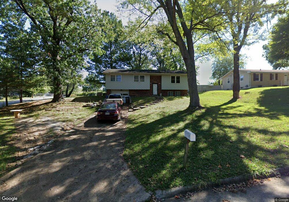
1852 Rampart St Cape Girardeau, MO 63701
Estimated Value: $183,000 - $236,000
3
Beds
3
Baths
1,208
Sq Ft
$177/Sq Ft
Est. Value
About This Home
This home is located at 1852 Rampart St, Cape Girardeau, MO 63701 and is currently estimated at $213,722, approximately $176 per square foot. 1852 Rampart St is a home with nearby schools including Alma Schrader Elementary School, Central Middle School, and Central Junior High School.
Ownership History
Date
Name
Owned For
Owner Type
Purchase Details
Closed on
Mar 27, 2025
Sold by
Vanderpool Alicia Marie and Tucker Alicia M
Bought by
Tucker Alicia M and Tucker Raymond E
Current Estimated Value
Home Financials for this Owner
Home Financials are based on the most recent Mortgage that was taken out on this home.
Original Mortgage
$75,500
Outstanding Balance
$75,179
Interest Rate
6.87%
Mortgage Type
New Conventional
Estimated Equity
$138,543
Purchase Details
Closed on
Nov 14, 2007
Sold by
Us Bank Na
Bought by
Vanderpool Alicia Marie and Vanderpool Merle Owen
Home Financials for this Owner
Home Financials are based on the most recent Mortgage that was taken out on this home.
Original Mortgage
$102,000
Interest Rate
6.43%
Mortgage Type
New Conventional
Purchase Details
Closed on
Aug 2, 2007
Sold by
Leible Charles and Leible Terri
Bought by
Us Bank National Association and Fidelity National Foreclosure Solution
Create a Home Valuation Report for This Property
The Home Valuation Report is an in-depth analysis detailing your home's value as well as a comparison with similar homes in the area
Home Values in the Area
Average Home Value in this Area
Purchase History
| Date | Buyer | Sale Price | Title Company |
|---|---|---|---|
| Tucker Alicia M | -- | None Listed On Document | |
| Vanderpool Alicia Marie | -- | None Available | |
| Us Bank National Association | -- | None Available |
Source: Public Records
Mortgage History
| Date | Status | Borrower | Loan Amount |
|---|---|---|---|
| Open | Tucker Alicia M | $75,500 | |
| Previous Owner | Vanderpool Alicia Marie | $102,000 |
Source: Public Records
Tax History Compared to Growth
Tax History
| Year | Tax Paid | Tax Assessment Tax Assessment Total Assessment is a certain percentage of the fair market value that is determined by local assessors to be the total taxable value of land and additions on the property. | Land | Improvement |
|---|---|---|---|---|
| 2025 | $11 | $21,300 | $2,900 | $18,400 |
| 2024 | $11 | $20,280 | $2,760 | $17,520 |
| 2023 | $1,054 | $20,280 | $2,760 | $17,520 |
| 2022 | $972 | $18,690 | $2,540 | $16,150 |
| 2021 | $972 | $18,690 | $2,540 | $16,150 |
| 2020 | $975 | $18,690 | $2,540 | $16,150 |
| 2019 | $973 | $18,690 | $0 | $0 |
| 2018 | $971 | $18,690 | $0 | $0 |
| 2017 | $2,198 | $18,690 | $0 | $0 |
| 2016 | $970 | $18,690 | $0 | $0 |
| 2015 | $970 | $18,690 | $0 | $0 |
| 2014 | $975 | $18,690 | $0 | $0 |
Source: Public Records
Map
Nearby Homes
- 1966 Randol Ave
- 1705 Paul Revere Dr
- 2137 Wood Hollow Ct
- 2520 Horseshoe Ridge
- 2519 Horseshoe Ridge
- 2550 Marvin St
- 2528 Palomino Dr
- 2415 Perryville Rd
- 1938 Westwood Dr
- 2085 Derbyshire Ln
- 1960 Briarwood Dr
- 2412 Masters Dr
- 2206 Derbyshire Ln
- 2062 Concord Place
- 1246 Marilyn Dr
- 1701 Brookwood Dr
- 1623 Lexington Ave
- 1912 Perryville Rd
- 2449 Janet Dr
- 1107 Dorothy St
- 1842 Rampart St
- 1853 Belleridge Pike
- 1853 Rampart St
- 1832 Rampart St
- 1843 Rampart St
- 1903 Belleridge Pike
- 1833 Belleridge Pike
- 1903 Rampart St
- 1914 Rampart St
- 1833 Rampart St
- 1913 Belleridge
- 1822 Rampart St
- 1842 Belleridge Pike
- 1913 Rampart St
- 1852 Belleridge Pike
- 1823 Belleridge Pike
- 1823 Rampart St
- 1842 Dixie Blvd
- 1902 Belleridge Pike