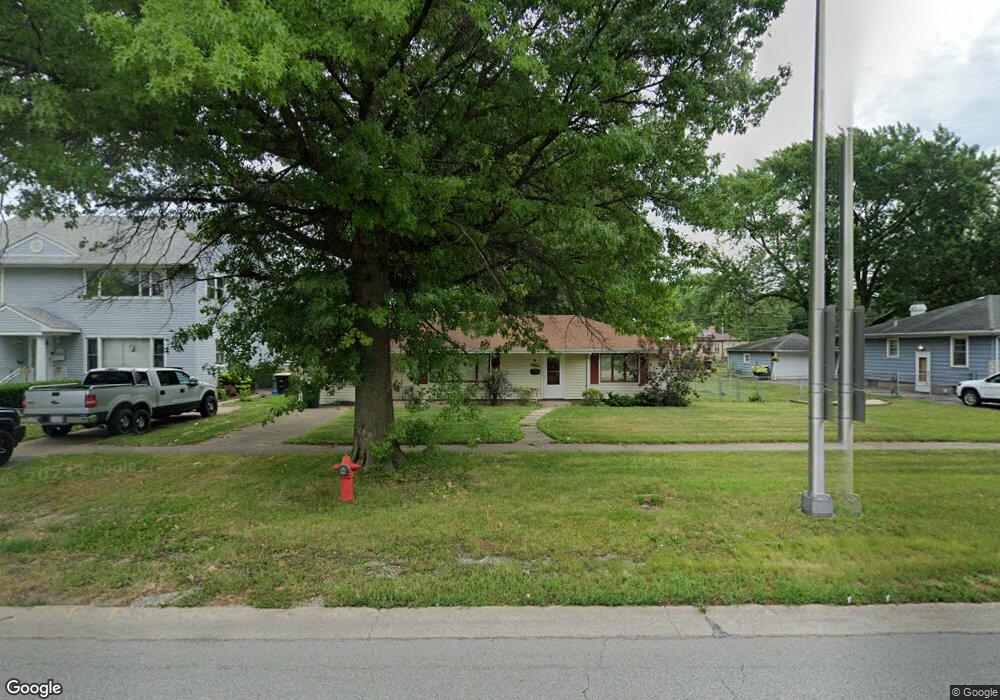
18525 Burnham Ave Lansing, IL 60438
Estimated Value: $160,000 - $242,000
2
Beds
1
Bath
1,510
Sq Ft
$133/Sq Ft
Est. Value
About This Home
This home is located at 18525 Burnham Ave, Lansing, IL 60438 and is currently estimated at $201,170, approximately $133 per square foot. 18525 Burnham Ave is a home located in Cook County with nearby schools including Coolidge Elementary School, Memorial Jr High School, and Thornton Fractnl So High School.
Ownership History
Date
Name
Owned For
Owner Type
Purchase Details
Closed on
Dec 1, 2016
Sold by
Chicago Title Land Trust Co
Bought by
Clark Jennifer L
Current Estimated Value
Home Financials for this Owner
Home Financials are based on the most recent Mortgage that was taken out on this home.
Original Mortgage
$58,600
Outstanding Balance
$48,353
Interest Rate
4.25%
Mortgage Type
New Conventional
Estimated Equity
$152,817
Create a Home Valuation Report for This Property
The Home Valuation Report is an in-depth analysis detailing your home's value as well as a comparison with similar homes in the area
Home Values in the Area
Average Home Value in this Area
Purchase History
| Date | Buyer | Sale Price | Title Company |
|---|---|---|---|
| Clark Jennifer L | $63,000 | Chicago Title Land Trust Com |
Source: Public Records
Mortgage History
| Date | Status | Borrower | Loan Amount |
|---|---|---|---|
| Open | Clark Jennifer L | $58,600 |
Source: Public Records
Tax History Compared to Growth
Tax History
| Year | Tax Paid | Tax Assessment Tax Assessment Total Assessment is a certain percentage of the fair market value that is determined by local assessors to be the total taxable value of land and additions on the property. | Land | Improvement |
|---|---|---|---|---|
| 2024 | $2,436 | $7,025 | $1,719 | $5,306 |
| 2023 | $1,764 | $7,025 | $1,719 | $5,306 |
| 2022 | $1,764 | $4,767 | $1,484 | $3,283 |
| 2021 | $1,750 | $4,766 | $1,484 | $3,282 |
| 2020 | $1,704 | $4,766 | $1,484 | $3,282 |
| 2019 | $1,661 | $4,976 | $1,250 | $3,726 |
| 2018 | $1,629 | $4,976 | $1,250 | $3,726 |
| 2017 | $1,665 | $4,976 | $1,250 | $3,726 |
| 2016 | $1,475 | $4,196 | $1,171 | $3,025 |
| 2015 | $1,332 | $4,196 | $1,171 | $3,025 |
| 2014 | $1,330 | $4,196 | $1,171 | $3,025 |
| 2013 | $1,729 | $5,418 | $1,171 | $4,247 |
Source: Public Records
Map
Nearby Homes
- 3225 Otto St
- 18315 Burnham Ave Unit 204
- 18302 Roy St
- 2934 186th St
- 18602 Chicago Ave
- 18429 Ridgewood Ave
- 18514 Ridgewood Ave
- 18275 Ada St
- 3445 N Schultz Dr
- 18316 Sherman St
- 18828 Greenbay Ave
- 18301 Chicago Ave
- 18747 Sherman St
- 18855 Burnham Ave Unit 234
- 18855 Burnham Ave Unit 132
- 18855 Burnham Ave Unit 231
- 18452 Oakwood Ave
- 18864 Greenbay Ave
- 2950 188th Place
- 18504 Wentworth Ave
- 18525 Burnham Ave
- 18525 Burnham Ave
- 18535 Burnham Ave
- 18535 Burnham Ave
- 18519 Burnham Ave
- 18539 Burnham Ave
- 18539 Burnham Ave
- 18515 Burnham Ave
- 18515 Burnham Ave
- 18545 Burnham Ave
- 18545 Burnham Ave
- 18530 Walter St
- 18522 Walter St
- 18522 Walter St
- 18518 Walter St
- 18536 Walter St
- 18511 Burnham Ave
- 18514 Walter St
- 3218 186th St
- 3218 186th St