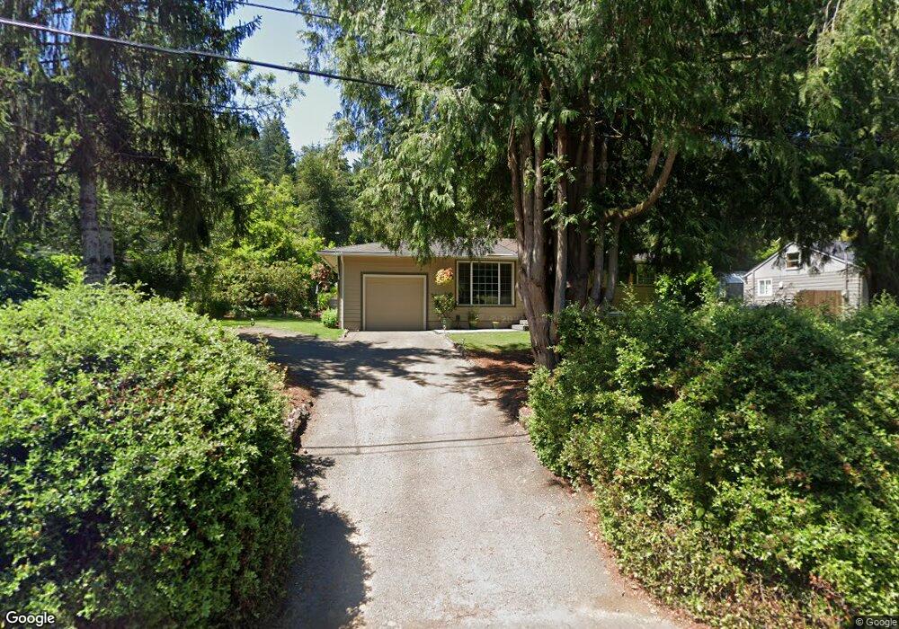
18525 Lower Midhill Dr West Linn, OR 97068
Robinwood NeighborhoodEstimated Value: $388,000 - $450,000
2
Beds
1
Bath
748
Sq Ft
$571/Sq Ft
Est. Value
About This Home
This home is located at 18525 Lower Midhill Dr, West Linn, OR 97068 and is currently estimated at $426,792, approximately $570 per square foot. 18525 Lower Midhill Dr is a home located in Clackamas County with nearby schools including Cedaroak Park Primary School, West Linn High School, and Harmony Academy.
Ownership History
Date
Name
Owned For
Owner Type
Purchase Details
Closed on
Sep 5, 2001
Sold by
Benko Robert and Benko Judy K
Bought by
Swart John R
Current Estimated Value
Home Financials for this Owner
Home Financials are based on the most recent Mortgage that was taken out on this home.
Original Mortgage
$136,700
Outstanding Balance
$52,939
Interest Rate
7.05%
Estimated Equity
$373,853
Purchase Details
Closed on
Jun 25, 1998
Sold by
Rivord Christopher L
Bought by
Benko Robert and Benko Judy K
Home Financials for this Owner
Home Financials are based on the most recent Mortgage that was taken out on this home.
Original Mortgage
$92,000
Interest Rate
7.06%
Create a Home Valuation Report for This Property
The Home Valuation Report is an in-depth analysis detailing your home's value as well as a comparison with similar homes in the area
Home Values in the Area
Average Home Value in this Area
Purchase History
| Date | Buyer | Sale Price | Title Company |
|---|---|---|---|
| Swart John R | $143,900 | Ticor Title | |
| Benko Robert | $115,000 | Fidelity National Title Co |
Source: Public Records
Mortgage History
| Date | Status | Borrower | Loan Amount |
|---|---|---|---|
| Open | Swart John R | $136,700 | |
| Previous Owner | Benko Robert | $92,000 |
Source: Public Records
Tax History Compared to Growth
Tax History
| Year | Tax Paid | Tax Assessment Tax Assessment Total Assessment is a certain percentage of the fair market value that is determined by local assessors to be the total taxable value of land and additions on the property. | Land | Improvement |
|---|---|---|---|---|
| 2025 | $3,041 | $157,799 | -- | -- |
| 2024 | $2,927 | $153,203 | -- | -- |
| 2023 | $2,927 | $148,741 | $0 | $0 |
| 2022 | $2,763 | $144,409 | $0 | $0 |
| 2021 | $2,623 | $140,203 | $0 | $0 |
| 2020 | $2,641 | $136,120 | $0 | $0 |
| 2019 | $2,518 | $132,156 | $0 | $0 |
| 2018 | $2,406 | $128,307 | $0 | $0 |
| 2017 | $2,312 | $124,570 | $0 | $0 |
| 2016 | $2,253 | $120,942 | $0 | $0 |
| 2015 | $2,188 | $117,419 | $0 | $0 |
| 2014 | $2,107 | $113,999 | $0 | $0 |
Source: Public Records
Map
Nearby Homes
- 2041 Marylhurst Dr
- 18194 Shady Hollow Way
- 18711 Willamette Dr
- 2636 Maria Ct
- 2167 Marylwood Ct
- 3340 Arbor Dr
- 2455 College Hill Place
- 17833 Marylcreek Dr
- 1354 Skye Pkwy
- 19661 Sun Cir
- 1397 Skye Pkwy
- 18649 Old River Dr
- 1384 Celtic Ct
- 4400 Calaroga Dr
- 17634 Brookhurst Dr
- 3777 Parkwood Way
- 1611 Arran Ct
- 17623 Brookhurst Dr
- 1777 Skyland Dr
- 3446 Fernvilla Dr
- 18485 Lower Midhill Dr
- 18575 Lower Midhill Dr
- 2655 Marylhurst Dr-New Mill
- 18445 Lower Midhill Dr
- 2671 Marylhurst Dr
- 18933 Upper Midhill Dr
- 2615 Marylhurst Dr
- 18510 Lower Midhill Dr
- 18490 Lower Midhill Dr
- 18470 Lower Midhill Dr
- 18835 Upper Midhill Dr
- 18395 Lower Midhill Dr
- 2797 Marylhurst Dr
- 2777 Marylhurst Dr
- 18430 Lower Midhill Dr
- 2757 Marylhurst Dr
- 18819 Upper Midhill Dr
- 2622 Marylhurst Dr
- 18906 Upper Midhill Dr
- 18610 Midhill Cir