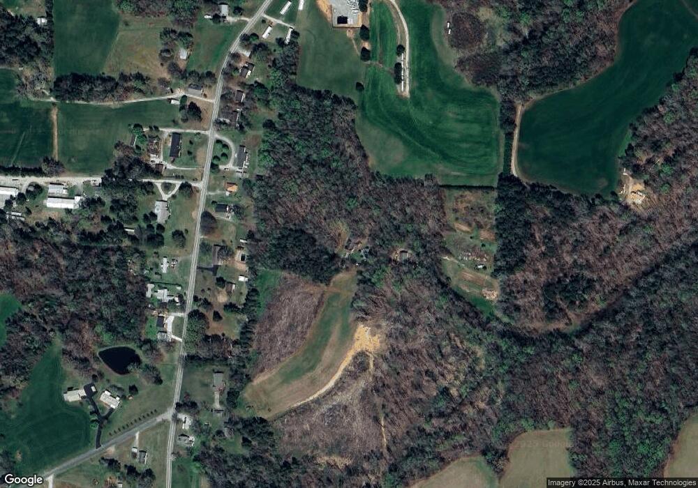
1853 Briggs Rd Salisbury, NC 28147
Estimated Value: $464,000 - $816,413
Studio
3
Baths
3,576
Sq Ft
$165/Sq Ft
Est. Value
About This Home
This home is located at 1853 Briggs Rd, Salisbury, NC 28147 and is currently estimated at $591,471, approximately $165 per square foot. 1853 Briggs Rd is a home located in Rowan County with nearby schools including Mount Ulla Elementary School, West Rowan Middle School, and West Rowan High School.
Ownership History
Date
Name
Owned For
Owner Type
Purchase Details
Closed on
Jun 2, 2009
Sold by
Cannon Homer Ray and Cannon Shelia D
Bought by
Kluttz Richard David and Kluttz Pamela Garrison
Current Estimated Value
Home Financials for this Owner
Home Financials are based on the most recent Mortgage that was taken out on this home.
Original Mortgage
$20,556
Interest Rate
4.79%
Mortgage Type
Seller Take Back
Purchase Details
Closed on
Aug 15, 1994
Bought by
Kluttz Richard David and Kluttz F
Create a Home Valuation Report for This Property
The Home Valuation Report is an in-depth analysis detailing your home's value as well as a comparison with similar homes in the area
Purchase History
| Date | Buyer | Sale Price | Title Company |
|---|---|---|---|
| Kluttz Richard David | $25,000 | None Available | |
| Kluttz Richard David | $26,000 | -- |
Source: Public Records
Mortgage History
| Date | Status | Borrower | Loan Amount |
|---|---|---|---|
| Closed | Kluttz Richard David | $20,556 |
Source: Public Records
Tax History Compared to Growth
Tax History
| Year | Tax Paid | Tax Assessment Tax Assessment Total Assessment is a certain percentage of the fair market value that is determined by local assessors to be the total taxable value of land and additions on the property. | Land | Improvement |
|---|---|---|---|---|
| 2025 | $4,167 | $615,029 | $121,495 | $493,534 |
| 2024 | $4,167 | $615,029 | $121,495 | $493,534 |
| 2023 | $2,492 | $615,029 | $121,495 | $493,534 |
| 2022 | $1,948 | $414,795 | $98,838 | $315,957 |
| 2021 | $3,101 | $414,795 | $98,838 | $315,957 |
| 2020 | $1,928 | $414,795 | $98,838 | $315,957 |
| 2019 | $3,101 | $414,795 | $98,838 | $315,957 |
| 2018 | $2,846 | $383,993 | $98,838 | $285,155 |
| 2017 | $2,846 | $383,993 | $98,838 | $285,155 |
| 2016 | $2,846 | $383,993 | $98,838 | $285,155 |
| 2015 | $2,880 | $383,993 | $98,838 | $285,155 |
| 2014 | $2,726 | $381,218 | $98,838 | $282,380 |
Source: Public Records
Map
Nearby Homes
- 2190 Neel Rd
- 135 Devon Dr
- 114 Graham Acres Rd
- 170 Heritage Ln
- 000 Mooresville Rd
- 161 Moore Haven Dr
- 5075 Lakeview Dr
- 4712 Mooresville Rd
- 4710 Mooresville Rd
- 0 Yount Dr Unit CAR4321628
- 1500 N Carolina Highway 150
- 1456 N Carolina Highway 150
- 1466 N Carolina Highway 150
- 415 Autumnlight Dr
- 1038 S Devonpark Place
- 1030 Hurley School Rd
- 2885 Wright Ave
- 170 Smoke Ln Unit L3
- 140 Smoke Ln
- 265 Prospect Trail
- 1885 Briggs Rd
- 1825 Briggs Rd
- 1935 Briggs Rd
- 1965 Briggs Rd
- 2035 Briggs Rd
- 1735 Briggs Rd
- 2045 Briggs Rd
- 1820 Briggs Rd
- 0 Cannon Rd
- 0 Cannon Rd Unit NULL R58222
- 1705 Briggs Rd
- 1770 Briggs Rd
- 2065 Briggs Rd
- 1960 Briggs Rd
- 1760 Briggs Rd
- 2125 Briggs Rd
- 2050 Briggs Rd
- 2135 Briggs Rd
- 2220 Briggs Rd
- 2226 Briggs Rd
