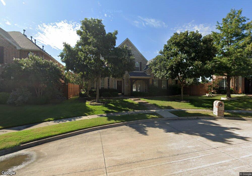
1853 Thorndale Cir Frisco, TX 75034
Southwest Frisco NeighborhoodEstimated Value: $792,000 - $830,000
4
Beds
4
Baths
4,159
Sq Ft
$195/Sq Ft
Est. Value
About This Home
This home is located at 1853 Thorndale Cir, Frisco, TX 75034 and is currently estimated at $812,302, approximately $195 per square foot. 1853 Thorndale Cir is a home located in Denton County with nearby schools including Sparks Elementary School, Pioneer Heritage Middle School, and Reedy High School.
Ownership History
Date
Name
Owned For
Owner Type
Purchase Details
Closed on
Jan 29, 2003
Sold by
Drees Custom Homes Lp
Bought by
Griffith William J and Griffith Courtney B
Current Estimated Value
Home Financials for this Owner
Home Financials are based on the most recent Mortgage that was taken out on this home.
Original Mortgage
$277,960
Outstanding Balance
$123,805
Interest Rate
6.5%
Estimated Equity
$688,497
Purchase Details
Closed on
Dec 12, 2001
Sold by
Frisco Lakes Ltd
Bought by
Drees Custom Homes Lp
Create a Home Valuation Report for This Property
The Home Valuation Report is an in-depth analysis detailing your home's value as well as a comparison with similar homes in the area
Home Values in the Area
Average Home Value in this Area
Purchase History
| Date | Buyer | Sale Price | Title Company |
|---|---|---|---|
| Griffith William J | -- | -- | |
| Drees Custom Homes Lp | -- | -- |
Source: Public Records
Mortgage History
| Date | Status | Borrower | Loan Amount |
|---|---|---|---|
| Open | Griffith William J | $277,960 | |
| Closed | Griffith William J | $69,490 |
Source: Public Records
Tax History Compared to Growth
Tax History
| Year | Tax Paid | Tax Assessment Tax Assessment Total Assessment is a certain percentage of the fair market value that is determined by local assessors to be the total taxable value of land and additions on the property. | Land | Improvement |
|---|---|---|---|---|
| 2025 | $9,845 | $752,863 | $192,860 | $604,165 |
| 2024 | $11,432 | $684,421 | $0 | $0 |
| 2023 | $8,669 | $622,201 | $192,860 | $653,119 |
| 2022 | $10,617 | $565,637 | $154,288 | $492,474 |
| 2021 | $10,191 | $514,215 | $106,073 | $408,142 |
| 2020 | $9,866 | $490,819 | $106,073 | $384,746 |
| 2019 | $10,241 | $484,838 | $106,073 | $378,765 |
| 2018 | $10,590 | $493,848 | $106,073 | $387,775 |
| 2017 | $10,209 | $473,000 | $106,073 | $366,927 |
| 2016 | $9,667 | $447,893 | $82,930 | $364,963 |
| 2015 | $8,413 | $422,169 | $82,930 | $339,239 |
| 2013 | -- | $361,374 | $82,930 | $278,444 |
Source: Public Records
Map
Nearby Homes
- 1632 Pleasant Valley Ln
- 1717 Angel Falls Dr
- 1859 Hollow Falls Ct
- 2066 Angel Falls Dr
- 8201 Mckenzie Ct
- 1860 Hollow Falls Ct
- 2100 Copperfield Ct
- 7872 Crazy Horse Dr
- 2338 Angel Falls Dr
- 8492 Liverpool Ln
- 1699 Garrison Dr
- 2385 Bannister Dr
- 1104 Churchill Dr
- 2040 Chisholm Trail
- 2313 Campfire Ln
- 7760 Hackamore St
- 2498 Spillway Cir
- 2339 Campfire Ln
- 2499 Streamside Ct
- 1101 Knightsbridge Dr
- 1871 Thorndale Cir
- 1835 Thorndale Cir
- 1828 Calloway Ln
- 1852 Calloway Ln
- 1804 Calloway Ln
- 1889 Thorndale Cir
- 1817 Thorndale Cir
- 1876 Calloway Ln
- 1907 Thorndale Cir
- 1900 Calloway Ln
- 8481 Albritton Dr
- 1872 Thorndale Cir
- 1854 Thorndale Cir
- 1836 Thorndale Cir
- 8540 Beartooth Dr
- 8560 Beartooth Dr
- 1890 Thorndale Cir
- 8520 Beartooth Dr
- 8580 Beartooth Dr
- 1920 Calloway Ln