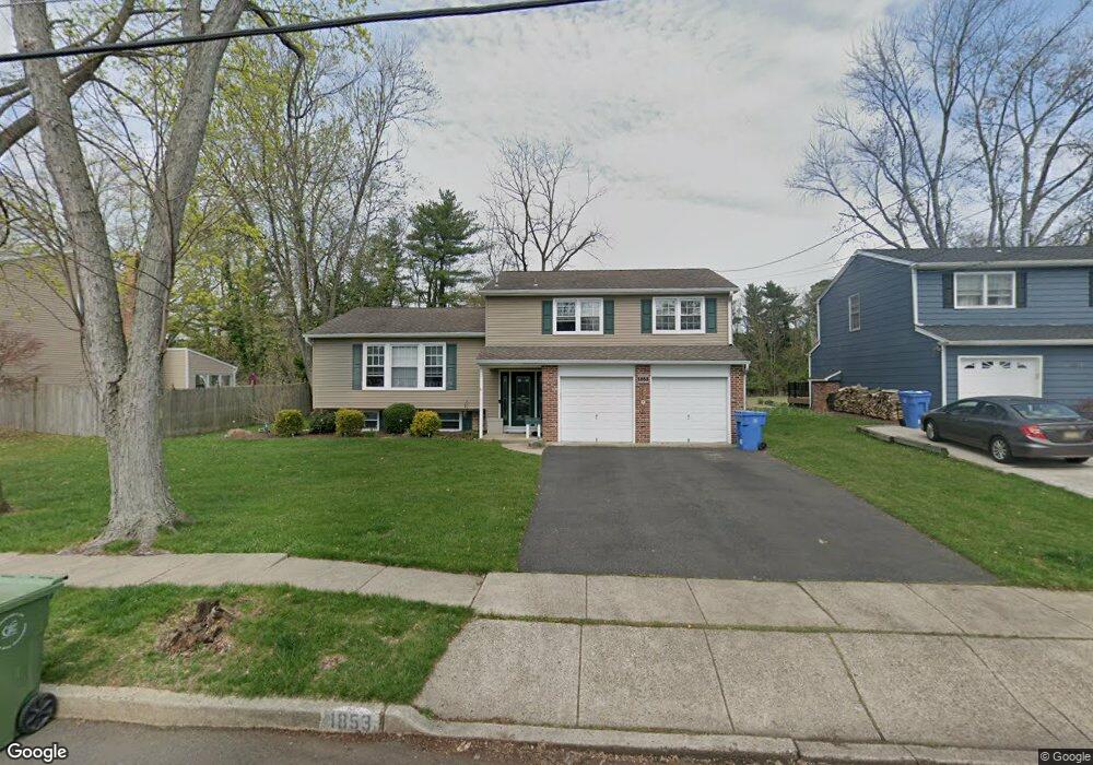
1853 W Point Dr Cherry Hill, NJ 08003
Estimated Value: $522,074 - $560,000
--
Bed
--
Bath
1,841
Sq Ft
$293/Sq Ft
Est. Value
About This Home
This home is located at 1853 W Point Dr, Cherry Hill, NJ 08003 and is currently estimated at $540,019, approximately $293 per square foot. 1853 W Point Dr is a home located in Camden County with nearby schools including Bret Harte Elementary School, Henry C. Beck Middle School, and Cherry Hill High-East High School.
Ownership History
Date
Name
Owned For
Owner Type
Purchase Details
Closed on
Apr 12, 2007
Sold by
Dickinson Jon A
Bought by
Pelfrey Troy E and Pelfrey Virginia A
Current Estimated Value
Home Financials for this Owner
Home Financials are based on the most recent Mortgage that was taken out on this home.
Original Mortgage
$277,960
Outstanding Balance
$168,431
Interest Rate
6.19%
Estimated Equity
$371,588
Purchase Details
Closed on
Oct 19, 2006
Sold by
Baroni Philip
Bought by
Dickinson Jon A and Ulus Arzu S
Home Financials for this Owner
Home Financials are based on the most recent Mortgage that was taken out on this home.
Original Mortgage
$220,000
Interest Rate
6.48%
Purchase Details
Closed on
Feb 16, 2000
Sold by
Wu Shiann J
Bought by
Dickinson Jon A
Home Financials for this Owner
Home Financials are based on the most recent Mortgage that was taken out on this home.
Original Mortgage
$140,000
Interest Rate
8.11%
Create a Home Valuation Report for This Property
The Home Valuation Report is an in-depth analysis detailing your home's value as well as a comparison with similar homes in the area
Home Values in the Area
Average Home Value in this Area
Purchase History
| Date | Buyer | Sale Price | Title Company |
|---|---|---|---|
| Pelfrey Troy E | $347,450 | -- | |
| Dickinson Jon A | $275,000 | -- | |
| Dickinson Jon A | $156,000 | -- |
Source: Public Records
Mortgage History
| Date | Status | Borrower | Loan Amount |
|---|---|---|---|
| Open | Pelfrey Troy E | $277,960 | |
| Previous Owner | Dickinson Jon A | $220,000 | |
| Previous Owner | Dickinson Jon A | $140,000 |
Source: Public Records
Tax History Compared to Growth
Tax History
| Year | Tax Paid | Tax Assessment Tax Assessment Total Assessment is a certain percentage of the fair market value that is determined by local assessors to be the total taxable value of land and additions on the property. | Land | Improvement |
|---|---|---|---|---|
| 2025 | $9,734 | $218,300 | $73,800 | $144,500 |
| 2024 | $9,173 | $218,300 | $73,800 | $144,500 |
| 2023 | $9,173 | $218,300 | $73,800 | $144,500 |
| 2022 | $8,920 | $218,300 | $73,800 | $144,500 |
| 2021 | $8,948 | $218,300 | $73,800 | $144,500 |
| 2020 | $8,839 | $218,300 | $73,800 | $144,500 |
| 2019 | $8,835 | $218,300 | $73,800 | $144,500 |
| 2018 | $8,811 | $218,300 | $73,800 | $144,500 |
| 2017 | $8,691 | $218,300 | $73,800 | $144,500 |
| 2016 | $8,575 | $218,300 | $73,800 | $144,500 |
| 2015 | $8,439 | $218,300 | $73,800 | $144,500 |
| 2014 | $8,346 | $218,300 | $73,800 | $144,500 |
Source: Public Records
Map
Nearby Homes
- 1869 W Point Dr
- 1104 Willowdale Dr
- 1108 Crane Dr
- 1224 Concord Ln
- 1105 Heartwood Dr
- 1217 Liberty Bell Dr
- 1852 Lark Ln
- 1684 Blue Jay Ln
- 1333 Bunker Hill Dr
- 1809 E Fireside Ct
- 1613 Mayflower Ln
- 4 Southwood Dr
- 28 Vanessa Ct
- 503 Balsam Rd
- 102 Lane of Trees
- 1134 Winding Dr
- 506 Cranford Rd
- 1304 Marlkress Rd
- 1121 Winding Dr
- 414 Lavender Hill Dr
- 1857 W Point Dr
- 1849 W Point Dr
- 1861 W Point Dr
- 1845 W Point Dr
- 1860 W Point Dr
- 1856 W Point Dr
- 1864 W Point Dr
- 1865 W Point Dr
- 1841 W Point Dr
- 1852 W Point Dr
- 1901 Cardinal Lake Dr
- 1905 Cardinal Lake Dr
- 1837 W Point Dr
- 1872 W Point Dr
- 1909 Cardinal Lake Dr
- 1848 W Point Dr
- 1849 Cardinal Lake Dr
- 1913 Cardinal Lake Dr
- 1873 W Point Dr
- 1876 W Point Dr