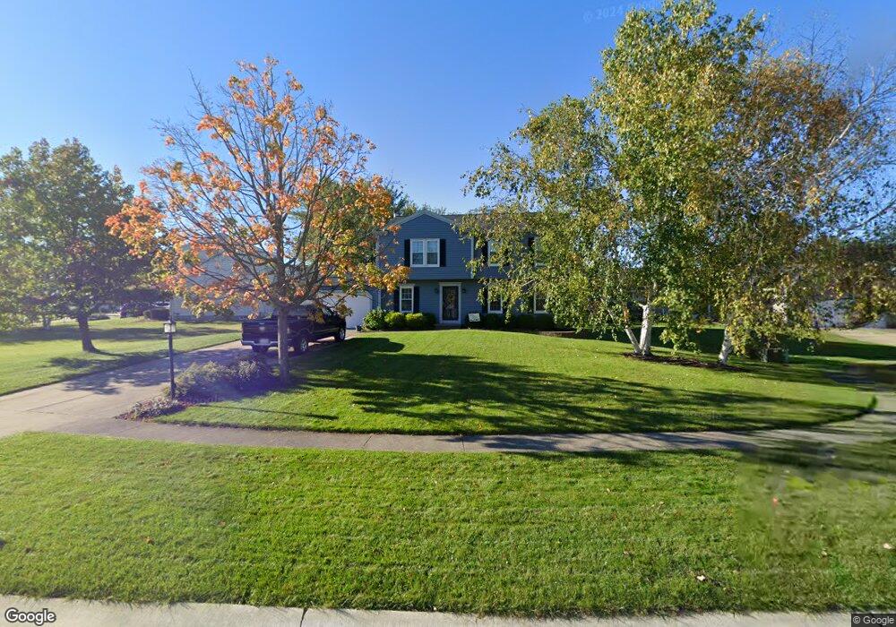
18532 Butternut Cir Strongsville, OH 44136
Estimated Value: $382,518 - $402,000
4
Beds
3
Baths
2,098
Sq Ft
$187/Sq Ft
Est. Value
About This Home
This home is located at 18532 Butternut Cir, Strongsville, OH 44136 and is currently estimated at $391,630, approximately $186 per square foot. 18532 Butternut Cir is a home located in Cuyahoga County with nearby schools including Strongsville High School, Royal Redeemer Lutheran School, and Sts Joseph & John Interparochial School.
Ownership History
Date
Name
Owned For
Owner Type
Purchase Details
Closed on
Sep 15, 2009
Sold by
Wardlaw H G and Wardlaw Jan W
Bought by
Walkiewicz David M and Walkiewicz Stephanie L
Current Estimated Value
Home Financials for this Owner
Home Financials are based on the most recent Mortgage that was taken out on this home.
Original Mortgage
$154,800
Outstanding Balance
$101,905
Interest Rate
5.32%
Mortgage Type
New Conventional
Estimated Equity
$289,725
Purchase Details
Closed on
Jul 28, 1989
Sold by
Golden Terry Gene
Bought by
Wardlaw Hg
Purchase Details
Closed on
Nov 20, 1987
Bought by
Golden Terry Gene
Purchase Details
Closed on
Jul 10, 1986
Bought by
Cheuvront Michael B
Purchase Details
Closed on
May 7, 1984
Bought by
Dean Homes Inc
Purchase Details
Closed on
Jan 1, 1979
Bought by
North East Land Co
Create a Home Valuation Report for This Property
The Home Valuation Report is an in-depth analysis detailing your home's value as well as a comparison with similar homes in the area
Home Values in the Area
Average Home Value in this Area
Purchase History
| Date | Buyer | Sale Price | Title Company |
|---|---|---|---|
| Walkiewicz David M | $193,500 | Attorney | |
| Wardlaw Hg | $130,000 | -- | |
| Golden Terry Gene | $117,000 | -- | |
| Equitable Relocation | -- | -- | |
| Cheuvront Michael B | $100,000 | -- | |
| Dean Homes Inc | -- | -- | |
| Hunting Valley Bldrs Inc | -- | -- | |
| North East Land Co | -- | -- |
Source: Public Records
Mortgage History
| Date | Status | Borrower | Loan Amount |
|---|---|---|---|
| Open | Walkiewicz David M | $154,800 |
Source: Public Records
Tax History Compared to Growth
Tax History
| Year | Tax Paid | Tax Assessment Tax Assessment Total Assessment is a certain percentage of the fair market value that is determined by local assessors to be the total taxable value of land and additions on the property. | Land | Improvement |
|---|---|---|---|---|
| 2024 | $4,981 | $106,085 | $21,595 | $84,490 |
| 2023 | $5,448 | $87,010 | $21,210 | $65,800 |
| 2022 | $5,409 | $87,010 | $21,210 | $65,800 |
| 2021 | $5,366 | $87,010 | $21,210 | $65,800 |
| 2020 | $4,973 | $71,330 | $17,400 | $53,940 |
| 2019 | $4,827 | $203,800 | $49,700 | $154,100 |
| 2018 | $4,307 | $71,330 | $17,400 | $53,940 |
| 2017 | $4,312 | $65,000 | $12,850 | $52,150 |
| 2016 | $4,277 | $65,000 | $12,850 | $52,150 |
| 2015 | $4,337 | $65,000 | $12,850 | $52,150 |
| 2014 | $4,337 | $65,000 | $12,850 | $52,150 |
Source: Public Records
Map
Nearby Homes
- 14132 Walking Stick Way
- 14558 Drake Rd
- 13448 Compass Point Dr
- 18987 Laurell Cir
- 13335 Tradewinds Dr
- 19252 Hidden Woods Ln
- 14292 Trenton Ave
- 19297 Hunt Rd
- 14985 Camden Cir
- 18229 Howe Rd
- 19813 Cross Trail S
- 17130 Golden Star Dr
- 15188 Trails Landing
- 19694 Benbow Rd
- 19740 Benbow Rd
- 3137 Blackburn Ln
- 15604-REAR Boston Rd
- 106 Briarleigh Dr
- 15772 Boston Rd
- 18680 Bennett Rd
- 18456 Butternut Cir
- 18570 Butternut Cir
- 18344 Butternut Cir
- 14204 Bent Tree Ct
- 18646 Butternut Cir
- 14226 Bent Tree Ct
- 14248 Bent Tree Ct
- 14182 Bent Tree Ct
- 18533 Butternut Cir
- 18495 Butternut Cir
- 18647 Butternut Cir
- 18457 Butternut Cir
- 14270 Bent Tree Ct
- 18571 Butternut Cir
- 18419 Butternut Cir
- 18302 Butternut Cir
- 18381 Butternut Cir
- 14160 Bent Tree Ct
- 18343 Butternut Cir
- 18609 Butternut Cir