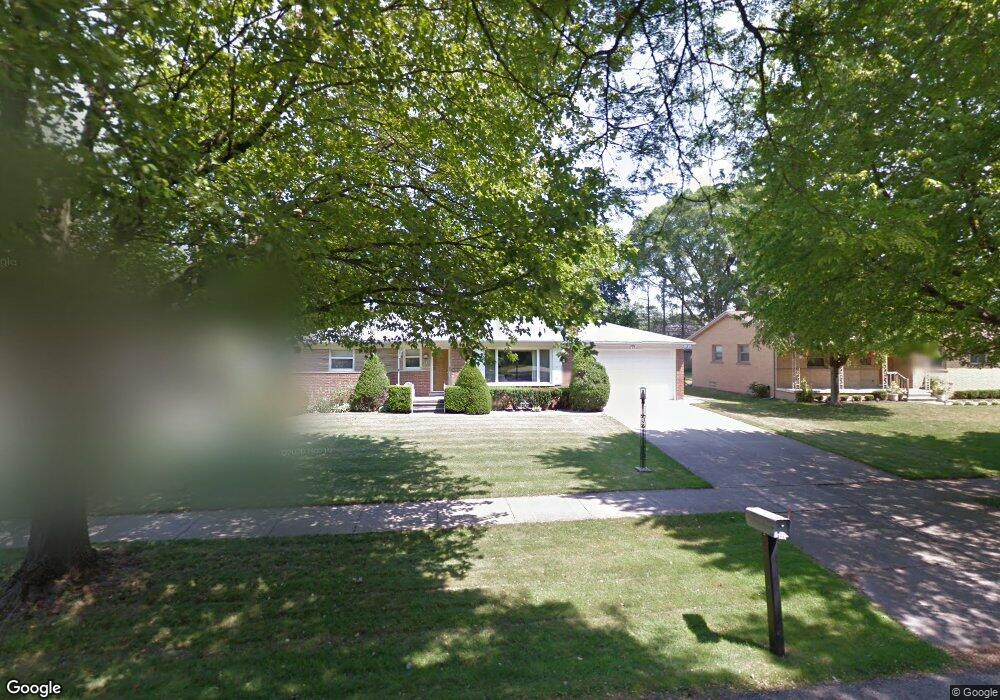
18536 Roseland Blvd Lathrup Village, MI 48076
Estimated Value: $283,763 - $329,000
2
Beds
3
Baths
1,335
Sq Ft
$227/Sq Ft
Est. Value
About This Home
This home is located at 18536 Roseland Blvd, Lathrup Village, MI 48076 and is currently estimated at $302,941, approximately $226 per square foot. 18536 Roseland Blvd is a home located in Oakland County with nearby schools including Alice M. Birney K-8 School, Mcintyre Elementary School, and Crescent Academy Pk-1.
Ownership History
Date
Name
Owned For
Owner Type
Purchase Details
Closed on
Jun 7, 2023
Sold by
Frey Annie J
Bought by
Frey Annie J
Current Estimated Value
Purchase Details
Closed on
Dec 13, 2022
Sold by
Frey Annie J
Bought by
Frey Annie J
Purchase Details
Closed on
Dec 2, 2020
Sold by
Frey Annie J
Bought by
Frey Sharron A
Purchase Details
Closed on
Sep 6, 2017
Sold by
Frey Dale E and Frey Annie J
Bought by
Frey Annie J and Frey Sharon A
Create a Home Valuation Report for This Property
The Home Valuation Report is an in-depth analysis detailing your home's value as well as a comparison with similar homes in the area
Home Values in the Area
Average Home Value in this Area
Purchase History
| Date | Buyer | Sale Price | Title Company |
|---|---|---|---|
| Frey Annie J | -- | None Listed On Document | |
| Frey Annie J | -- | -- | |
| Frey Annie J | -- | -- | |
| Frey Annie J | -- | None Listed On Document | |
| Frey Sharron A | -- | None Available | |
| Frey Annie J | -- | None Available |
Source: Public Records
Tax History Compared to Growth
Tax History
| Year | Tax Paid | Tax Assessment Tax Assessment Total Assessment is a certain percentage of the fair market value that is determined by local assessors to be the total taxable value of land and additions on the property. | Land | Improvement |
|---|---|---|---|---|
| 2024 | $2,855 | $127,810 | $0 | $0 |
| 2023 | $2,791 | $110,670 | $0 | $0 |
| 2022 | $2,588 | $103,410 | $0 | $0 |
| 2021 | $3,021 | $94,480 | $0 | $0 |
| 2020 | $2,425 | $91,620 | $0 | $0 |
| 2019 | $2,967 | $87,720 | $0 | $0 |
| 2018 | $3,033 | $80,470 | $0 | $0 |
| 2017 | $2,995 | $74,250 | $0 | $0 |
| 2016 | $2,994 | $66,180 | $0 | $0 |
| 2015 | -- | $59,140 | $0 | $0 |
| 2014 | -- | $51,190 | $0 | $0 |
| 2011 | -- | $52,560 | $0 | $0 |
Source: Public Records
Map
Nearby Homes
- 29214 Candlewood Ln
- 29140 Candlewood Ln
- 29239 Somerset Dr
- 21650 W 11 Mile Rd
- 29484 Spring Hill Dr
- 18797 Wiltshire Blvd
- 29807 Spring Hill Dr
- 29848 Rambling Rd
- 29743 Chelmsford Rd
- 27943 Sunset Blvd W
- 19601 W 12 Mile Rd Unit 102
- 29662 Westbrook Pkwy
- 18830 San Quentin Dr
- 27619 California Dr SW
- 28580 Red Leaf Ln
- 28249 Red Leaf Ln
- 28405 Stuart Ave
- 27714 California Dr NE
- 28775 Glasgow St
- 20141 Lacrosse Ave
- 18520 Roseland Blvd
- 18554 Roseland Blvd
- 18504 Roseland Blvd
- 18525 Roseland Blvd
- 18490 Roseland Blvd
- 28770 Bloomfield Dr
- 28740 Eldorado Place
- 28827 Somerset Place
- 18720 Roseland Blvd
- 18476 Roseland Blvd
- 18451 W Twelve Mile Rd
- 18451 W 12 Mile Rd
- 18451 W 12 Mile Rd Unit 201
- 28761 Bloomfield Dr
- 18740 Roseland Blvd
- 28807 Somerset Plc
- 29256 Candlewood Ln
- 18454 Roseland Blvd
- 28807 Somerset Place
- 29242 Candlewood Ln