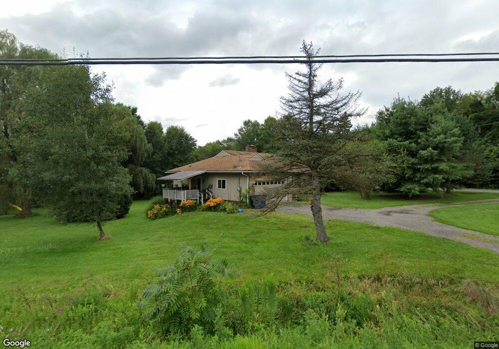
1854 Brookfield Rd Hubbard, OH 44425
Estimated Value: $166,000 - $273,000
3
Beds
2
Baths
1,480
Sq Ft
$145/Sq Ft
Est. Value
About This Home
This home is located at 1854 Brookfield Rd, Hubbard, OH 44425 and is currently estimated at $214,689, approximately $145 per square foot. 1854 Brookfield Rd is a home located in Trumbull County with nearby schools including Hubbard Elementary School, Hubbard Middle School, and Hubbard High School.
Ownership History
Date
Name
Owned For
Owner Type
Purchase Details
Closed on
Jan 29, 2004
Sold by
Miller Charles D and Miller Charles Duane
Bought by
Brush Robert D and Brush Pamela L
Current Estimated Value
Home Financials for this Owner
Home Financials are based on the most recent Mortgage that was taken out on this home.
Original Mortgage
$68,500
Outstanding Balance
$31,307
Interest Rate
5.91%
Mortgage Type
New Conventional
Estimated Equity
$183,382
Purchase Details
Closed on
Jan 17, 2004
Sold by
Miller Charles D and Miller Charles Duane
Bought by
Brush Robert D and Brush Pamela L
Home Financials for this Owner
Home Financials are based on the most recent Mortgage that was taken out on this home.
Original Mortgage
$68,500
Outstanding Balance
$31,307
Interest Rate
5.91%
Mortgage Type
New Conventional
Estimated Equity
$183,382
Purchase Details
Closed on
Oct 12, 2001
Sold by
Miller Lou A and Mastron Delores L
Bought by
Miller Charles D
Purchase Details
Closed on
Jan 1, 1990
Bought by
Charles D Miller
Create a Home Valuation Report for This Property
The Home Valuation Report is an in-depth analysis detailing your home's value as well as a comparison with similar homes in the area
Home Values in the Area
Average Home Value in this Area
Purchase History
| Date | Buyer | Sale Price | Title Company |
|---|---|---|---|
| Brush Robert D | $68,500 | -- | |
| Brush Robert D | $68,500 | -- | |
| Miller Charles D | -- | -- | |
| Charles D Miller | -- | -- |
Source: Public Records
Mortgage History
| Date | Status | Borrower | Loan Amount |
|---|---|---|---|
| Open | Miller Charles D | $68,500 | |
| Closed | Brush Robert D | $68,500 |
Source: Public Records
Tax History
| Year | Tax Paid | Tax Assessment Tax Assessment Total Assessment is a certain percentage of the fair market value that is determined by local assessors to be the total taxable value of land and additions on the property. | Land | Improvement |
|---|---|---|---|---|
| 2024 | $2,740 | $33,010 | $8,860 | $24,150 |
| 2023 | $2,740 | $33,010 | $8,860 | $24,150 |
| 2022 | $3,157 | $30,140 | $8,090 | $22,050 |
| 2021 | $3,165 | $30,140 | $8,090 | $22,050 |
| 2020 | $3,172 | $30,140 | $8,090 | $22,050 |
| 2019 | $3,045 | $26,670 | $7,490 | $19,180 |
| 2018 | $2,980 | $26,670 | $7,490 | $19,180 |
| 2017 | $2,615 | $26,670 | $7,490 | $19,180 |
| 2016 | $2,187 | $21,110 | $7,490 | $13,620 |
| 2015 | $2,191 | $21,110 | $7,490 | $13,620 |
| 2014 | $2,166 | $21,110 | $7,490 | $13,620 |
| 2013 | $1,329 | $21,110 | $7,490 | $13,620 |
Source: Public Records
Map
Nearby Homes
- 7058 Pine Grove Dr
- 1952 Hubbard Masury Rd
- 7647 Connelly Rd
- 132 Drummond Ave
- 764 Jones St
- 5910 Chestnut Ridge Rd
- 868 Saul Dr
- 784 Elmwood Dr
- 7822 2nd St
- 5950 Mount Everett Rd
- 327 W Park Ave
- 228 Stewart St
- 1145 Doris Dr
- 1017 Broadway St
- 7931 Service St
- 7304 Oakwood Dr Unit 9
- 836 School St
- 2675 Seifert-Lewis Rd
- 1441 Warner Rd
- 0 Addison Rd Unit 5181382
- 0 Chestnut-Ridge Rd Unit 1116478
- 0 Chestnut-Ridge Rd Unit 4306015
- 0 Chestnut-Ridge Rd Unit 4182627
- 6884 Chestnut Ridge Rd
- 1888 Brookfield Rd
- 6881 Chestnut-Ridge Rd Unit B
- 6882 Chestnut Ridge Rd
- 1837 Brookfield Rd
- 1899 Brookfield Rd
- 6881 Chestnut Ridge Rd
- 1904 Brookfield Rd
- 6969 Chestnut Ridge Rd
- 1915 Brookfield Rd
- 6875 Chestnut Ridge Rd
- 1916 Brookfield Rd
- 6968 Chestnut Ridge Rd
- 6943 Tamarack Dr
- 1796 Brookfield Rd
- 1923 Brookfield Rd
- 6857 Chestnut Ridge Rd
Your Personal Tour Guide
Ask me questions while you tour the home.