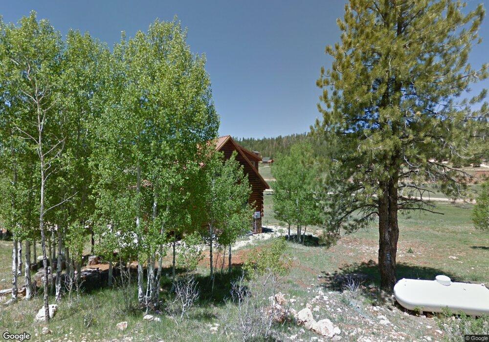
1855 N White Pine Rd Kanab, UT 84741
Duck Creek Village NeighborhoodEstimated Value: $543,000 - $630,000
--
Bed
--
Bath
2,397
Sq Ft
$239/Sq Ft
Est. Value
About This Home
This home is located at 1855 N White Pine Rd, Kanab, UT 84741 and is currently estimated at $572,529, approximately $238 per square foot. 1855 N White Pine Rd is a home with nearby schools including Valley Elementary School and Valley High School.
Ownership History
Date
Name
Owned For
Owner Type
Purchase Details
Closed on
Feb 4, 2022
Sold by
Dwbedu Ltd Ptshp
Bought by
Equity Trust Company Custodian
Current Estimated Value
Purchase Details
Closed on
Jun 27, 2011
Sold by
Dwbedu Limited Partnership
Bought by
Equity Trust Company
Purchase Details
Closed on
Mar 10, 2011
Sold by
Dejong Robert A
Bought by
Vendortrak Title Insurance Agency Llc
Purchase Details
Closed on
Nov 2, 2009
Sold by
Dunseath Swayne and Dunseath Beverly
Bought by
Dwbedu Limited Partnership
Create a Home Valuation Report for This Property
The Home Valuation Report is an in-depth analysis detailing your home's value as well as a comparison with similar homes in the area
Home Values in the Area
Average Home Value in this Area
Purchase History
| Date | Buyer | Sale Price | Title Company |
|---|---|---|---|
| Equity Trust Company Custodian | -- | -- | |
| Equity Trust Company | -- | -- | |
| Vendortrak Title Insurance Agency Llc | -- | -- | |
| Dwbedu Limited Partnership | -- | -- |
Source: Public Records
Tax History Compared to Growth
Tax History
| Year | Tax Paid | Tax Assessment Tax Assessment Total Assessment is a certain percentage of the fair market value that is determined by local assessors to be the total taxable value of land and additions on the property. | Land | Improvement |
|---|---|---|---|---|
| 2025 | $3,443 | $526,673 | $90,690 | $435,983 |
| 2024 | $3,443 | $272,860 | $41,566 | $231,294 |
| 2023 | $3,159 | $265,932 | $34,638 | $231,294 |
| 2022 | $3,462 | $257,939 | $26,645 | $231,294 |
| 2021 | $3,245 | $363,000 | $37,260 | $325,740 |
| 2020 | $2,922 | $315,536 | $37,260 | $278,276 |
| 2019 | $3,133 | $328,910 | $37,260 | $291,650 |
| 2018 | $2,750 | $286,126 | $41,400 | $244,726 |
| 2017 | $2,872 | $286,126 | $41,400 | $244,726 |
| 2016 | $2,426 | $235,098 | $38,502 | $196,596 |
| 2015 | $2,379 | $235,098 | $38,502 | $196,596 |
| 2014 | $2,379 | $230,076 | $33,480 | $196,596 |
| 2013 | -- | $195,868 | $0 | $0 |
Source: Public Records
Map
Nearby Homes
- 1740 Ponderosa View Loop
- 1840 Gulf Stream Dr
- 1685 Gulf Stream Dr
- 1660 Centurion Cir
- 1885 Strawberry Point Rd
- 1675 Centurion Cir
- 1720 Centurion Cir
- 1335 E Boeing Dr
- 1790 Gulf Stream Dr
- 1800 E Gulf Stream Dr
- Lot 5 Valley View Dr
- 2155 Big Timber Dr
- 1655 Valley View Dr
- 13A Runway Dr
- 1830 Gulf Stream Dr
- 1705 Bear Country Rd
- 1635 E Bear Country Rd
- 1780 E Beech Craft Dr
- 1660 E Beech Craft Dr
- 1815 E Beech Craft Dr
- 1640 N Ponderosa View Loop
- 1650 N Ponderosa View Loop
- 1860 N White Pine Rd
- 1650 Ponderosa View Loop
- 1660 Ponderosa View Loop
- 1880 N White Pine Rd
- 1890 N White Pine Rd
- 1905 N White Pine Rd
- 1680 E Ponderosa View Loop
- 1910 N White Pine Rd
- 1715 E Ponderosa View Loop
- 1710 E Ponderosa View Loop Pv G-12
- 1685 Ponderosa View Loop Unit G
- 36 Ponderosa View Loop
- 1950&1960 Ponderosa View Loop Unit G
- 1710 Ponderosa View Loop
- 1680 E Strawberry Point Rd
- 1690 E Strawberry Point Rd
- 1730 E Ponderosa View Loop
- 1895 N Ponderosa View Loop