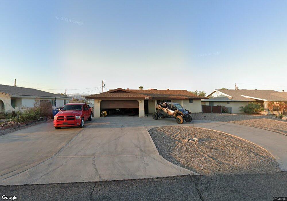
1856 Beavertail Dr Lake Havasu City, AZ 86403
Estimated Value: $300,000 - $418,000
3
Beds
2
Baths
1,374
Sq Ft
$266/Sq Ft
Est. Value
About This Home
This home is located at 1856 Beavertail Dr, Lake Havasu City, AZ 86403 and is currently estimated at $364,913, approximately $265 per square foot. 1856 Beavertail Dr is a home located in Mohave County with nearby schools including Smoketree Elementary School, Thunderbolt Middle School, and Lake Havasu High School.
Ownership History
Date
Name
Owned For
Owner Type
Purchase Details
Closed on
Aug 15, 2025
Sold by
Hill Jeffrey Scott and Hill Renee Ann
Bought by
Jeffrey And Renee Hill Revocable Trust and Hill
Current Estimated Value
Purchase Details
Closed on
Jun 6, 2024
Sold by
James Harold Hill and James Carolyn Sue
Bought by
Hill Jeffrey Scott and Hill Renee Ann
Purchase Details
Closed on
Feb 13, 2012
Sold by
Hills Jams H and Hill Carolyn Sue
Bought by
Hill James Harold and Hill Carolyn Sue
Purchase Details
Closed on
Aug 14, 2009
Sold by
Holford Jessie C
Bought by
Hill James H and Hill Carolyn Sue
Purchase Details
Closed on
Jun 7, 2002
Sold by
Denton Diana
Bought by
Hill James H and Hill Carolyn Sue
Home Financials for this Owner
Home Financials are based on the most recent Mortgage that was taken out on this home.
Original Mortgage
$50,000
Interest Rate
6.71%
Mortgage Type
New Conventional
Create a Home Valuation Report for This Property
The Home Valuation Report is an in-depth analysis detailing your home's value as well as a comparison with similar homes in the area
Home Values in the Area
Average Home Value in this Area
Purchase History
| Date | Buyer | Sale Price | Title Company |
|---|---|---|---|
| Jeffrey And Renee Hill Revocable Trust | -- | None Listed On Document | |
| Hill Jeffrey Scott | -- | None Listed On Document | |
| Hill James Harold | -- | None Available | |
| Hill James H | -- | None Available | |
| Hill James H | $95,501 | First American Title |
Source: Public Records
Mortgage History
| Date | Status | Borrower | Loan Amount |
|---|---|---|---|
| Previous Owner | Hill James H | $50,000 |
Source: Public Records
Tax History Compared to Growth
Tax History
| Year | Tax Paid | Tax Assessment Tax Assessment Total Assessment is a certain percentage of the fair market value that is determined by local assessors to be the total taxable value of land and additions on the property. | Land | Improvement |
|---|---|---|---|---|
| 2026 | -- | -- | -- | -- |
| 2025 | $1,266 | $22,964 | $0 | $0 |
| 2024 | $1,266 | $36,821 | $0 | $0 |
| 2023 | $1,266 | $25,372 | $0 | $0 |
| 2022 | $1,212 | $22,248 | $0 | $0 |
| 2021 | $1,374 | $18,949 | $0 | $0 |
| 2019 | $1,307 | $16,949 | $0 | $0 |
| 2018 | $1,264 | $16,079 | $0 | $0 |
| 2017 | $1,252 | $15,570 | $0 | $0 |
| 2016 | $1,138 | $13,609 | $0 | $0 |
| 2015 | $1,092 | $12,440 | $0 | $0 |
Source: Public Records
Map
Nearby Homes
- 1939 Pine Ln
- 1926 Swanson Ave
- 1910 Swanson Ave Unit A22
- 1910 Swanson Ave Unit B11
- 1910 Swanson Ave Unit B19
- 1962 Cliffrose Dr
- 211 Columbine Dr
- 1806 Swanson Ave Unit 205
- 1806 Swanson Ave Unit 103
- 1806 Swanson Ave Unit 226
- 1806 Swanson Ave Unit 108
- 1776 Swanson Ave
- 1760 Swanson Ave
- 1760/1776 Swanson
- 1775 Los Lagos Dr Unit B
- 1771 Los Lagos Dr Unit D
- 72 Mariposa Dr Unit D
- 2042 Swanson Ave Unit A
- 2042 Swanson Ave Unit H
- 189 Sunflower Dr
- 1848 Beavertail Dr
- 1864 Beavertail Dr
- 1827 Cliffrose Dr
- 1849 Cliffrose Dr
- 1799 Cliffrose Dr
- 1842 Beavertail Dr
- 1842 Beavertail Dr
- 1857 Beavertail Dr
- 147 Smoketree Ave S
- 1849 Beavertail Dr
- 1865 Beavertail Dr
- 1795 Cliffrose Dr
- 1871 Cliffrose Dr
- 1834 Beavertail Dr
- 1843 Beavertail Dr
- 1871 Beavertail Dr
- 1791 Cliffrose Dr
- 2291 Caboose
- 1800 Cliffrose Dr
- 1870 Magnolia Dr