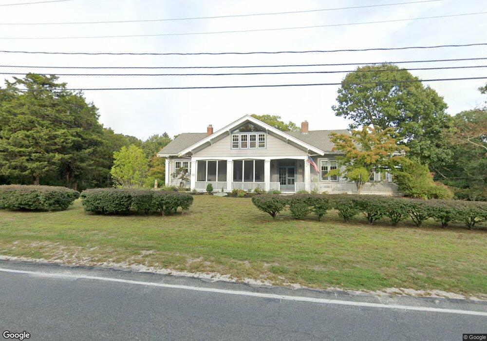
1856 Main Rd Westport Point, MA 02791
Westport Point NeighborhoodEstimated Value: $1,520,226 - $1,932,000
4
Beds
--
Bath
4,137
Sq Ft
$412/Sq Ft
Est. Value
About This Home
This home is located at 1856 Main Rd, Westport Point, MA 02791 and is currently estimated at $1,704,742, approximately $412 per square foot. 1856 Main Rd is a home with nearby schools including Alice A. Macomber Primary School, Westport Elementary School, and Westport Middle-High School.
Ownership History
Date
Name
Owned For
Owner Type
Purchase Details
Closed on
Mar 3, 2021
Sold by
Chausse Leo R
Bought by
Leo R Chausse T R and Leo Chausse
Current Estimated Value
Purchase Details
Closed on
Oct 11, 1984
Bought by
Chausse Leo R
Create a Home Valuation Report for This Property
The Home Valuation Report is an in-depth analysis detailing your home's value as well as a comparison with similar homes in the area
Home Values in the Area
Average Home Value in this Area
Purchase History
| Date | Buyer | Sale Price | Title Company |
|---|---|---|---|
| Leo R Chausse T R | -- | None Available | |
| Leo R Chausse T R | -- | None Available | |
| Chausse Leo R | $155,000 | -- |
Source: Public Records
Mortgage History
| Date | Status | Borrower | Loan Amount |
|---|---|---|---|
| Previous Owner | Chausse Leo R | $153,100 |
Source: Public Records
Tax History Compared to Growth
Tax History
| Year | Tax Paid | Tax Assessment Tax Assessment Total Assessment is a certain percentage of the fair market value that is determined by local assessors to be the total taxable value of land and additions on the property. | Land | Improvement |
|---|---|---|---|---|
| 2025 | $9,014 | $1,209,900 | $712,800 | $497,100 |
| 2024 | $8,644 | $1,118,200 | $624,900 | $493,300 |
| 2023 | $8,255 | $1,011,600 | $560,200 | $451,400 |
| 2022 | $6,126 | $808,000 | $501,300 | $306,700 |
| 2021 | $3,751 | $710,700 | $438,500 | $272,200 |
| 2020 | $5,855 | $694,500 | $422,300 | $272,200 |
| 2019 | $5,594 | $676,400 | $402,800 | $273,600 |
| 2018 | $5,432 | $664,900 | $397,700 | $267,200 |
| 2017 | $5,212 | $654,000 | $397,700 | $256,300 |
| 2016 | $5,089 | $643,300 | $397,700 | $245,600 |
| 2015 | $4,817 | $607,500 | $410,200 | $197,300 |
Source: Public Records
Map
Nearby Homes
- 1881 Main Rd
- 1749 Main Rd
- 1702J Drift Rd
- 1702 Drift Rd
- 1580 Main Rd
- 1346 Main Rd Unit B
- 99 Sylvia Ln
- 19 Seabury Ln
- 189 Brayton Point Rd
- 304 Brayton Point Rd
- 238-242 E Beach Rd
- 255 John Dyer Rd
- 225 Hixbridge Rd
- 920 Drift Rd
- Lot 2 Horseneck Rd
- 245 John Dyer Rd
- 17 Quail Trail
- 101 Adamsville Rd
- 837 Main Rd
- Lot 2E Horseneck Rd
- 1800 Main Rd
- 1853 Main Rd
- 1846 Main Rd
- 1865 Main Rd
- 1847 Main Rd
- 1868 Main Rd
- 1901 Drift Rd
- 1838 Main Rd
- 6 Cape Bial Ln
- 6 Cape Bial Ln Unit FALL RENTAL
- 6 Cape Bial Ln Unit WEEKLY
- 1907 Drift Rd
- 6 Cape Bial Unit WEEKLY
- 1871 Main Rd
- 1871 Main Rd
- 1835 Main Road U: Summer Rental
- 15 Cape Bial Ln
- 1946 Drift Rd Unit 1
- 1835 Main Rd
- 1835 Main Rd