1856 Robindale St Wickliffe, OH 44092
Estimated Value: $180,000 - $191,000
3
Beds
1
Bath
912
Sq Ft
$203/Sq Ft
Est. Value
About This Home
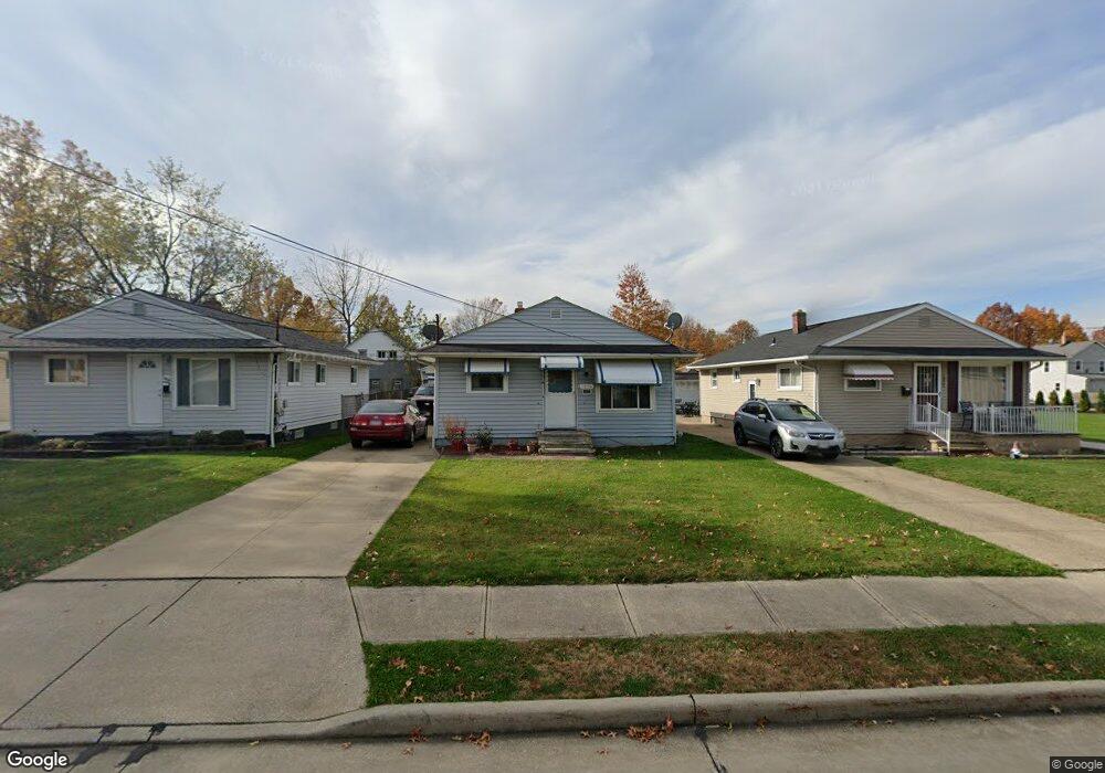
This home is located at 1856 Robindale St, Wickliffe, OH 44092 and is currently estimated at $185,365, approximately $203 per square foot. 1856 Robindale St is a home located in Lake County with nearby schools including Wickliffe Elementary School, Wickliffe Middle School, and Wickliffe High School.
Ownership History
Date
Name
Owned For
Owner Type
Purchase Details
Closed on
Dec 5, 2007
Sold by
Bland Theresa M
Bought by
Shields Ronald L and Shields Ruthie J
Current Estimated Value
Home Financials for this Owner
Home Financials are based on the most recent Mortgage that was taken out on this home.
Original Mortgage
$104,545
Outstanding Balance
$65,372
Interest Rate
6.33%
Mortgage Type
Purchase Money Mortgage
Estimated Equity
$119,993
Purchase Details
Closed on
Jan 1, 1990
Bought by
Massey Robert E
Create a Home Valuation Report for This Property
The Home Valuation Report is an in-depth analysis detailing your home's value as well as a comparison with similar homes in the area
Home Values in the Area
Average Home Value in this Area
Purchase History
| Date | Buyer | Sale Price | Title Company |
|---|---|---|---|
| Shields Ronald L | $106,000 | Enterprise Title | |
| Massey Robert E | -- | -- |
Source: Public Records
Mortgage History
| Date | Status | Borrower | Loan Amount |
|---|---|---|---|
| Open | Shields Ronald L | $104,545 |
Source: Public Records
Tax History
| Year | Tax Paid | Tax Assessment Tax Assessment Total Assessment is a certain percentage of the fair market value that is determined by local assessors to be the total taxable value of land and additions on the property. | Land | Improvement |
|---|---|---|---|---|
| 2025 | -- | $55,970 | $13,020 | $42,950 |
| 2024 | -- | $55,970 | $13,020 | $42,950 |
| 2023 | $2,406 | $33,770 | $11,000 | $22,770 |
| 2022 | $2,423 | $33,770 | $11,000 | $22,770 |
| 2021 | $2,433 | $33,770 | $11,000 | $22,770 |
| 2020 | $2,346 | $27,680 | $9,010 | $18,670 |
| 2019 | $2,346 | $27,680 | $9,010 | $18,670 |
| 2018 | $2,024 | $26,340 | $8,820 | $17,520 |
| 2017 | $1,855 | $26,340 | $8,820 | $17,520 |
| 2016 | $1,846 | $26,340 | $8,820 | $17,520 |
| 2015 | $1,814 | $26,340 | $8,820 | $17,520 |
| 2014 | $1,598 | $26,340 | $8,820 | $17,520 |
| 2013 | $1,597 | $26,340 | $8,820 | $17,520 |
Source: Public Records
Map
Nearby Homes
- 1540 E 298th St
- 1526 E 298th St
- 1807 E 294th St
- 1719 E 300th St
- 1597 Lee Terrace Dr Unit F11
- 1842 Eldon Dr
- 30302 Overlook Dr
- 0 Green Ridge Dr
- 30350 Twin Lakes Dr
- 29315 Nehls Park Dr
- 28900 Euclid Ave
- 2265 Country Club Dr
- 30530 Grant St
- 30529 Ridge Rd
- 2250 Pine Ridge Dr
- 29800 Robert St
- 28756 Hazel Ave
- 29566 Shaker Dr
- 30335 Euclid Ave Unit 40 and 20
- 1677 Mapledale Rd
- 1860 Robindale St
- 1852 Robindale St
- 1900 Robindale St
- 1903 E 296th St
- 1844 Robindale St
- 1857 E 296th St
- 1907 E 296th St
- 1851 E 296th St
- 1909 E 296th St
- 1910 Robindale St
- 1913 E 296th St
- 1845 E 296th St
- 1859 Robindale St
- 1836 Robindale St
- 1917 E 296th St
- 1916 Robindale St
- 1840 Robindale St
- V/L 96 V/L Wood St
- 0 Wood St
- 1903 Robindale St
Your Personal Tour Guide
Ask me questions while you tour the home.