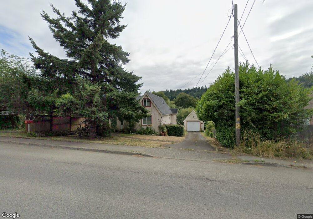
1856 Southwest Blvd Coos Bay, OR 97420
Estimated Value: $223,000 - $235,576
1
Bed
2
Baths
786
Sq Ft
$292/Sq Ft
Est. Value
About This Home
This home is located at 1856 Southwest Blvd, Coos Bay, OR 97420 and is currently estimated at $229,288, approximately $291 per square foot. 1856 Southwest Blvd is a home located in Coos County with nearby schools including Eastside School, Millicoma School, and Marshfield Senior High School.
Ownership History
Date
Name
Owned For
Owner Type
Purchase Details
Closed on
Jun 14, 2023
Sold by
Decker Benjamin S
Bought by
Gimlin Barbara J
Current Estimated Value
Purchase Details
Closed on
Oct 26, 2022
Sold by
Gimlin Barbara J
Bought by
Gimlin Barbara J and Decker Benjamin S
Purchase Details
Closed on
Oct 25, 2022
Sold by
Gimlin Barbara
Bought by
Gimlin Barbara and Mast Dancia
Purchase Details
Closed on
Oct 1, 2022
Sold by
Gimlin Barbara J
Bought by
Decker Benjamin S
Purchase Details
Closed on
Jul 28, 2008
Sold by
Harrison Mercedes and Harrison Petrona Mercedes
Bought by
Gimlin Barbara
Create a Home Valuation Report for This Property
The Home Valuation Report is an in-depth analysis detailing your home's value as well as a comparison with similar homes in the area
Home Values in the Area
Average Home Value in this Area
Purchase History
| Date | Buyer | Sale Price | Title Company |
|---|---|---|---|
| Gimlin Barbara J | -- | None Listed On Document | |
| Gimlin Barbara J | -- | None Listed On Document | |
| Gimlin Barbara | -- | None Listed On Document | |
| Decker Benjamin S | $175,000 | -- | |
| Gimlin Barbara | $100,000 | Fidelity National Title Co |
Source: Public Records
Tax History Compared to Growth
Tax History
| Year | Tax Paid | Tax Assessment Tax Assessment Total Assessment is a certain percentage of the fair market value that is determined by local assessors to be the total taxable value of land and additions on the property. | Land | Improvement |
|---|---|---|---|---|
| 2024 | $1,587 | $88,420 | -- | -- |
| 2023 | $1,540 | $85,850 | $0 | $0 |
| 2022 | $1,516 | $83,350 | $0 | $0 |
| 2021 | $1,478 | $80,930 | $0 | $0 |
| 2020 | $1,438 | $80,930 | $0 | $0 |
| 2019 | $1,383 | $76,300 | $0 | $0 |
| 2018 | $1,337 | $74,080 | $0 | $0 |
| 2017 | $1,191 | $71,930 | $0 | $0 |
| 2016 | $1,139 | $69,840 | $0 | $0 |
| 2015 | $1,045 | $67,810 | $0 | $0 |
| 2014 | $1,045 | $65,840 | $0 | $0 |
Source: Public Records
Map
Nearby Homes
- 1123 Oregon Ave
- 1138 Oregon Ave
- 1194 Oregon Ave
- 1169 Washington Ave
- 0 California Ave
- 0 Graham St Unit 546213972
- 0 Pennsylvania Ave Unit 23250131
- 1351 Dakota St
- 2250 S 17th St
- 1348 Dakota Ave
- 93195 Coal Bank Ln
- 0 Minnesota
- 766 Southwest Blvd
- 0 Miriam Unit 740433342
- 0 Idaho Dr Unit 300 21226511
- 63559 Shinglehouse Rd
- 1050 S 8th St
- 63606 Andrews Rd
- 63232 Flanasgan Rd Unit LotWP001
- 0 Johnson Ave
- 1856 Southwestern Bv
- 1802 Southwest Blvd
- 1860 Southwest Blvd
- 1780 Southwest Blvd
- 1873 Southwest Blvd
- 1881 Southwest Blvd
- 1133 Idaho Ave
- 1752 Southwest Blvd
- 1137 Idaho Ave
- 1105 Montana Ave
- 1785 Southwest Blvd
- 1765 Southwestern Bv
- 1141 Idaho Ave
- 1130 Montana Ave
- 1115 Montana Ave
- 1734 Southwest Blvd
- 1765 Southwest Blvd
- 1136 Idaho Ave
- 1063 California Ave
- 1721 Southwest Blvd