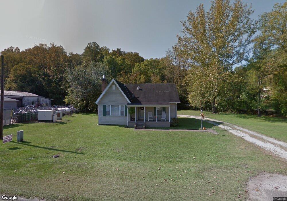
1856 State Route 243 Ironton, OH 45638
Estimated Value: $88,800 - $138,000
3
Beds
1
Bath
2,130
Sq Ft
$50/Sq Ft
Est. Value
About This Home
This home is located at 1856 State Route 243, Ironton, OH 45638 and is currently estimated at $106,700, approximately $50 per square foot. 1856 State Route 243 is a home located in Lawrence County with nearby schools including Dawson-Bryant Elementary School, Dawson-Bryant Middle School, and Dawson-Bryant High School.
Ownership History
Date
Name
Owned For
Owner Type
Purchase Details
Closed on
Jul 30, 2019
Sold by
Rutherford David and Rutherford Angela
Bought by
Fields Eric and Fields Allison
Current Estimated Value
Purchase Details
Closed on
Jul 8, 2016
Sold by
York Melissa
Bought by
Fields Eric M
Home Financials for this Owner
Home Financials are based on the most recent Mortgage that was taken out on this home.
Original Mortgage
$82,262
Interest Rate
3.64%
Mortgage Type
New Conventional
Purchase Details
Closed on
Nov 28, 2000
Sold by
Dillon George C
Bought by
Dillon Shirley
Create a Home Valuation Report for This Property
The Home Valuation Report is an in-depth analysis detailing your home's value as well as a comparison with similar homes in the area
Home Values in the Area
Average Home Value in this Area
Purchase History
| Date | Buyer | Sale Price | Title Company |
|---|---|---|---|
| Fields Eric | -- | -- | |
| Fields Eric M | $80,000 | None Available | |
| Dillon Shirley | -- | -- |
Source: Public Records
Mortgage History
| Date | Status | Borrower | Loan Amount |
|---|---|---|---|
| Previous Owner | Fields Eric M | $82,262 |
Source: Public Records
Tax History Compared to Growth
Tax History
| Year | Tax Paid | Tax Assessment Tax Assessment Total Assessment is a certain percentage of the fair market value that is determined by local assessors to be the total taxable value of land and additions on the property. | Land | Improvement |
|---|---|---|---|---|
| 2024 | -- | $21,170 | $2,540 | $18,630 |
| 2023 | $606 | $21,170 | $2,540 | $18,630 |
| 2022 | $604 | $21,170 | $2,540 | $18,630 |
| 2021 | $544 | $19,290 | $2,400 | $16,890 |
| 2020 | $560 | $19,290 | $2,400 | $16,890 |
| 2019 | $557 | $19,290 | $2,400 | $16,890 |
| 2018 | $556 | $19,040 | $2,400 | $16,640 |
| 2017 | $555 | $19,040 | $2,400 | $16,640 |
| 2016 | $511 | $19,040 | $2,400 | $16,640 |
| 2015 | $493 | $16,910 | $2,410 | $14,500 |
| 2014 | $486 | $16,910 | $2,410 | $14,500 |
| 2013 | $508 | $17,690 | $2,410 | $15,280 |
Source: Public Records
Map
Nearby Homes
- 156 Township Road 181
- 2088 State Route 243
- 342 Township Road 296
- 103 Carrico Dr
- 119 Remy St
- 519 Lane St
- 514 Lane St
- 135 Lane St
- 805 1/2 High St
- 125 Center St
- 309 High St
- 309 High St Unit LAO-5
- 0 Carter Ave
- 1824 Carter Ave
- 0 18th Street & Central Ave
- 2135 Central Ave
- 0 Central Ave
- 0 Central & Mlk
- 0 27th Block of Carter Ave
- 2829 Carter Ave
- 1848 State Route 243
- 54 Township Road 300
- 1833 State Route 243
- 1784 State Route 243
- 90 Township Road 300
- 1879 State Route 243
- 1884 State Route 243
- 1891 State Route 243
- 45 Township Road 102
- 111 Township Road 300
- 1912 State Route 243
- 1902 State Route 243
- 24 Township Road 1051
- 64 Township Road 102
- 190 Township Road 385 Rd
- 25 Township Road 181
- 1740 State Route 243
- 77 Township Road 102
- 64 Township Road 181
- 1930 State Route 243