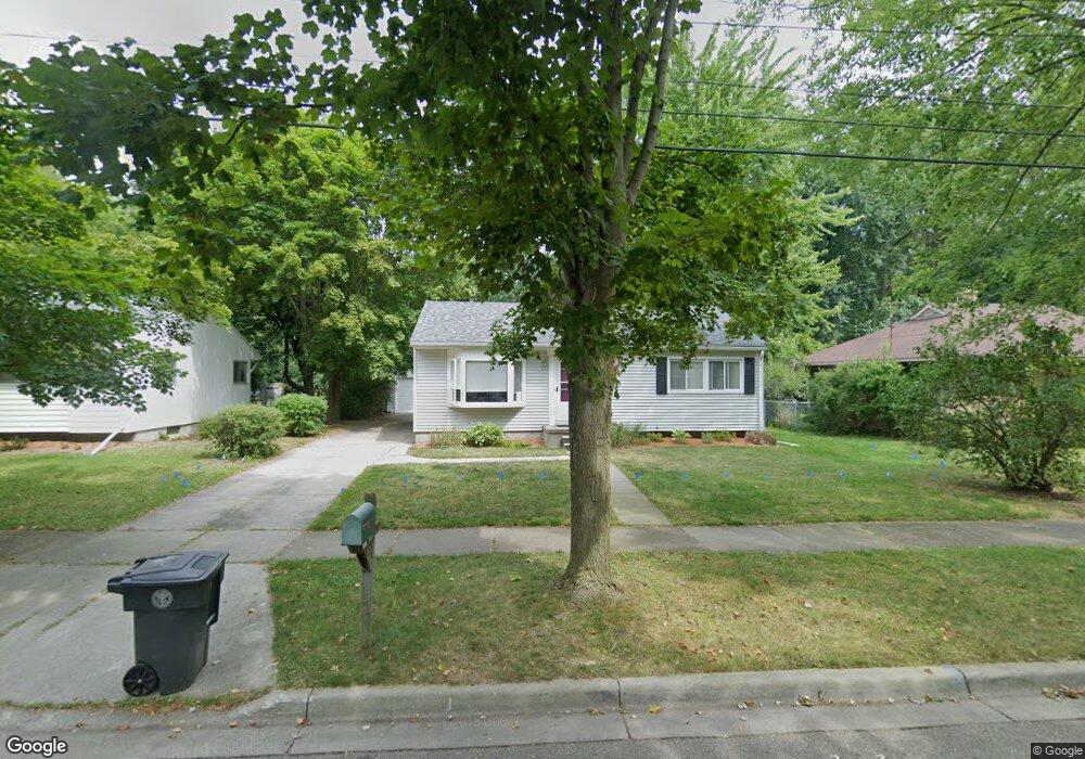
1857 Melrose Ave East Lansing, MI 48823
Estimated Value: $221,000 - $245,000
3
Beds
1
Bath
2,012
Sq Ft
$116/Sq Ft
Est. Value
About This Home
This home is located at 1857 Melrose Ave, East Lansing, MI 48823 and is currently estimated at $234,392, approximately $116 per square foot. 1857 Melrose Ave is a home located in Ingham County with nearby schools including Marble Elementary School, MacDonald Middle School, and East Lansing High School.
Ownership History
Date
Name
Owned For
Owner Type
Purchase Details
Closed on
Nov 2, 2020
Sold by
Stock Jody L and Jody L Stock Trust No 1
Bought by
Kirouac Jacqueline R and Woff Steven J
Current Estimated Value
Home Financials for this Owner
Home Financials are based on the most recent Mortgage that was taken out on this home.
Original Mortgage
$121,500
Outstanding Balance
$108,118
Interest Rate
2.8%
Mortgage Type
New Conventional
Estimated Equity
$126,274
Purchase Details
Closed on
Jan 18, 2016
Sold by
Stock Jody
Bought by
Stock Jody
Purchase Details
Closed on
Aug 10, 2007
Sold by
Federal Home Loan Mortgage Corporation
Bought by
Stock Jody
Home Financials for this Owner
Home Financials are based on the most recent Mortgage that was taken out on this home.
Original Mortgage
$97,500
Interest Rate
6.69%
Mortgage Type
Purchase Money Mortgage
Purchase Details
Closed on
Dec 14, 2006
Sold by
Dupree Michael J and Dupree Lisa M
Bought by
Federal Home Loan Mortgage Corporation
Purchase Details
Closed on
Dec 3, 2004
Sold by
Peddicord Patrick A and Peddicord Devon
Bought by
Dupree Michael J and Dupree Lisa M
Home Financials for this Owner
Home Financials are based on the most recent Mortgage that was taken out on this home.
Original Mortgage
$112,000
Interest Rate
6.85%
Mortgage Type
New Conventional
Purchase Details
Closed on
Jan 31, 2003
Sold by
Davis Thomas M and Davis Karen S
Bought by
Peddicord Patrick A
Home Financials for this Owner
Home Financials are based on the most recent Mortgage that was taken out on this home.
Original Mortgage
$116,000
Interest Rate
5.95%
Purchase Details
Closed on
Jul 20, 1998
Sold by
Grimes Kristofor X and Grimes Tami M
Bought by
Davis Thomas M and Davis Karen S
Purchase Details
Closed on
May 1, 1997
Purchase Details
Closed on
Nov 1, 1984
Purchase Details
Closed on
Nov 1, 1982
Create a Home Valuation Report for This Property
The Home Valuation Report is an in-depth analysis detailing your home's value as well as a comparison with similar homes in the area
Home Values in the Area
Average Home Value in this Area
Purchase History
| Date | Buyer | Sale Price | Title Company |
|---|---|---|---|
| Kirouac Jacqueline R | $162,000 | Transnation Title Agency | |
| Stock Jody | -- | None Available | |
| Stock Jody | $121,900 | Attorneys Title Agency Llc | |
| Federal Home Loan Mortgage Corporation | $115,940 | None Available | |
| Dupree Michael J | $140,000 | Devon Title | |
| Peddicord Patrick A | $145,000 | Transnation Title | |
| Davis Thomas M | $112,000 | -- | |
| -- | $105,500 | -- | |
| -- | $46,000 | -- | |
| -- | $45,000 | -- |
Source: Public Records
Mortgage History
| Date | Status | Borrower | Loan Amount |
|---|---|---|---|
| Open | Kirouac Jacqueline R | $121,500 | |
| Previous Owner | Stock Jody | $97,500 | |
| Previous Owner | Dupree Michael J | $112,000 | |
| Previous Owner | Peddicord Patrick A | $116,000 | |
| Closed | Peddicord Patrick A | $29,000 | |
| Closed | Dupree Michael J | $25,000 |
Source: Public Records
Tax History Compared to Growth
Tax History
| Year | Tax Paid | Tax Assessment Tax Assessment Total Assessment is a certain percentage of the fair market value that is determined by local assessors to be the total taxable value of land and additions on the property. | Land | Improvement |
|---|---|---|---|---|
| 2025 | $4,468 | $105,700 | $24,900 | $80,800 |
| 2024 | $37 | $96,600 | $24,900 | $71,700 |
| 2023 | $4,173 | $83,800 | $21,300 | $62,500 |
| 2022 | $3,998 | $74,200 | $18,500 | $55,700 |
| 2021 | $3,929 | $69,700 | $17,600 | $52,100 |
| 2020 | $3,033 | $66,000 | $17,600 | $48,400 |
| 2019 | $2,908 | $61,200 | $19,000 | $42,200 |
| 2018 | $3,180 | $59,600 | $13,800 | $45,800 |
| 2017 | $3,053 | $59,600 | $14,000 | $45,600 |
| 2016 | -- | $56,000 | $13,400 | $42,600 |
| 2015 | -- | $52,200 | $24,745 | $27,455 |
| 2014 | -- | $49,600 | $24,745 | $24,855 |
Source: Public Records
Map
Nearby Homes
- 692 Moorland Dr Unit 10
- 1653 Ann St
- 5435 Blue Haven Dr
- 5420 Park Lake Rd
- 1542 Ann St
- 5189 E Brookfield Dr
- 586 Lexington Ave
- 2545 Koala Dr
- 562 Virginia Ave
- 5120 Wardcliff Dr
- 5604 Deville Ct
- 657 Spartan Ave
- 5403 Wild Oak Dr
- 5680 Deville Ct Unit 61
- 2617 Greencliff Dr
- 1105 Robb St
- 1608 Haslett Rd
- 2462 Burcham Dr
- 5359 Wild Oak Dr Unit 54
- 5724 Lebaron Ct
- 1851 Melrose Ave
- 1865 Melrose Ave
- 1843 Melrose Ave
- 1844 Snyder Rd
- 1837 Melrose Ave
- 1850 Snyder Rd
- 1838 Snyder Rd
- 1860 Melrose Ave
- 1868 Melrose Ave
- 1850 Melrose Ave
- 1829 Melrose Ave
- 1842 Melrose Ave
- 1832 Snyder Rd
- 1876 Melrose Ave
- 1836 Melrose Ave
- 1826 Snyder Rd
- 1821 Melrose Ave
- 1886 Melrose Ave
- 1830 Melrose Ave