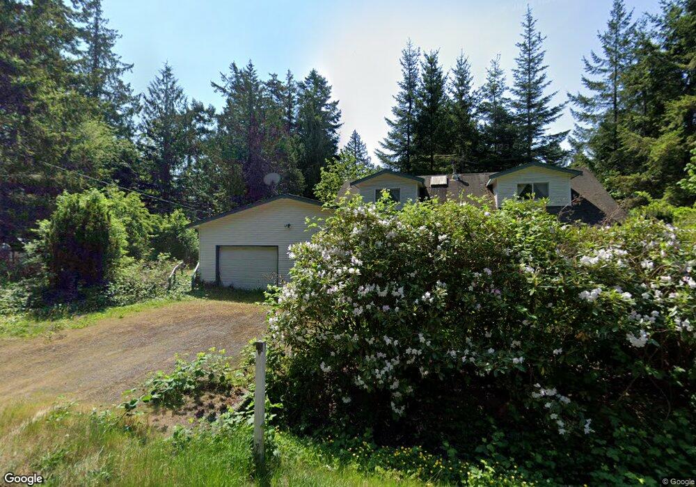
1857 Washington Dr Point Roberts, WA 98281
Estimated Value: $460,000 - $464,000
3
Beds
2
Baths
2,113
Sq Ft
$218/Sq Ft
Est. Value
About This Home
This home is located at 1857 Washington Dr, Point Roberts, WA 98281 and is currently estimated at $461,335, approximately $218 per square foot. 1857 Washington Dr is a home located in Whatcom County with nearby schools including Point Roberts Primary School, Blaine Middle School, and Blaine High School.
Ownership History
Date
Name
Owned For
Owner Type
Purchase Details
Closed on
Nov 14, 2017
Sold by
Dunnigan William and Dunnigan Denise
Bought by
Tian Jihuai
Current Estimated Value
Purchase Details
Closed on
Apr 21, 2006
Sold by
Mitchell William M and Mitchell Gail N
Bought by
Dunnigan William and Dunnigan Denise
Home Financials for this Owner
Home Financials are based on the most recent Mortgage that was taken out on this home.
Original Mortgage
$125,000
Outstanding Balance
$71,543
Interest Rate
6.29%
Mortgage Type
Fannie Mae Freddie Mac
Estimated Equity
$389,792
Purchase Details
Closed on
Jun 13, 2005
Sold by
Taranger Edvin K and Taranger Karen
Bought by
Mitchell William M and Mitchell Gail N
Home Financials for this Owner
Home Financials are based on the most recent Mortgage that was taken out on this home.
Original Mortgage
$34,500
Interest Rate
5.25%
Mortgage Type
Fannie Mae Freddie Mac
Create a Home Valuation Report for This Property
The Home Valuation Report is an in-depth analysis detailing your home's value as well as a comparison with similar homes in the area
Home Values in the Area
Average Home Value in this Area
Purchase History
| Date | Buyer | Sale Price | Title Company |
|---|---|---|---|
| Tian Jihuai | -- | Whatcom Land Title Co Inc | |
| Dunnigan William | $295,280 | Chicago Title Insurance | |
| Mitchell William M | $204,500 | Chicago Title Insurance |
Source: Public Records
Mortgage History
| Date | Status | Borrower | Loan Amount |
|---|---|---|---|
| Open | Dunnigan William | $125,000 | |
| Previous Owner | Mitchell William M | $34,500 |
Source: Public Records
Tax History Compared to Growth
Tax History
| Year | Tax Paid | Tax Assessment Tax Assessment Total Assessment is a certain percentage of the fair market value that is determined by local assessors to be the total taxable value of land and additions on the property. | Land | Improvement |
|---|---|---|---|---|
| 2024 | $3,243 | $402,130 | $102,383 | $299,747 |
| 2023 | $3,243 | $392,822 | $93,075 | $299,747 |
| 2022 | $2,492 | $358,742 | $85,000 | $273,742 |
| 2021 | $2,482 | $247,605 | $32,102 | $215,503 |
| 2020 | $2,472 | $229,261 | $29,724 | $199,537 |
| 2019 | $2,293 | $219,913 | $28,512 | $191,401 |
| 2018 | $2,176 | $197,700 | $25,632 | $172,068 |
| 2017 | $1,887 | $188,814 | $24,480 | $164,334 |
| 2016 | $2,042 | $185,112 | $24,000 | $161,112 |
| 2015 | $2,171 | $194,816 | $32,847 | $161,969 |
| 2014 | -- | $203,664 | $34,340 | $169,324 |
| 2013 | -- | $194,561 | $32,980 | $161,581 |
Source: Public Records
Map
Nearby Homes
- 1852 Washington Dr
- 1871 Johnson Rd
- 1931 Sanders Ct Unit 11
- 2 Mill Rd
- 308 Mill Rd
- 1 Mill Rd
- 25 Roosevelt Way
- 323 Evergreen Way
- 8 Heather Way
- 125 Park Dr
- 0 3 73 Acres Derby Ave
- 157 Northwood Dr
- 2 Benson Rd
- 103 Goodman Rd
- 2136 Culp Ct
- 0 6 39 Acres South Beach Rd
- 2145 Fir St
- 2132 Maple St
- 17 Lot Massey Way
- Lot 2 Greenwood Dr
- 1853 Washington Dr
- 160 Kennedy Rd
- 1862 Washington Dr
- 1854 Washington Dr
- 1860 Washington Dr
- 1866 Washington Dr
- 1849 Washington Dr
- 1850 Washington Dr
- 1847 Washington Dr
- 156 Burns Way
- 178 Kennedy Rd
- 1872 Washington Dr
- 146 Burns Way
- 1845 Washington Dr
- 1846 Washington Dr
- 184 Kennedy Rd
- 142 Burns Way
- 1851 Province Rd
- 1885 Washington Dr