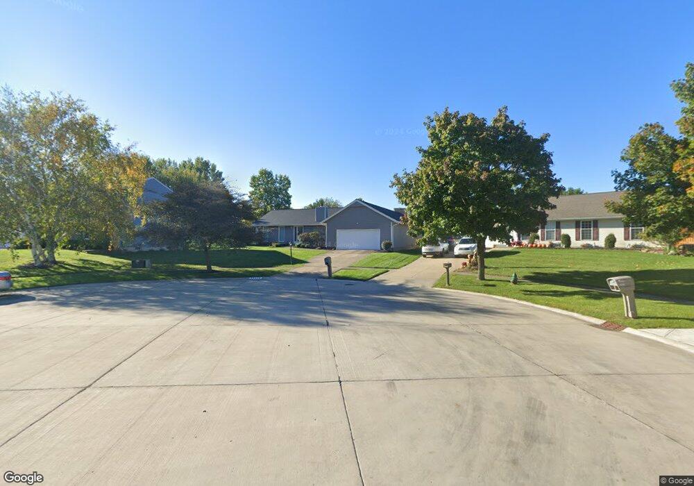
18570 Butternut Cir Strongsville, OH 44136
Estimated Value: $310,000 - $372,000
3
Beds
2
Baths
1,852
Sq Ft
$188/Sq Ft
Est. Value
About This Home
This home is located at 18570 Butternut Cir, Strongsville, OH 44136 and is currently estimated at $347,858, approximately $187 per square foot. 18570 Butternut Cir is a home located in Cuyahoga County with nearby schools including Strongsville High School, Royal Redeemer Lutheran School, and Sts Joseph & John Interparochial School.
Ownership History
Date
Name
Owned For
Owner Type
Purchase Details
Closed on
Feb 1, 1983
Bought by
Bianchi Donald A
Current Estimated Value
Purchase Details
Closed on
Jun 2, 1981
Bought by
Shave Maurice F
Purchase Details
Closed on
Jan 1, 1979
Bought by
North East Land Co
Create a Home Valuation Report for This Property
The Home Valuation Report is an in-depth analysis detailing your home's value as well as a comparison with similar homes in the area
Home Values in the Area
Average Home Value in this Area
Purchase History
| Date | Buyer | Sale Price | Title Company |
|---|---|---|---|
| Bianchi Donald A | $89,900 | -- | |
| Hunting Valley Bldrs Inc | -- | -- | |
| Shave Maurice F | $24,000 | -- | |
| North East Land Co | -- | -- |
Source: Public Records
Tax History Compared to Growth
Tax History
| Year | Tax Paid | Tax Assessment Tax Assessment Total Assessment is a certain percentage of the fair market value that is determined by local assessors to be the total taxable value of land and additions on the property. | Land | Improvement |
|---|---|---|---|---|
| 2024 | $4,419 | $103,915 | $21,140 | $82,775 |
| 2023 | $4,558 | $81,970 | $20,790 | $61,180 |
| 2022 | $4,551 | $81,970 | $20,790 | $61,180 |
| 2021 | $4,515 | $81,970 | $20,790 | $61,180 |
| 2020 | $4,685 | $67,200 | $17,050 | $50,160 |
| 2019 | $4,548 | $192,000 | $48,700 | $143,300 |
| 2018 | $4,127 | $67,200 | $17,050 | $50,160 |
| 2017 | $4,084 | $61,570 | $13,650 | $47,920 |
| 2016 | $4,051 | $61,570 | $13,650 | $47,920 |
| 2015 | $4,010 | $61,570 | $13,650 | $47,920 |
| 2014 | $4,109 | $61,570 | $13,650 | $47,920 |
Source: Public Records
Map
Nearby Homes
- 14132 Walking Stick Way
- 14558 Drake Rd
- 13448 Compass Point Dr
- 18987 Laurell Cir
- 13335 Tradewinds Dr
- 19252 Hidden Woods Ln
- 14292 Trenton Ave
- 19297 Hunt Rd
- 14985 Camden Cir
- 18229 Howe Rd
- 19813 Cross Trail S
- 17130 Golden Star Dr
- 15188 Trails Landing
- 19694 Benbow Rd
- 19740 Benbow Rd
- 3137 Blackburn Ln
- 15604-REAR Boston Rd
- 106 Briarleigh Dr
- 15772 Boston Rd
- 18680 Bennett Rd
- 18532 Butternut Cir
- 18646 Butternut Cir
- 14226 Bent Tree Ct
- 14248 Bent Tree Ct
- 14204 Bent Tree Ct
- 14270 Bent Tree Ct
- 18456 Butternut Cir
- 14182 Bent Tree Ct
- 18647 Butternut Cir
- 18344 Butternut Cir
- 14292 Bent Tree Ct
- 18001 Alpine Cir
- 14160 Bent Tree Ct
- 14314 Bent Tree Ct
- 18302 Butternut Cir
- 18571 Butternut Cir
- 18609 Butternut Cir
- 18039 Alpine Cir
- 18533 Butternut Cir
- 14332 Bent Tree Ct