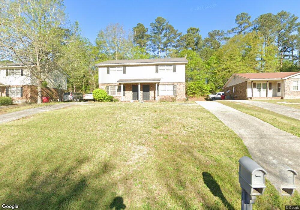
1858 Clinton Rd Macon, GA 31211
Estimated Value: $151,621 - $210,000
4
Beds
4
Baths
2,100
Sq Ft
$91/Sq Ft
Est. Value
About This Home
This home is located at 1858 Clinton Rd, Macon, GA 31211 and is currently estimated at $190,655, approximately $90 per square foot. 1858 Clinton Rd is a home located in Bibb County with nearby schools including Martin Luther King Jr. Elementary School, Appling Middle School, and Northeast High School.
Ownership History
Date
Name
Owned For
Owner Type
Purchase Details
Closed on
Jun 9, 2025
Sold by
K & Kp Properties Llc
Bought by
Diversified 2004 Llc
Current Estimated Value
Home Financials for this Owner
Home Financials are based on the most recent Mortgage that was taken out on this home.
Original Mortgage
$229,000
Outstanding Balance
$228,412
Interest Rate
6.81%
Mortgage Type
New Conventional
Estimated Equity
-$37,757
Purchase Details
Closed on
Aug 21, 2003
Sold by
Jones Walter L and Jones Linda C
Bought by
K&Kp Properties Llc
Create a Home Valuation Report for This Property
The Home Valuation Report is an in-depth analysis detailing your home's value as well as a comparison with similar homes in the area
Home Values in the Area
Average Home Value in this Area
Purchase History
| Date | Buyer | Sale Price | Title Company |
|---|---|---|---|
| Diversified 2004 Llc | $249,000 | None Listed On Document | |
| Diversified 2004 Llc | $249,000 | None Listed On Document | |
| K&Kp Properties Llc | $150,000 | -- |
Source: Public Records
Mortgage History
| Date | Status | Borrower | Loan Amount |
|---|---|---|---|
| Open | Diversified 2004 Llc | $229,000 | |
| Closed | Diversified 2004 Llc | $229,000 |
Source: Public Records
Tax History Compared to Growth
Tax History
| Year | Tax Paid | Tax Assessment Tax Assessment Total Assessment is a certain percentage of the fair market value that is determined by local assessors to be the total taxable value of land and additions on the property. | Land | Improvement |
|---|---|---|---|---|
| 2025 | $1,315 | $53,498 | $2,106 | $51,392 |
| 2024 | $1,250 | $49,205 | $1,620 | $47,585 |
| 2023 | $1,250 | $49,205 | $1,620 | $47,585 |
| 2022 | $1,009 | $29,152 | $4,998 | $24,154 |
| 2021 | $1,108 | $29,152 | $4,998 | $24,154 |
| 2020 | $1,132 | $29,152 | $4,998 | $24,154 |
| 2019 | $1,141 | $29,152 | $4,998 | $24,154 |
| 2018 | $2,108 | $29,152 | $4,998 | $24,154 |
| 2017 | $1,092 | $29,152 | $4,998 | $24,154 |
| 2016 | $1,009 | $29,151 | $4,998 | $24,154 |
| 2015 | $1,428 | $29,151 | $4,998 | $24,154 |
| 2014 | $1,642 | $29,151 | $4,998 | $24,154 |
Source: Public Records
Map
Nearby Homes
- 1854 Clinton Rd
- 1862 Clinton Rd
- 1855 Crestview Dr
- 1866 Clinton Rd
- 1861 Crestview Dr
- 1847 Crestview Dr
- 1867 Crestview Dr
- 1842 Clinton Rd
- 1872 Clinton Rd
- 0 Crestview Dr
- 1871 Crestview Dr
- 1832 Clinton Rd
- 1843 Crestview Dr
- 1880 Clinton Rd
- 1826 Clinton Rd
- 1875 Crestview Dr
- 1848 Crestview Dr
- 1820 Clinton Rd
- 1821 Clinton Rd
- 1884 Clinton Rd