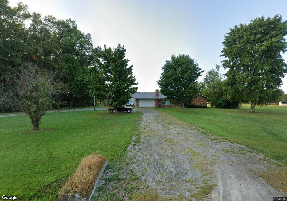
1858 Oakland-Locust Ridge Rd Mount Orab, OH 45154
Estimated Value: $367,000 - $388,000
--
Bed
2
Baths
--
Sq Ft
2
Acres
About This Home
This home is located at 1858 Oakland-Locust Ridge Rd, Mount Orab, OH 45154 and is currently estimated at $376,791. 1858 Oakland-Locust Ridge Rd is a home located in Brown County with nearby schools including Western Brown High School.
Ownership History
Date
Name
Owned For
Owner Type
Purchase Details
Closed on
Feb 25, 2011
Sold by
Veterans Of Foreign Wars Mt Orab Post #9
Bought by
Stapleton James Clinton
Current Estimated Value
Purchase Details
Closed on
May 21, 1999
Sold by
Pugh Kenneth D
Bought by
Stapleton Larry C and Stapleton Mary A
Home Financials for this Owner
Home Financials are based on the most recent Mortgage that was taken out on this home.
Original Mortgage
$80,000
Interest Rate
6.99%
Mortgage Type
New Conventional
Create a Home Valuation Report for This Property
The Home Valuation Report is an in-depth analysis detailing your home's value as well as a comparison with similar homes in the area
Home Values in the Area
Average Home Value in this Area
Purchase History
| Date | Buyer | Sale Price | Title Company |
|---|---|---|---|
| Stapleton James Clinton | $58,000 | Attorney | |
| Stapleton Larry C | $100,000 | -- |
Source: Public Records
Mortgage History
| Date | Status | Borrower | Loan Amount |
|---|---|---|---|
| Previous Owner | Stapleton Larry C | $80,000 |
Source: Public Records
Tax History Compared to Growth
Tax History
| Year | Tax Paid | Tax Assessment Tax Assessment Total Assessment is a certain percentage of the fair market value that is determined by local assessors to be the total taxable value of land and additions on the property. | Land | Improvement |
|---|---|---|---|---|
| 2024 | $2,705 | $95,370 | $13,450 | $81,920 |
| 2023 | $2,705 | $73,230 | $9,700 | $63,530 |
| 2022 | $2,138 | $73,230 | $9,700 | $63,530 |
| 2021 | $2,114 | $73,230 | $9,700 | $63,530 |
| 2020 | $1,825 | $61,030 | $8,090 | $52,940 |
| 2019 | $1,962 | $61,030 | $8,090 | $52,940 |
| 2018 | $973 | $61,030 | $8,090 | $52,940 |
| 2017 | $1,672 | $51,870 | $8,090 | $43,780 |
| 2016 | $1,672 | $51,870 | $8,090 | $43,780 |
| 2015 | $1,660 | $51,870 | $8,090 | $43,780 |
| 2014 | $1,660 | $51,130 | $7,350 | $43,780 |
| 2013 | $1,655 | $51,130 | $7,350 | $43,780 |
Source: Public Records
Map
Nearby Homes
- 12570 Liming van Thompson Rd
- 3750 Starling Rd
- 11818 Cloverlick Rd
- 11475 Colthar Rd
- 3685 Happy Hollow Rd
- 3644 Deer Trace
- 3631 Bass Rd
- 3722 Coon Ave
- 0 Deer Trace Rd
- 0 Colthar Rd Unit 1822757
- B Spring Grove Rd
- A Spring Grove Rd
- 3614 Bootjack Corner Rd
- 3305 Pleasant Hill Rd
- 1993 Old State Rd
- 49-acres Yankeetown Rd
- 23-acres Yankeetown Rd
- acres Yankeetown Rd
- 153 Willow Run Rd
- 3555 Davis Farms Ln
- 12730 Liming van Thompson Rd
- 12720 Liming van Thompson Rd
- 12708 Liming van Thompson Rd
- 1799 Oakland Locust Ridge Rd
- 1934 Oakland Locust Ridge Rd
- 1934 Oakland Locust Ridge Rd
- 1934 Oakland Locust Ridge Rd
- 1934 Oakland Locust Ridge Rd
- 12668 Liming van Thompson Rd
- 1923 Oakland-Locust Ridge Rd
- 12666 Liming van Thompson Rd
- 0 Oakland Locust Ridge Rd Unit 1446132
- 0 Oakland Locust Ridge Rd Unit 1508671
- 21.170ac Oakland-Locust Ridge Rd
- 0 Oakland Locust Ridge Rd Unit 1668026
- 12625 Liming van Thompson Rd
- 12594 Liming van Thompson Rd
- 1708 Oakland Locust Ridge Rd
- 2044 Oakland-Locust Ridge Rd
- 2044 Oakland Locust Ridge Rd