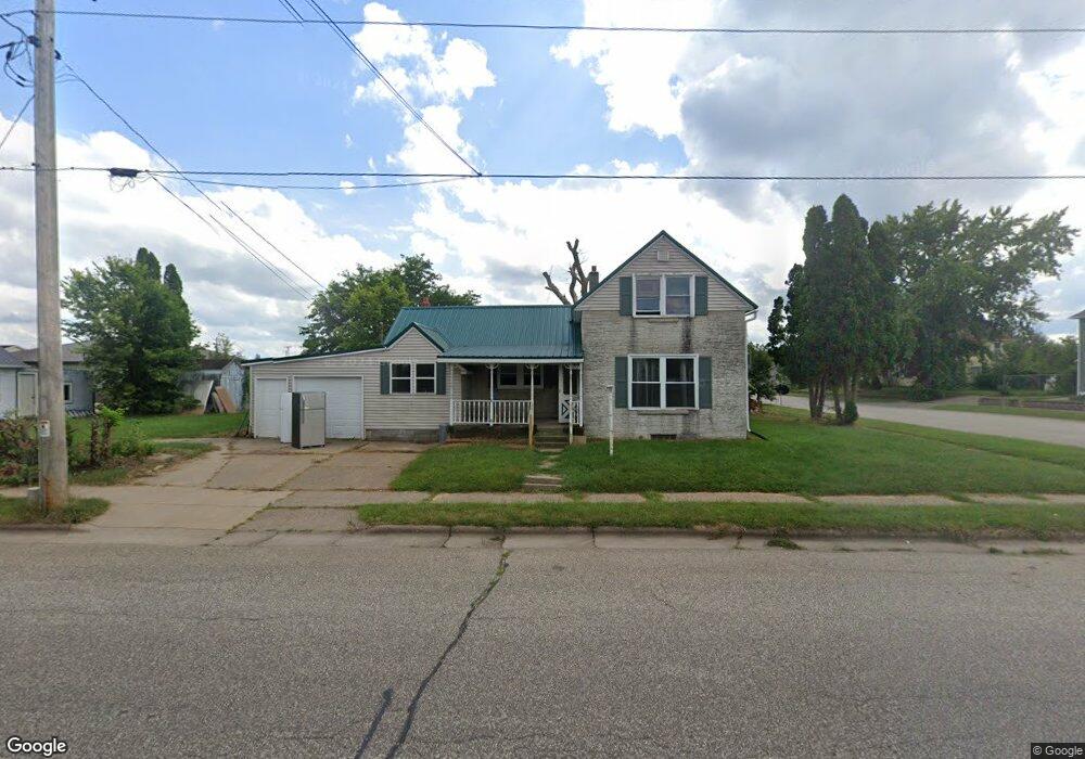
18587 Blair St Whitehall, WI 54773
Estimated Value: $121,000 - $179,000
3
Beds
2
Baths
1,500
Sq Ft
$104/Sq Ft
Est. Value
About This Home
This home is located at 18587 Blair St, Whitehall, WI 54773 and is currently estimated at $156,336, approximately $104 per square foot. 18587 Blair St is a home located in Trempealeau County with nearby schools including Whitehall Memorial Elementary School, Whitehall Memorial Jr./Sr. High School, and Fly Creek Amish School.
Ownership History
Date
Name
Owned For
Owner Type
Purchase Details
Closed on
Nov 19, 2024
Sold by
Lee Meng
Bought by
City Of Whitehall
Current Estimated Value
Purchase Details
Closed on
Dec 17, 2007
Sold by
Albertson Sandra D
Bought by
Lee Meng
Home Financials for this Owner
Home Financials are based on the most recent Mortgage that was taken out on this home.
Original Mortgage
$88,211
Interest Rate
6.31%
Mortgage Type
FHA
Create a Home Valuation Report for This Property
The Home Valuation Report is an in-depth analysis detailing your home's value as well as a comparison with similar homes in the area
Home Values in the Area
Average Home Value in this Area
Purchase History
| Date | Buyer | Sale Price | Title Company |
|---|---|---|---|
| City Of Whitehall | $85,000 | Legends Title Services, Llc #2 | |
| Lee Meng | $89,000 | None Available |
Source: Public Records
Mortgage History
| Date | Status | Borrower | Loan Amount |
|---|---|---|---|
| Previous Owner | Lee Meng | $88,211 |
Source: Public Records
Tax History Compared to Growth
Tax History
| Year | Tax Paid | Tax Assessment Tax Assessment Total Assessment is a certain percentage of the fair market value that is determined by local assessors to be the total taxable value of land and additions on the property. | Land | Improvement |
|---|---|---|---|---|
| 2024 | $2,083 | $99,300 | $10,400 | $88,900 |
| 2023 | $1,987 | $99,300 | $10,400 | $88,900 |
| 2022 | $1,963 | $99,300 | $10,400 | $88,900 |
| 2021 | $2,275 | $78,200 | $8,700 | $69,500 |
| 2020 | $2,191 | $15,650 | $8,700 | $6,950 |
| 2019 | $2,146 | $78,200 | $8,700 | $69,500 |
| 2018 | $1,938 | $78,200 | $8,700 | $69,500 |
| 2017 | $1,992 | $78,200 | $8,700 | $69,500 |
| 2016 | $1,943 | $78,200 | $8,700 | $69,500 |
| 2015 | $1,877 | $78,200 | $8,700 | $69,500 |
| 2014 | $1,785 | $78,200 | $8,700 | $69,500 |
| 2011 | $1,411 | $58,800 | $7,900 | $50,900 |
Source: Public Records
Map
Nearby Homes
- 36015 Main St
- 36290 Camp St
- 18430 Hillside Dr
- 18144 Anderson St
- 18124 Fredrickson St
- N36836 Us Highway 53 121
- N32838 Briten Rd
- 36121 Ash St
- 35979 Osseo Rd
- 35433 Wayne St
- 23898 Adams St
- 23942 Tracy St
- N34701 County Rd N
- N34855 County Rd S
- N30732 Square Bluff Rd
- 39971 Anderson St
- 517 W Broadway St
- 39885 Winsand Dr
- 102 S Peterson Ave
- N34701 County Rd S
- 18573 Blair St
- 18584 Blair St
- 18592 Blair St
- 36487 Ellis St
- 36463 Ellis St
- 36469 Ellis St
- 36487 Ellis St
- 36472 Ellis St
- 36496 Ellis St
- 36502 Ellis St
- 36432 Hancock St
- 36484 Hancock St
- 18529 Blair St
- 18592 Scranton St Unit 2
- 36485 Ellis St
- 36496 Hancock St
- 18576 Scranton St
- 36437 Hancock St
- 36487 Hancock St
- 36443 Hancock St