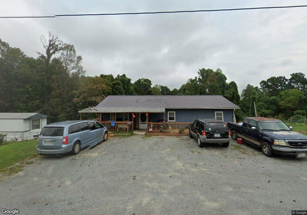
1859 Doe Run Rd Rocky Mount, VA 24151
Estimated Value: $231,000 - $289,000
3
Beds
2
Baths
1,344
Sq Ft
$188/Sq Ft
Est. Value
About This Home
This home is located at 1859 Doe Run Rd, Rocky Mount, VA 24151 and is currently estimated at $252,168, approximately $187 per square foot. 1859 Doe Run Rd is a home located in Franklin County with nearby schools including Sontag Elementary School, Benjamin Franklin Middle School, and Franklin County High School.
Ownership History
Date
Name
Owned For
Owner Type
Purchase Details
Closed on
Sep 29, 2020
Sold by
Smith George C and Smith Hiedi
Bought by
Dc Holdings Of Virginia Inc
Current Estimated Value
Home Financials for this Owner
Home Financials are based on the most recent Mortgage that was taken out on this home.
Original Mortgage
$100,000
Outstanding Balance
$88,542
Interest Rate
2.9%
Mortgage Type
Credit Line Revolving
Estimated Equity
$163,626
Create a Home Valuation Report for This Property
The Home Valuation Report is an in-depth analysis detailing your home's value as well as a comparison with similar homes in the area
Purchase History
| Date | Buyer | Sale Price | Title Company |
|---|---|---|---|
| Dc Holdings Of Virginia Inc | $125,000 | Fidelity National Ttl Ins Co |
Source: Public Records
Mortgage History
| Date | Status | Borrower | Loan Amount |
|---|---|---|---|
| Open | Dc Holdings Of Virginia Inc | $100,000 |
Source: Public Records
Tax History
| Year | Tax Paid | Tax Assessment Tax Assessment Total Assessment is a certain percentage of the fair market value that is determined by local assessors to be the total taxable value of land and additions on the property. | Land | Improvement |
|---|---|---|---|---|
| 2025 | $943 | $219,400 | $29,700 | $189,700 |
| 2024 | $943 | $219,400 | $29,700 | $189,700 |
| 2023 | $763 | $125,100 | $22,700 | $102,400 |
| 2022 | $763 | $125,100 | $22,700 | $102,400 |
| 2021 | $763 | $125,100 | $22,700 | $102,400 |
| 2020 | $763 | $125,100 | $22,700 | $102,400 |
| 2019 | $709 | $116,300 | $22,700 | $93,600 |
| 2018 | $709 | $116,300 | $22,700 | $93,600 |
| 2017 | $640 | $98,300 | $22,700 | $75,600 |
| 2016 | $640 | $98,300 | $22,700 | $75,600 |
| 2015 | -- | $98,300 | $22,700 | $75,600 |
| 2014 | -- | $98,300 | $22,700 | $75,600 |
| 2013 | -- | $98,300 | $22,700 | $75,600 |
Source: Public Records
Map
Nearby Homes
- 0 Doe Run Rd
- 00 Doe Run Rd
- 998 Power Dam Rd
- 403 Ball Park Rd
- 585 Doe Run Rd
- 3145 Doe Run Rd
- 3266 Doe Run Rd
- LOT 60 Summit Dr
- LOT 12 Summit Dr
- LOT 13 Summit Dr
- Lot 13 Creekwood Dr
- LOT 59 Summit Dr
- LOT 24 Summit Dr
- LOT 11 Summit Dr
- LOT 18 Summit Dr
- LOT 25 Summit Dr
- LOT 14 Summit Dr
- Lot 1 Callaway Rd
- LOT 27 Summit Dr
- 0 Hollyfield Rd Unit 924032
- 1833 Doe Run Rd
- 1873 Doe Run Rd
- 1858 Doe Run Rd
- 1828 Doe Run Rd
- 1815 Doe Run Rd
- 1875 Doe Run Rd
- 1872 Doe Run Rd
- 1803 Doe Run Rd
- 1880 Doe Run Rd
- 1899 Doe Run Rd
- 1796 Doe Run Rd
- 1745 Doe Run Rd
- 1736 Doe Run Rd
- 1735 Doe Run Rd
- 1939 Doe Run Rd
- 1939 Doe Run Rd
- 1729 Doe Run Rd
- 33 Chestnut Hill Rd
- 1980 Doe Run Rd
- 24 Power Dam Rd
Your Personal Tour Guide
Ask me questions while you tour the home.