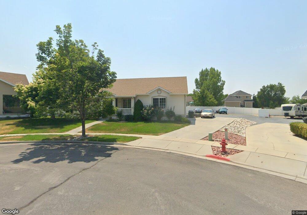
1859 N 270 W Tooele, UT 84074
Estimated Value: $456,000 - $498,000
3
Beds
2
Baths
2,944
Sq Ft
$160/Sq Ft
Est. Value
About This Home
This home is located at 1859 N 270 W, Tooele, UT 84074 and is currently estimated at $472,263, approximately $160 per square foot. 1859 N 270 W is a home located in Tooele County with nearby schools including Overlake Elementary School, Clarke N. Johnsen Junior High School, and Stansbury High School.
Ownership History
Date
Name
Owned For
Owner Type
Purchase Details
Closed on
Jun 13, 2012
Sold by
Birdseye Caywood Bonnie Jean
Bought by
Berry Kimberly Dawn
Current Estimated Value
Home Financials for this Owner
Home Financials are based on the most recent Mortgage that was taken out on this home.
Original Mortgage
$163,265
Outstanding Balance
$112,936
Interest Rate
3.79%
Mortgage Type
New Conventional
Estimated Equity
$359,327
Purchase Details
Closed on
Apr 23, 2009
Sold by
Caywood Bonnie B
Bought by
Caywood Bonnie Jean Birdseye
Home Financials for this Owner
Home Financials are based on the most recent Mortgage that was taken out on this home.
Original Mortgage
$139,000
Interest Rate
5.02%
Mortgage Type
New Conventional
Create a Home Valuation Report for This Property
The Home Valuation Report is an in-depth analysis detailing your home's value as well as a comparison with similar homes in the area
Home Values in the Area
Average Home Value in this Area
Purchase History
| Date | Buyer | Sale Price | Title Company |
|---|---|---|---|
| Berry Kimberly Dawn | -- | Cornerstone Title Tooele Ach | |
| Caywood Bonnie Jean Birdseye | -- | Inwest Title |
Source: Public Records
Mortgage History
| Date | Status | Borrower | Loan Amount |
|---|---|---|---|
| Open | Berry Kimberly Dawn | $163,265 | |
| Previous Owner | Caywood Bonnie Jean Birdseye | $139,000 |
Source: Public Records
Tax History Compared to Growth
Tax History
| Year | Tax Paid | Tax Assessment Tax Assessment Total Assessment is a certain percentage of the fair market value that is determined by local assessors to be the total taxable value of land and additions on the property. | Land | Improvement |
|---|---|---|---|---|
| 2025 | $2,929 | $429,158 | $122,500 | $306,658 |
| 2024 | $3,105 | $229,574 | $67,375 | $162,199 |
| 2023 | $3,105 | $230,629 | $64,140 | $166,489 |
| 2022 | $2,888 | $238,652 | $75,515 | $163,137 |
| 2021 | $2,612 | $179,421 | $26,331 | $153,090 |
| 2020 | $2,450 | $296,398 | $47,875 | $248,523 |
| 2019 | $2,286 | $273,805 | $47,875 | $225,930 |
| 2018 | $1,987 | $226,466 | $35,000 | $191,466 |
| 2017 | $1,551 | $209,060 | $35,000 | $174,060 |
| 2016 | $1,284 | $95,748 | $11,000 | $84,748 |
| 2015 | $1,284 | $91,053 | $0 | $0 |
| 2014 | -- | $91,053 | $0 | $0 |
Source: Public Records
Map
Nearby Homes
- 1969 N 270 W
- 1913 N 370 W
- 295 Drysdale Way
- 437 W 1910 N Unit 317
- 535 W 2030 N Unit 23
- 1861 N 70 W Unit 616
- 1877 N 70 W Unit 618
- 1893 N 70 W
- 1893 N 70 W Unit 620
- Drysdale Twinhomes Plan at Drysdale Twinhomes
- 1885 N 70 W Unit 619
- 1909 N 70 W
- 81 W 1930 N
- 69 1930 N
- 1558 Durocher Ln
- 1557 Colavito Way
- 519 W 1960 N Unit 230
- Franklin Plan at Compass Point
- Ash Plan at Compass Point
- Kennedy Plan at Compass Point
- 288 Dimaggio Dr
- 1858 N 270 W
- 1869 N 270 W
- 278 Dimaggio Dr
- 298 Dimaggio Dr
- 1866 N 270 W
- 1875 N 270 W
- 268 Dimaggio Dr
- 1831 N 210 W
- 235 E Ventura Blvd Unit 124
- 1845 N 210 W
- 1888 N 270 W
- 318 Dimaggio Dr
- 1848 Clemens Way
- 1811 N 210 W
- 1864 Clemens Way
- 1887 N 270 W
- 260 Dimaggio Dr
- 1880 Clemens Way
- 285 Dimaggio Dr