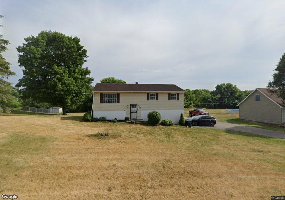
186 Anderson Station Rd Chillicothe, OH 45601
Estimated Value: $178,817 - $243,000
3
Beds
1
Bath
1,008
Sq Ft
$206/Sq Ft
Est. Value
About This Home
This home is located at 186 Anderson Station Rd, Chillicothe, OH 45601 and is currently estimated at $207,954, approximately $206 per square foot. 186 Anderson Station Rd is a home located in Ross County with nearby schools including Unioto Elementary School, Unioto Middle School, and Unioto High School.
Ownership History
Date
Name
Owned For
Owner Type
Purchase Details
Closed on
Jul 18, 2014
Sold by
Jackson Angela J and Jackson Timothy
Bought by
Simmons Frank and Simmons Cassidy
Current Estimated Value
Home Financials for this Owner
Home Financials are based on the most recent Mortgage that was taken out on this home.
Original Mortgage
$104,591
Outstanding Balance
$79,547
Interest Rate
4.12%
Mortgage Type
New Conventional
Estimated Equity
$128,407
Purchase Details
Closed on
Aug 18, 2013
Sold by
Jackson Timothy Mark
Bought by
Jackson Angela J
Purchase Details
Closed on
Dec 30, 2011
Sold by
Fannie Mae
Bought by
Jackson Timothy M and Jackson Angela J
Purchase Details
Closed on
Aug 1, 2011
Sold by
Mckee Betty R
Bought by
Federal National Mortgage Association
Create a Home Valuation Report for This Property
The Home Valuation Report is an in-depth analysis detailing your home's value as well as a comparison with similar homes in the area
Home Values in the Area
Average Home Value in this Area
Purchase History
| Date | Buyer | Sale Price | Title Company |
|---|---|---|---|
| Simmons Frank | $102,500 | Chicago Title Agency | |
| Jackson Angela J | -- | Attorney | |
| Jackson Timothy M | $58,300 | Allodial Title Llc | |
| Federal National Mortgage Association | $58,000 | None Available |
Source: Public Records
Mortgage History
| Date | Status | Borrower | Loan Amount |
|---|---|---|---|
| Open | Simmons Frank | $104,591 |
Source: Public Records
Tax History Compared to Growth
Tax History
| Year | Tax Paid | Tax Assessment Tax Assessment Total Assessment is a certain percentage of the fair market value that is determined by local assessors to be the total taxable value of land and additions on the property. | Land | Improvement |
|---|---|---|---|---|
| 2024 | $1,374 | $39,830 | $8,540 | $31,290 |
| 2023 | $1,374 | $39,830 | $8,540 | $31,290 |
| 2022 | $1,404 | $39,830 | $8,540 | $31,290 |
| 2021 | $1,229 | $32,620 | $7,100 | $25,520 |
| 2020 | $1,236 | $32,620 | $7,100 | $25,520 |
| 2019 | $1,235 | $32,620 | $7,100 | $25,520 |
| 2018 | $1,168 | $30,220 | $5,390 | $24,830 |
| 2017 | $1,170 | $30,220 | $5,390 | $24,830 |
| 2016 | $1,140 | $30,220 | $5,390 | $24,830 |
| 2015 | $1,122 | $29,500 | $5,390 | $24,110 |
| 2014 | $1,095 | $29,500 | $5,390 | $24,110 |
| 2013 | $1,101 | $29,500 | $5,390 | $24,110 |
Source: Public Records
Map
Nearby Homes
- 54 Moccasin Dr
- 313 Goodale Dr
- 102 Franklin Cir
- 365 Golfview Dr
- 559 Golfview Dr
- 435 Mount Carmel Rd
- 11303 County Road 550
- 10217 County Road 550
- 420 Steiner Rd
- 18 Sarah Ct
- 2083 Anderson Station Rd
- 2719 Sulphur Lick Rd
- 12690 Pleasant Valley Rd
- 1036 Clinton Rd
- 320 Summerhill Dr
- 13223 Pleasant Valley Rd
- 265 Brookside Dr
- 2153 Egypt Pike
- 2391 Simmons Rd
- 88 Fruit Hill Dr
- 160 Anderson Station Rd
- 210 Anderson Station Rd
- 199 Anderson Station Rd
- 140 Anderson Station Rd
- 230 Anderson Station Rd
- 34 Flint Dr
- 139 Anderson Station Rd
- 221 Anderson Station Rd
- 52 Flint Dr
- 120 Anderson Station Rd
- 250 Anderson Station Rd
- 41 Mound Ln
- 100 Anderson Station Rd
- 27 Flint Dr
- 101 Anderson Station Rd
- 270 Anderson Station Rd
- 45 Flint Dr
- 99 Anderson Station Rd
- 70 Peace Pipe Rd