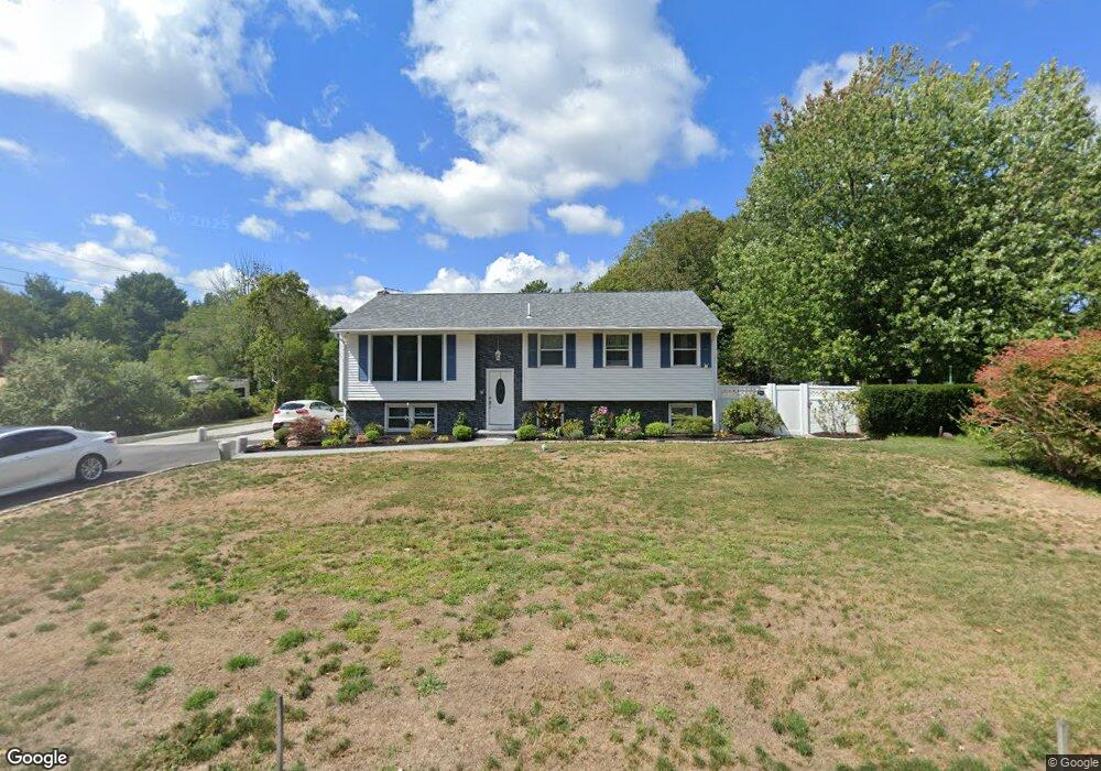
186 Braley Rd East Freetown, MA 02717
Estimated Value: $502,000 - $616,000
3
Beds
2
Baths
2,243
Sq Ft
$250/Sq Ft
Est. Value
About This Home
This home is located at 186 Braley Rd, East Freetown, MA 02717 and is currently estimated at $560,710, approximately $249 per square foot. 186 Braley Rd is a home located in Bristol County with nearby schools including Freetown Elementary School, George R Austin Intermediate School, and Freetown-Lakeville Middle School.
Ownership History
Date
Name
Owned For
Owner Type
Purchase Details
Closed on
Feb 6, 2019
Sold by
Alves Madeicha
Bought by
Alves Napoleon and Alves Alan L
Current Estimated Value
Create a Home Valuation Report for This Property
The Home Valuation Report is an in-depth analysis detailing your home's value as well as a comparison with similar homes in the area
Home Values in the Area
Average Home Value in this Area
Purchase History
| Date | Buyer | Sale Price | Title Company |
|---|---|---|---|
| Alves Napoleon | -- | -- |
Source: Public Records
Tax History Compared to Growth
Tax History
| Year | Tax Paid | Tax Assessment Tax Assessment Total Assessment is a certain percentage of the fair market value that is determined by local assessors to be the total taxable value of land and additions on the property. | Land | Improvement |
|---|---|---|---|---|
| 2025 | $4,499 | $454,000 | $157,400 | $296,600 |
| 2024 | $4,512 | $432,600 | $148,500 | $284,100 |
| 2023 | $4,387 | $409,600 | $133,700 | $275,900 |
| 2022 | $4,220 | $349,900 | $113,300 | $236,600 |
| 2021 | $4,049 | $318,800 | $103,000 | $215,800 |
| 2020 | $4,066 | $312,300 | $99,100 | $213,200 |
| 2019 | $3,836 | $291,700 | $94,300 | $197,400 |
| 2018 | $3,611 | $271,300 | $94,300 | $177,000 |
| 2017 | $3,536 | $265,500 | $94,300 | $171,200 |
| 2016 | $3,379 | $258,100 | $91,600 | $166,500 |
| 2015 | $3,264 | $253,000 | $91,600 | $161,400 |
| 2014 | $3,042 | $241,200 | $89,700 | $151,500 |
Source: Public Records
Map
Nearby Homes
- 1599 Braley Rd Unit 68
- 595 Quanapoag Rd
- 1573 Braley Rd Unit 39
- 599 Quanapoag Rd
- 0 Costa Dr
- 13 Luscomb Ln
- 16 Swallow St
- 1069 Cherokee St
- 4597 Acushnet Ave
- 3 Elaine Ave
- 122 Quanapoag Rd
- 64 Blaze Rd
- 34 Poplar Rd
- 210 Heritage Dr
- 26 Blueberry Dr
- 145 Heritage Dr
- 150 Quanapoag Rd
- 23 Parker Dr
- 1063 Westgate St
- 62 Longview Rd