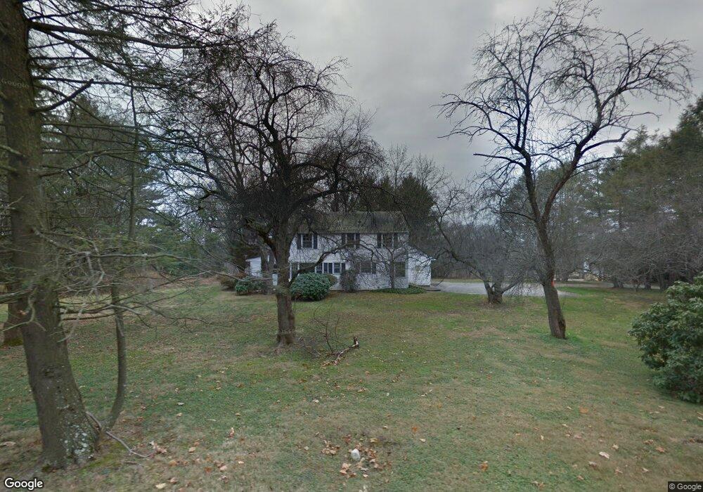
186 Brushy Ridge Rd New Canaan, CT 06840
Estimated Value: $3,489,000 - $4,336,000
5
Beds
6
Baths
5,222
Sq Ft
$733/Sq Ft
Est. Value
About This Home
This home is located at 186 Brushy Ridge Rd, New Canaan, CT 06840 and is currently estimated at $3,826,186, approximately $732 per square foot. 186 Brushy Ridge Rd is a home located in Fairfield County with nearby schools including East Elementary School, Saxe Middle School, and New Canaan High School.
Ownership History
Date
Name
Owned For
Owner Type
Purchase Details
Closed on
Jul 17, 2020
Sold by
Oneal Margaret
Bought by
Sneddon Kendall and Sneddon Jaime
Current Estimated Value
Home Financials for this Owner
Home Financials are based on the most recent Mortgage that was taken out on this home.
Original Mortgage
$1,578,500
Outstanding Balance
$1,399,709
Interest Rate
3.1%
Mortgage Type
Purchase Money Mortgage
Estimated Equity
$2,426,477
Purchase Details
Closed on
Oct 21, 2014
Sold by
Novokus John A
Bought by
White Justin D and White Alison G
Home Financials for this Owner
Home Financials are based on the most recent Mortgage that was taken out on this home.
Original Mortgage
$552,500
Interest Rate
3.13%
Mortgage Type
Adjustable Rate Mortgage/ARM
Purchase Details
Closed on
Mar 11, 2014
Sold by
Novokus John A and Sirico Thomas P
Bought by
Sirico Thomas P and Fanone Mario
Create a Home Valuation Report for This Property
The Home Valuation Report is an in-depth analysis detailing your home's value as well as a comparison with similar homes in the area
Home Values in the Area
Average Home Value in this Area
Purchase History
| Date | Buyer | Sale Price | Title Company |
|---|---|---|---|
| Sneddon Kendall | $2,255,000 | None Available | |
| White Justin D | $850,000 | -- | |
| Sirico Thomas P | -- | -- |
Source: Public Records
Mortgage History
| Date | Status | Borrower | Loan Amount |
|---|---|---|---|
| Open | Sneddon Kendall | $1,578,500 | |
| Previous Owner | Sirico Thomas P | $552,500 | |
| Previous Owner | Sirico Thomas P | $50,000 |
Source: Public Records
Tax History Compared to Growth
Tax History
| Year | Tax Paid | Tax Assessment Tax Assessment Total Assessment is a certain percentage of the fair market value that is determined by local assessors to be the total taxable value of land and additions on the property. | Land | Improvement |
|---|---|---|---|---|
| 2025 | $32,571 | $1,951,530 | $598,500 | $1,353,030 |
| 2024 | $31,498 | $1,951,530 | $598,500 | $1,353,030 |
| 2023 | $28,753 | $1,518,090 | $575,540 | $942,550 |
| 2022 | $27,887 | $1,518,090 | $575,540 | $942,550 |
| 2021 | $27,569 | $1,518,090 | $575,540 | $942,550 |
| 2020 | $26,704 | $1,470,490 | $575,540 | $894,950 |
| 2019 | $27,015 | $1,470,490 | $575,540 | $894,950 |
| 2018 | $22,416 | $1,321,670 | $620,620 | $701,050 |
| 2017 | $10,346 | $620,620 | $620,620 | $0 |
| 2016 | $11,132 | $682,500 | $620,620 | $61,880 |
| 2015 | $10,913 | $682,500 | $620,620 | $61,880 |
| 2014 | $10,606 | $682,500 | $620,620 | $61,880 |
Source: Public Records
Map
Nearby Homes
- 52 Garibaldi Ln
- 262 Brushy Ridge Rd
- 145 River St
- 61 Smith Ridge Rd
- 101 Parade Hill Rd
- 240 Rosebrook Rd
- 204 Parade Hill Rd
- 42 Forest St Unit A
- 60 East Ave
- 64 East Ave
- 15 Burtis Ave Unit Townhome B
- 15 Burtis Ave Unit Townhome D
- 15 Burtis Ave Unit West Penthouse B
- 15 Burtis Ave Unit East Penthouse C
- 15 Burtis Ave Unit Townhome A
- 15 Burtis Ave Unit East Plaza 203
- 67 Carter St
- 48 Brookwood Ln
- 180 Summer St
- 122 Brookwood Ln
- 186 Brushy Ridge Rd
- 190 Brushy Ridge Rd
- 190 Brushy Ridge Rd
- 184 Brushy Ridge Rd
- 188 Brushy Ridge Rd
- 192 Brushy Ridge Rd
- 170 Brushy Ridge Rd
- 204 Brushy Ridge Rd
- 54 Rosebrook Rd
- 100 Garibaldi Ln
- 100 Garibaldi Ln Unit Lot 138
- 109 Garibaldi Ln
- 123 Garibaldi Ln
- 148 Brushy Ridge Rd
- 61 Strawberry Hill Rd
- 181 Brushy Ridge Rd
- 146 Brushy Ridge Rd
- 150 Brushy Ridge Rd
- 57 Strawberry Hill Rd
- 48 Rosebrook Rd