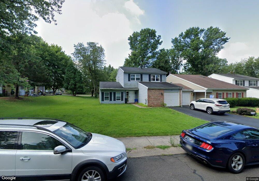
186 Commonwealth Dr Newtown, PA 18940
Estimated Value: $434,000 - $527,000
3
Beds
2
Baths
1,090
Sq Ft
$433/Sq Ft
Est. Value
About This Home
This home is located at 186 Commonwealth Dr, Newtown, PA 18940 and is currently estimated at $472,022, approximately $433 per square foot. 186 Commonwealth Dr is a home located in Bucks County with nearby schools including Goodnoe Elementary School, Newtown Middle School, and Council Rock High School North.
Ownership History
Date
Name
Owned For
Owner Type
Purchase Details
Closed on
Dec 14, 2024
Sold by
Rand Scott M and Rand Jacquelyn S
Bought by
Jacquelyn Rand And Scott Rand Revocable Livin and Rand
Current Estimated Value
Purchase Details
Closed on
Jul 18, 2007
Sold by
Staley Alan and Staley Bonnie J
Bought by
Rand Scott M and Rand Jacquelyn S
Home Financials for this Owner
Home Financials are based on the most recent Mortgage that was taken out on this home.
Original Mortgage
$227,920
Interest Rate
6.78%
Mortgage Type
Purchase Money Mortgage
Purchase Details
Closed on
Jul 25, 1977
Bought by
Staley Alan and Staley Bonnie J
Create a Home Valuation Report for This Property
The Home Valuation Report is an in-depth analysis detailing your home's value as well as a comparison with similar homes in the area
Home Values in the Area
Average Home Value in this Area
Purchase History
| Date | Buyer | Sale Price | Title Company |
|---|---|---|---|
| Jacquelyn Rand And Scott Rand Revocable Livin | -- | None Listed On Document | |
| Jacquelyn Rand And Scott Rand Revocable Livin | -- | None Listed On Document | |
| Rand Scott M | $284,900 | None Available | |
| Staley Alan | $50,000 | -- |
Source: Public Records
Mortgage History
| Date | Status | Borrower | Loan Amount |
|---|---|---|---|
| Previous Owner | Rand Scott M | $227,920 |
Source: Public Records
Tax History Compared to Growth
Tax History
| Year | Tax Paid | Tax Assessment Tax Assessment Total Assessment is a certain percentage of the fair market value that is determined by local assessors to be the total taxable value of land and additions on the property. | Land | Improvement |
|---|---|---|---|---|
| 2025 | $4,905 | $27,600 | $4,000 | $23,600 |
| 2024 | $4,905 | $27,600 | $4,000 | $23,600 |
| 2023 | $4,693 | $27,600 | $4,000 | $23,600 |
| 2022 | $4,602 | $27,600 | $4,000 | $23,600 |
| 2021 | $4,531 | $27,600 | $4,000 | $23,600 |
| 2020 | $4,313 | $27,600 | $4,000 | $23,600 |
| 2019 | $4,211 | $27,600 | $4,000 | $23,600 |
| 2018 | $4,131 | $27,600 | $4,000 | $23,600 |
| 2017 | $3,987 | $27,600 | $4,000 | $23,600 |
| 2016 | $3,960 | $27,600 | $4,000 | $23,600 |
| 2015 | -- | $27,600 | $4,000 | $23,600 |
| 2014 | -- | $27,600 | $4,000 | $23,600 |
Source: Public Records
Map
Nearby Homes
- 210 E Hanover St
- 163 Leedom Way Unit 25
- 4 Westwood Ct
- 104 Cornell Rd
- 48 Old Mill Ln
- 21 Tree Bark Ln
- 1016 Diamond Dr Unit 1016
- 23 Brianna Rd
- 8 Dunham Ln
- 226 Court St
- 113 Thorton Ln
- 22 Penn St
- 66 Nathaniel Rd
- 113 Penn St
- 10014 Beacon Hill Dr Unit 7
- 3231 Durham Place
- 102 Keenan Ln
- 281 E Village Rd
- 180 Independence Dr
- 337 S Lincoln Ave
- 184 Commonwealth Dr
- 182 Commonwealth Dr
- 190 Commonwealth Dr
- 180 Commonwealth Dr
- 192 Commonwealth Dr
- 181 Commonwealth Dr
- 183 Commonwealth Dr
- 185 Commonwealth Dr
- 194 Commonwealth Dr
- 187 Commonwealth Dr
- 165 Commonwealth Dr
- 196 Commonwealth Dr
- 176 Commonwealth Dr
- 163 Commonwealth Dr
- 191 Commonwealth Dr
- 174 Commonwealth Dr
- 161 Commonwealth Dr
- 193 Commonwealth Dr
- 149 Commonwealth Dr
- 147 Commonwealth Dr