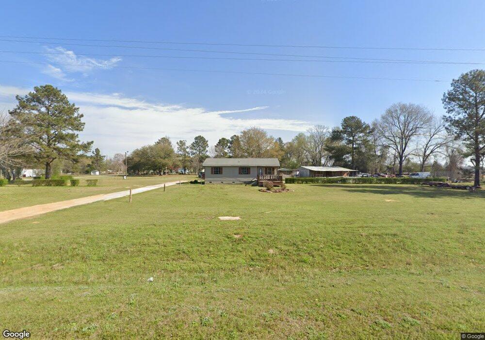
186 Drone Rd Waynesboro, GA 30830
Estimated Value: $140,289 - $228,000
3
Beds
2
Baths
984
Sq Ft
$170/Sq Ft
Est. Value
About This Home
This home is located at 186 Drone Rd, Waynesboro, GA 30830 and is currently estimated at $167,572, approximately $170 per square foot. 186 Drone Rd is a home located in Burke County with nearby schools including Burke County High School.
Ownership History
Date
Name
Owned For
Owner Type
Purchase Details
Closed on
Jan 27, 1998
Sold by
Jim Walter Homes
Bought by
Bostic Robert L
Current Estimated Value
Purchase Details
Closed on
Nov 21, 1997
Sold by
Morgan Leroy
Bought by
Mid-State Trust Vi
Purchase Details
Closed on
Jun 11, 1996
Sold by
Lawton Bertha
Bought by
Morgan Leroy
Purchase Details
Closed on
Apr 16, 1990
Bought by
Lawton Bertha
Create a Home Valuation Report for This Property
The Home Valuation Report is an in-depth analysis detailing your home's value as well as a comparison with similar homes in the area
Home Values in the Area
Average Home Value in this Area
Purchase History
| Date | Buyer | Sale Price | Title Company |
|---|---|---|---|
| Bostic Robert L | $46,000 | -- | |
| Mid-State Trust Vi | $56,900 | -- | |
| Morgan Leroy | -- | -- | |
| Lawton Bertha | $3,500 | -- |
Source: Public Records
Tax History Compared to Growth
Tax History
| Year | Tax Paid | Tax Assessment Tax Assessment Total Assessment is a certain percentage of the fair market value that is determined by local assessors to be the total taxable value of land and additions on the property. | Land | Improvement |
|---|---|---|---|---|
| 2024 | $657 | $35,708 | $1,616 | $34,092 |
| 2023 | $714 | $35,411 | $2,121 | $33,290 |
| 2022 | $617 | $30,895 | $2,121 | $28,774 |
| 2021 | $539 | $26,641 | $2,121 | $24,520 |
| 2020 | $540 | $26,641 | $2,121 | $24,520 |
| 2019 | $501 | $24,476 | $2,121 | $22,355 |
| 2018 | $501 | $24,476 | $2,121 | $22,355 |
| 2017 | $449 | $22,083 | $2,121 | $19,962 |
| 2016 | $452 | $22,083 | $2,121 | $19,962 |
| 2015 | $509 | $24,440 | $2,121 | $22,319 |
| 2014 | $513 | $24,440 | $2,121 | $22,319 |
| 2013 | -- | $24,440 | $2,121 | $22,319 |
Source: Public Records
Map
Nearby Homes
- 356 Massey-Doss Rd
- 0 Chappell Rd Unit 543723
- 0 Chappell Rd
- 4131 Quaker Rd
- 4278 W Quaker Rd
- 0 W Quaker Rd Unit 25649767
- 0 W Quaker Rd Unit 542155
- 5140 Quaker Rd
- 0 Bailey Rd
- 158 Live Oak Dr
- 0 Shady Oak Ct
- 01 Pine Hill Church Rd
- Georgia 305
- 0 Shady Oak Ln Unit 446794
- 0 Shady Oak Ln Unit 446777
- 166 Fairway Dr
- 0 Spread Oak Rd Unit 548018
- 0 Spread Oak Rd Unit 538280
- 2105 Susie Bailey Rd
- 140 Shibar Dr
- 2093 Susie Bailey Rd
- 172 Shibar Dr
- 324 Drone Rd
- 2067 Susie Bailey Rd
- 2098 Susie Bailey Rd
- 2088 Susie Bailey Rd
- 2063 Susie Bailey Rd
- 2047 Susie Bailey Rd
- 2060 Susie Bailey Rd
- 340 Drone Rd
- 2457 Susie Bailey Rd
- 2041 Susie Bailey Rd
- 350 Drone Rd
- 4339 Ga Highway 24 W
- 360 Drone Rd
- 370 Drone Rd
- 2024 Susie Bailey Rd
- 1988 Susie Bailey Rd