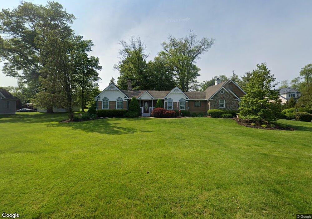
186 Folly Rd Chalfont, PA 18914
Estimated Value: $509,000 - $651,000
3
Beds
3
Baths
1,750
Sq Ft
$324/Sq Ft
Est. Value
About This Home
This home is located at 186 Folly Rd, Chalfont, PA 18914 and is currently estimated at $567,265, approximately $324 per square foot. 186 Folly Rd is a home located in Bucks County with nearby schools including Mill Creek Elementary School, Unami Middle School, and Central Bucks High School - South.
Ownership History
Date
Name
Owned For
Owner Type
Purchase Details
Closed on
Dec 12, 2016
Sold by
Dessel Steven and Dessel Cathy J
Bought by
Sandfrod Eric and Sandfrod Jill
Current Estimated Value
Home Financials for this Owner
Home Financials are based on the most recent Mortgage that was taken out on this home.
Original Mortgage
$306,450
Outstanding Balance
$247,605
Interest Rate
3.54%
Mortgage Type
VA
Estimated Equity
$319,660
Purchase Details
Closed on
Nov 20, 2000
Sold by
Schweinfurth William August and Schweinfurth Margaret Ann
Bought by
Dessel Steven and Dessel Cathy J
Home Financials for this Owner
Home Financials are based on the most recent Mortgage that was taken out on this home.
Original Mortgage
$60,000
Interest Rate
7.78%
Purchase Details
Closed on
Dec 14, 1953
Bought by
Schweinfurth Margaret A and Schweinfurth Wm
Create a Home Valuation Report for This Property
The Home Valuation Report is an in-depth analysis detailing your home's value as well as a comparison with similar homes in the area
Home Values in the Area
Average Home Value in this Area
Purchase History
| Date | Buyer | Sale Price | Title Company |
|---|---|---|---|
| Sandfrod Eric | -- | None Available | |
| Dessel Steven | $187,000 | -- | |
| Schweinfurth Margaret A | -- | -- |
Source: Public Records
Mortgage History
| Date | Status | Borrower | Loan Amount |
|---|---|---|---|
| Open | Sandfrod Eric | $306,450 | |
| Previous Owner | Dessel Steven | $60,000 |
Source: Public Records
Tax History Compared to Growth
Tax History
| Year | Tax Paid | Tax Assessment Tax Assessment Total Assessment is a certain percentage of the fair market value that is determined by local assessors to be the total taxable value of land and additions on the property. | Land | Improvement |
|---|---|---|---|---|
| 2025 | $5,841 | $31,640 | $8,000 | $23,640 |
| 2024 | $5,841 | $31,640 | $8,000 | $23,640 |
| 2023 | $5,408 | $31,640 | $8,000 | $23,640 |
| 2022 | $5,301 | $31,640 | $8,000 | $23,640 |
| 2021 | $5,242 | $31,640 | $8,000 | $23,640 |
| 2020 | $5,242 | $31,640 | $8,000 | $23,640 |
| 2019 | $5,210 | $31,640 | $8,000 | $23,640 |
| 2018 | $5,152 | $31,640 | $8,000 | $23,640 |
| 2017 | $5,083 | $31,640 | $8,000 | $23,640 |
| 2016 | $4,875 | $31,640 | $8,000 | $23,640 |
| 2015 | -- | $31,640 | $8,000 | $23,640 |
| 2014 | -- | $31,640 | $8,000 | $23,640 |
Source: Public Records
Map
Nearby Homes
- 3000 Tyler Way
- 1805 Regency Ct Unit 146
- 528 Fullerton Farm Ct
- 511 McNaney Farm Dr Lot #6
- 506 Fullerton Farm Court Lot #22
- 508 Fullerton Farm Court Lot#21
- 503
- 506 McNaney Farm Dr Lot # 27
- 204 Neighbors Rd
- 2627 County Line Rd
- 625 N Settlers Cir
- 3220 Wier Dr W Unit W
- 623 Addison Way
- 430 Homestead Cir
- 6 Park Rd
- 0000 Wythe Blvd
- 1231 Lower State Rd
- 2405 Cindy Ln
- 858 Elbow Ln
- 254 Nelson Dr