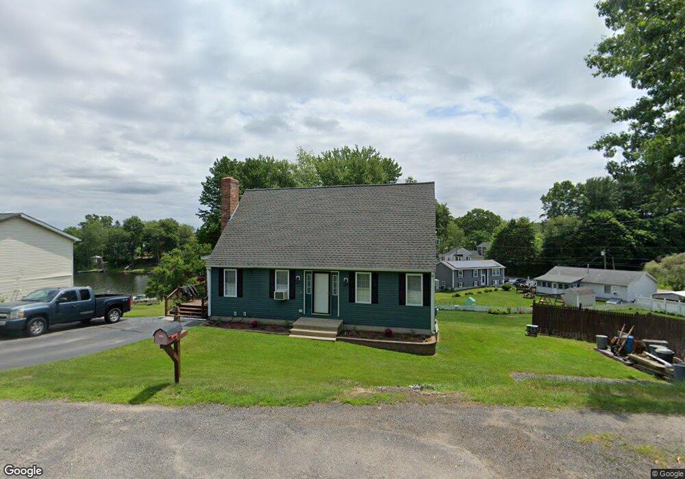
186 Millbury Ave Millbury, MA 01527
Estimated Value: $342,000 - $745,257
3
Beds
2
Baths
1,701
Sq Ft
$281/Sq Ft
Est. Value
About This Home
This home is located at 186 Millbury Ave, Millbury, MA 01527 and is currently estimated at $477,752, approximately $280 per square foot. 186 Millbury Ave is a home located in Worcester County with nearby schools including Elmwood Street Elementary School, Raymond E. Shaw Elementary School, and Millbury Junior/Senior High School.
Ownership History
Date
Name
Owned For
Owner Type
Purchase Details
Closed on
Jun 18, 2025
Sold by
Schroeder Carl S and Schroeder Susan M
Bought by
Schroeder Carl S
Current Estimated Value
Home Financials for this Owner
Home Financials are based on the most recent Mortgage that was taken out on this home.
Original Mortgage
$287,500
Outstanding Balance
$286,755
Interest Rate
6.76%
Mortgage Type
Purchase Money Mortgage
Estimated Equity
$190,997
Create a Home Valuation Report for This Property
The Home Valuation Report is an in-depth analysis detailing your home's value as well as a comparison with similar homes in the area
Home Values in the Area
Average Home Value in this Area
Purchase History
| Date | Buyer | Sale Price | Title Company |
|---|---|---|---|
| Schroeder Carl S | $277,500 | None Available | |
| Schroeder Carl S | $277,500 | None Available |
Source: Public Records
Mortgage History
| Date | Status | Borrower | Loan Amount |
|---|---|---|---|
| Open | Schroeder Carl S | $287,500 | |
| Closed | Schroeder Carl S | $287,500 |
Source: Public Records
Tax History Compared to Growth
Tax History
| Year | Tax Paid | Tax Assessment Tax Assessment Total Assessment is a certain percentage of the fair market value that is determined by local assessors to be the total taxable value of land and additions on the property. | Land | Improvement |
|---|---|---|---|---|
| 2025 | $9,611 | $717,806 | $355,606 | $362,200 |
| 2024 | $8,815 | $666,303 | $329,403 | $336,900 |
| 2023 | $6,588 | $455,948 | $170,748 | $285,200 |
| 2022 | $6,517 | $434,448 | $170,748 | $263,700 |
| 2021 | $6,438 | $417,248 | $170,748 | $246,500 |
| 2020 | $5,827 | $380,100 | $142,200 | $237,900 |
| 2019 | $5,533 | $349,100 | $129,000 | $220,100 |
| 2018 | $5,464 | $334,400 | $129,000 | $205,400 |
| 2017 | $4,962 | $302,000 | $129,000 | $173,000 |
| 2016 | $4,859 | $295,200 | $129,000 | $166,200 |
| 2015 | $4,923 | $299,100 | $137,300 | $161,800 |
| 2014 | $4,184 | $244,700 | $99,500 | $145,200 |
Source: Public Records
Map
Nearby Homes
- 12 Alstead Path
- 90 Macarthur Dr
- 3 May St
- 2 Diane St
- 1 Broadmeadow Ave
- 86 Wheelock Ave
- 1 Pineland Ave
- 52 Clearview Terrace Unit 39
- 11 Westview Ave
- 64 Millbury Ave
- 123 Riverlin St
- 12 Irene Ct
- 330 Millbury Ave
- 15 Clearview Terrace Unit 68
- 90 Park Hill Ave
- 497 Massasoit Rd
- 15 Rayburn Dr
- 17 Atwood Ave
- 54 Park Hill Rd
- 27 A-B Grafton St
- 188 Millbury Ave
- 188 Millbury Ave Unit 1
- 192 Millbury Ave Unit 194
- 184 Millbury Ave
- 189 Millbury Ave Unit C
- 189 Millbury Ave Unit E
- 189 Millbury Ave Unit B
- 7 Manor Rd
- 9 Manor Rd
- 198 Millbury Ave
- 187 Millbury Ave
- 5 Manor Rd
- 2 Shore Terrace
- 1 Manor Rd
- 182 Millbury Ave
- 15 Manor Rd
- 4 Shore Terrace
- 185 Millbury Ave
- 197 Millbury Ave
- 6 Shore Terrace