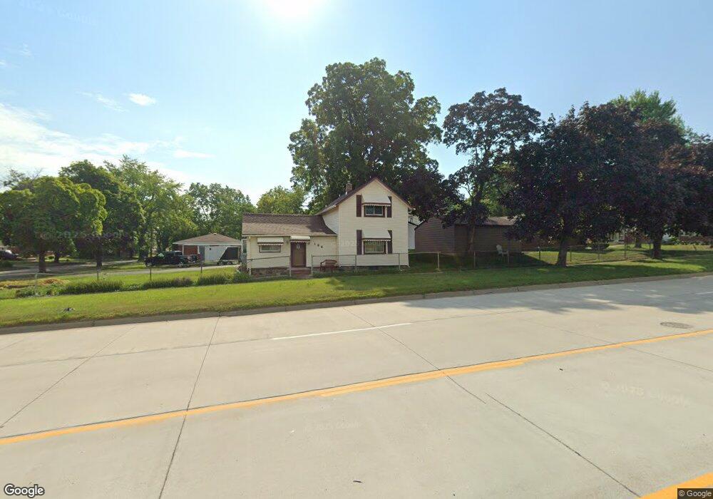
186 Ml King jr Blvd N Pontiac, MI 48342
Estimated Value: $115,018 - $181,000
4
Beds
2
Baths
949
Sq Ft
$162/Sq Ft
Est. Value
About This Home
This home is located at 186 Ml King jr Blvd N, Pontiac, MI 48342 and is currently estimated at $153,755, approximately $162 per square foot. 186 Ml King jr Blvd N is a home located in Oakland County with nearby schools including Walt Whitman Elementary School, Pontiac Middle School, and Pontiac High School.
Ownership History
Date
Name
Owned For
Owner Type
Purchase Details
Closed on
Dec 19, 2006
Sold by
Lewis Transou Aurelia and Transou Gentry
Bought by
Transou Gentry and Lewis Transou Aurelia
Current Estimated Value
Purchase Details
Closed on
Apr 2, 1998
Sold by
Transou Aurelia Lewis
Bought by
Gentry Transou
Home Financials for this Owner
Home Financials are based on the most recent Mortgage that was taken out on this home.
Original Mortgage
$95,400
Outstanding Balance
$18,237
Interest Rate
7.18%
Estimated Equity
$135,518
Purchase Details
Closed on
Jul 31, 1996
Sold by
Camill Shirley
Bought by
Lewis Aurelia
Purchase Details
Closed on
Jul 13, 1994
Sold by
Caddell Esther
Bought by
Camill Shirley
Create a Home Valuation Report for This Property
The Home Valuation Report is an in-depth analysis detailing your home's value as well as a comparison with similar homes in the area
Home Values in the Area
Average Home Value in this Area
Purchase History
| Date | Buyer | Sale Price | Title Company |
|---|---|---|---|
| Transou Gentry | -- | None Available | |
| Gentry Transou | -- | -- | |
| Lewis Aurelia | $43,900 | -- | |
| Camill Shirley | $7,000 | -- |
Source: Public Records
Mortgage History
| Date | Status | Borrower | Loan Amount |
|---|---|---|---|
| Open | Gentry Transou | $95,400 |
Source: Public Records
Tax History Compared to Growth
Tax History
| Year | Tax Paid | Tax Assessment Tax Assessment Total Assessment is a certain percentage of the fair market value that is determined by local assessors to be the total taxable value of land and additions on the property. | Land | Improvement |
|---|---|---|---|---|
| 2024 | $462 | $32,290 | $0 | $0 |
| 2023 | $441 | $27,960 | $0 | $0 |
| 2022 | $491 | $24,120 | $0 | $0 |
| 2021 | $478 | $22,400 | $0 | $0 |
| 2020 | $401 | $19,650 | $0 | $0 |
| 2019 | $454 | $17,080 | $0 | $0 |
| 2018 | $426 | $13,740 | $0 | $0 |
| 2017 | $408 | $13,070 | $0 | $0 |
| 2016 | $436 | $12,550 | $0 | $0 |
| 2015 | -- | $11,410 | $0 | $0 |
| 2014 | -- | $9,980 | $0 | $0 |
| 2011 | -- | $14,150 | $0 | $0 |
Source: Public Records
Map
Nearby Homes
- 291 Michigan Ave
- 88 N Astor St
- 46 N Anderson Ave
- 53 N Midland Dr
- 717 E Pike St
- 0 Cesar Chavez Rd Unit 50166552
- 511 E Pike St
- 472 University Dr
- 28 S Marshall St
- 428 Jordon Rd
- 97 N Roselawn St
- 70 N Roselawn St
- 57 N Roselawn St
- 33 S Tasmania St
- 55 N Roselawn St
- 53 N Roselawn St
- 442 Kenilworth Ave
- 514 Linda Vista Dr
- 18 S Shirley St
- 505 Auburn Ave
- 636 Riverside St
- 631 Phillips St
- 637 Phillips St
- 631 Riverside St
- 644 Riverside St
- 643 Phillips St
- 637 Riverside St
- 648 Riverside St
- 643 Riverside St
- 647 Phillips St
- 647 Riverside St
- 632 Phillips St
- 636 Phillips St
- 189 Westway St
- 644 Phillips St
- 183 Westway St
- 177 Westway St
- 651 Riverside St
- 648 Phillips St
- 193 Martin Luther King Junior Blvd N