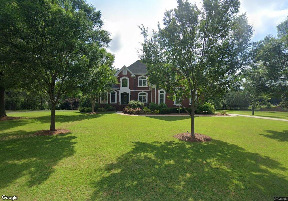
186 N Pointe Blvd Macon, GA 31210
Bolingbroke NeighborhoodEstimated Value: $544,000 - $692,020
3
Beds
4
Baths
3,980
Sq Ft
$159/Sq Ft
Est. Value
About This Home
This home is located at 186 N Pointe Blvd, Macon, GA 31210 and is currently estimated at $633,007, approximately $159 per square foot. 186 N Pointe Blvd is a home located in Monroe County with nearby schools including T.G. Scott Elementary School, Mary Persons High School, and Academy for Classical Education.
Ownership History
Date
Name
Owned For
Owner Type
Purchase Details
Closed on
Aug 25, 2010
Sold by
Veal Steve
Bought by
Veal Steve
Current Estimated Value
Home Financials for this Owner
Home Financials are based on the most recent Mortgage that was taken out on this home.
Original Mortgage
$242,150
Interest Rate
4.6%
Mortgage Type
New Conventional
Purchase Details
Closed on
May 25, 2010
Sold by
Veal Steve
Bought by
Veal Steve and Veal Ginger M
Purchase Details
Closed on
Jun 12, 1997
Bought by
Veal Steve
Purchase Details
Closed on
Oct 13, 1993
Create a Home Valuation Report for This Property
The Home Valuation Report is an in-depth analysis detailing your home's value as well as a comparison with similar homes in the area
Home Values in the Area
Average Home Value in this Area
Purchase History
| Date | Buyer | Sale Price | Title Company |
|---|---|---|---|
| Veal Steve | -- | -- | |
| Veal Steve | -- | -- | |
| Veal Steve | -- | -- | |
| Veal Steve | $22,500 | -- | |
| -- | -- | -- |
Source: Public Records
Mortgage History
| Date | Status | Borrower | Loan Amount |
|---|---|---|---|
| Closed | Veal Steve | $242,150 |
Source: Public Records
Tax History
| Year | Tax Paid | Tax Assessment Tax Assessment Total Assessment is a certain percentage of the fair market value that is determined by local assessors to be the total taxable value of land and additions on the property. | Land | Improvement |
|---|---|---|---|---|
| 2025 | $6,038 | $226,480 | $16,360 | $210,120 |
| 2024 | $6,038 | $226,480 | $16,360 | $210,120 |
| 2023 | $5,794 | $193,600 | $16,360 | $177,240 |
| 2022 | $4,917 | $193,600 | $16,360 | $177,240 |
| 2021 | $5,090 | $193,600 | $16,360 | $177,240 |
| 2020 | $4,259 | $160,240 | $16,360 | $143,880 |
| 2019 | $4,293 | $160,240 | $16,360 | $143,880 |
| 2018 | $4,306 | $160,240 | $16,360 | $143,880 |
| 2017 | $4,657 | $160,240 | $16,360 | $143,880 |
| 2016 | $4,096 | $160,240 | $16,360 | $143,880 |
| 2015 | $3,884 | $160,240 | $16,360 | $143,880 |
| 2014 | $3,747 | $160,240 | $16,360 | $143,880 |
Source: Public Records
Map
Nearby Homes
- 66 Quail Trail
- 121 James Place
- 158 Caroline Ct
- 140 Caroline Ct
- 198 Jennings Ln
- 311 N Rivoli Farms Dr
- 202 Hilltop Cir
- 37 Fawn Dr
- 328 Providence Blvd
- 332 Providence Blvd
- 340 Providence Blvd
- 120 Deer Ridge Trail
- 855 Tufthunter
- 730 Waverly Point
- 726 Waverly Point
- 135 Providence Blvd
- 376 Providence Blvd
- 605 Waverly Ct
- 609 Waverly Ct
- 410 Plantation Dr
- 204 N Pointe Blvd
- 16 Cedar Ridge Ct
- 33 Cedar Ridge Ct
- 112 Pate Rd
- 34 Cedar Ridge Ct
- 181 N Pointe Blvd
- 220 N Pointe Blvd
- 167 N Pointe Blvd
- 217 N Pointe Blvd
- 126 Pate Rd
- 57 Cedar Ridge Ct
- 15 Camilla Ct
- 54 Cedar Ridge Ct
- 37 Camilla Ct
- 151 N Pointe Blvd
- 44 Pate Rd
- 133 N Pointe Blvd
- 19 Pate Rd
- 152 Pate Rd
- 59 Camilla Ct
Your Personal Tour Guide
Ask me questions while you tour the home.