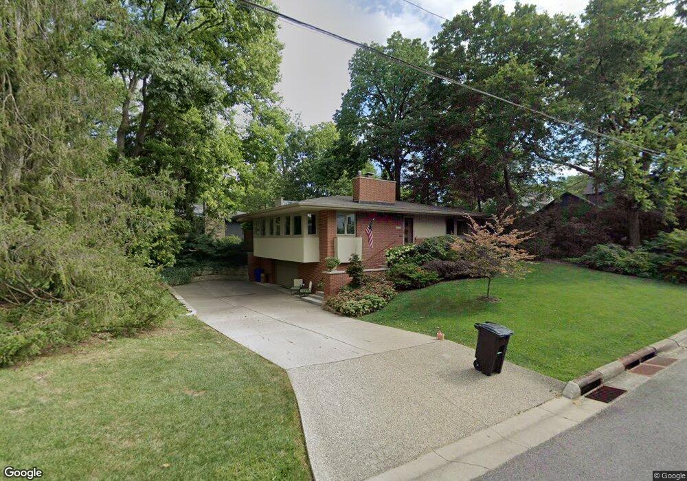
1860 Bluff Ave Columbus, OH 43212
Estimated Value: $660,787 - $722,000
2
Beds
2
Baths
1,630
Sq Ft
$427/Sq Ft
Est. Value
About This Home
This home is located at 1860 Bluff Ave, Columbus, OH 43212 and is currently estimated at $695,447, approximately $426 per square foot. 1860 Bluff Ave is a home located in Franklin County with nearby schools including Robert Louis Stevenson Elementary School, Larson Middle School, and Grandview Heights High School.
Ownership History
Date
Name
Owned For
Owner Type
Purchase Details
Closed on
Jun 25, 2024
Sold by
Guisinger Ronald J and Salmen Robert
Bought by
Heffron Adam P and Heffron Colleen M
Current Estimated Value
Home Financials for this Owner
Home Financials are based on the most recent Mortgage that was taken out on this home.
Original Mortgage
$631,800
Outstanding Balance
$622,057
Interest Rate
7.03%
Mortgage Type
Credit Line Revolving
Estimated Equity
$73,390
Purchase Details
Closed on
Aug 8, 2017
Sold by
Salmen Robert and Guisinger Ronald J
Bought by
Salmen Robert and Guisinger Ronald J
Purchase Details
Closed on
Jul 2, 1998
Sold by
Guisinger Ronald J
Bought by
Salmen Robert and Guisinger Ronald J
Purchase Details
Closed on
Jul 24, 1991
Purchase Details
Closed on
Nov 1, 1989
Create a Home Valuation Report for This Property
The Home Valuation Report is an in-depth analysis detailing your home's value as well as a comparison with similar homes in the area
Home Values in the Area
Average Home Value in this Area
Purchase History
| Date | Buyer | Sale Price | Title Company |
|---|---|---|---|
| Heffron Adam P | $730,000 | Northwest Title | |
| Salmen Robert | -- | None Available | |
| Guisinger Ronald J | -- | None Available | |
| Salmen Robert | $77,500 | -- | |
| -- | $81,500 | -- | |
| -- | -- | -- |
Source: Public Records
Mortgage History
| Date | Status | Borrower | Loan Amount |
|---|---|---|---|
| Open | Heffron Adam P | $631,800 |
Source: Public Records
Tax History
| Year | Tax Paid | Tax Assessment Tax Assessment Total Assessment is a certain percentage of the fair market value that is determined by local assessors to be the total taxable value of land and additions on the property. | Land | Improvement |
|---|---|---|---|---|
| 2025 | $10,736 | $184,070 | $96,180 | $87,890 |
| 2024 | $10,736 | $184,070 | $96,180 | $87,890 |
| 2023 | $9,404 | $184,070 | $96,180 | $87,890 |
| 2022 | $11,033 | $183,890 | $85,400 | $98,490 |
| 2021 | $10,330 | $183,890 | $85,400 | $98,490 |
| 2020 | $10,287 | $183,890 | $85,400 | $98,490 |
| 2019 | $10,490 | $165,970 | $85,400 | $80,570 |
| 2018 | $5,222 | $165,970 | $85,400 | $80,570 |
| 2017 | $9,781 | $165,970 | $85,400 | $80,570 |
| 2016 | $9,450 | $137,280 | $60,450 | $76,830 |
| 2015 | $4,725 | $137,280 | $60,450 | $76,830 |
| 2014 | $9,480 | $137,280 | $60,450 | $76,830 |
| 2013 | $4,050 | $121,345 | $54,950 | $66,395 |
Source: Public Records
Map
Nearby Homes
- 1230 Glenn Ave
- 1000 Urlin Ave Unit 2007
- 1000 Urlin Ave Unit 1407
- 1000 Urlin Ave Unit 1007
- 1000 Urlin Ave Unit 1507
- 1000 Urlin Ave Unit 920
- 1000 Urlin Ave Unit 1402
- 1000 Urlin Ave Unit 1607
- 1000 Urlin Ave Unit 518
- 1875 W 1st Ave
- 1263 Oakland Ave
- 1365 Elmwood Ave
- 1427 Roxbury Rd Unit Manor House North
- 1445 W 2nd Ave
- 1416 Inglis Ave
- 1411 Haines Ave
- 1523 Wyandotte Rd
- 1371 Bluff Ave Unit A
- 1561 Glenn Ave
- 1500 Fairview Ave
- 1130 Glenn Ave
- 1852 Bluff Ave
- 1134 Glenn Ave
- 1868 Bluff Ave
- 1857 Bluff Ave
- 1105 Westwood Ave
- 1113 Westwood Ave
- 1871 Bluff Ave
- 1845 Bluff Ave
- 1125 Westwood Ave
- 1874 Bluff Ave
- 1150 Glenn Ave
- 1131 Westwood Ave
- 1085 Westwood Ave
- 1147 Glenn Ave
- 1114 Wyandotte Rd
- 1894 Bluff Ave
- 9 Stonegate Village Dr
- 1160 Glenn Ave
- 1143 Westwood Ave
Your Personal Tour Guide
Ask me questions while you tour the home.