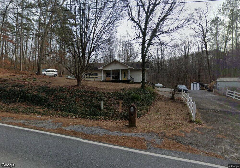
1860 Braswell Rd Rockmart, GA 30153
Estimated Value: $257,325 - $310,000
3
Beds
2
Baths
1,764
Sq Ft
$161/Sq Ft
Est. Value
About This Home
This home is located at 1860 Braswell Rd, Rockmart, GA 30153 and is currently estimated at $284,581, approximately $161 per square foot. 1860 Braswell Rd is a home located in Polk County.
Ownership History
Date
Name
Owned For
Owner Type
Purchase Details
Closed on
Feb 23, 2023
Sold by
Fennell Robbie Dianne Bishop Estate
Bought by
Fairel Lindy and Smith Kathy H
Current Estimated Value
Home Financials for this Owner
Home Financials are based on the most recent Mortgage that was taken out on this home.
Original Mortgage
$137,362
Outstanding Balance
$133,036
Interest Rate
6.5%
Mortgage Type
FHA
Estimated Equity
$151,545
Purchase Details
Closed on
Feb 28, 1983
Bought by
Fennell Reggie
Purchase Details
Closed on
May 30, 1981
Bought by
Fennell Reggie
Create a Home Valuation Report for This Property
The Home Valuation Report is an in-depth analysis detailing your home's value as well as a comparison with similar homes in the area
Home Values in the Area
Average Home Value in this Area
Purchase History
| Date | Buyer | Sale Price | Title Company |
|---|---|---|---|
| Fairel Lindy | -- | -- | |
| Fennell Reggie | -- | -- | |
| Fennell Reggie | -- | -- |
Source: Public Records
Mortgage History
| Date | Status | Borrower | Loan Amount |
|---|---|---|---|
| Open | Fairel Lindy | $137,362 |
Source: Public Records
Tax History Compared to Growth
Tax History
| Year | Tax Paid | Tax Assessment Tax Assessment Total Assessment is a certain percentage of the fair market value that is determined by local assessors to be the total taxable value of land and additions on the property. | Land | Improvement |
|---|---|---|---|---|
| 2024 | $1,807 | $86,452 | $4,166 | $82,286 |
| 2023 | $1,377 | $58,024 | $4,166 | $53,858 |
| 2022 | $857 | $49,515 | $2,778 | $46,737 |
| 2021 | $868 | $49,515 | $2,778 | $46,737 |
| 2020 | $870 | $49,515 | $2,778 | $46,737 |
| 2019 | $678 | $38,591 | $2,778 | $35,813 |
| 2018 | $667 | $37,555 | $2,778 | $34,777 |
| 2017 | $655 | $37,555 | $2,778 | $34,777 |
| 2016 | $871 | $38,767 | $3,990 | $34,777 |
| 2015 | $883 | $39,093 | $3,990 | $35,103 |
| 2014 | $890 | $39,093 | $3,990 | $35,103 |
Source: Public Records
Map
Nearby Homes
- 42 Stonebrook Dr
- 109 Stonecreek Ave
- 560 Coots Lake Rd
- 0 Skyline Dr Unit 7641536
- 0 Skyline Dr Unit 10595027
- 53 Skyline Dr
- 52 Skyline Dr
- LOT 11 Delta Ln
- 327 Delta Ln
- 80 Jacob Trail
- 222 Jacob Trail
- 4332 Brushy Mountain Rd
- 0 Coots Lake Rd Unit 10424314
- 0 Coots Lake Rd Unit 7495676
- 1150 Brushy Mountain Rd
- 0 Springdale Rd Unit 7626448
- 51 Yorkville Hwy
- 145 Arbor Chase Pkwy
- 503 Riverbirch Ct
- 1918 Braswell Rd
- 29 Stonebrook Dr
- 28 Ashton Ct
- 62 Stonebrook Dr
- 1965 Braswell Rd
- 36 Stonebrook Dr
- 39 Ashton Ct
- 61 Stonebrook Dr
- 0 Ashton Ct
- 1751 Braswell Rd
- 1761 Braswell Rd
- 1773 Braswell Rd
- 81 Stonebrook Dr
- 92 Stonebrook Dr
- 0 Stonebrook Dr Unit 5254671
- 0 Stonebrook Dr Unit 5313752
- 0 Stonebrook Dr Unit 5313759
- 0 Stonebrook Dr Unit 9000756
- 0 Stonebrook Dr Unit 8977287
- 0 Stonebrook Dr Unit 8923907