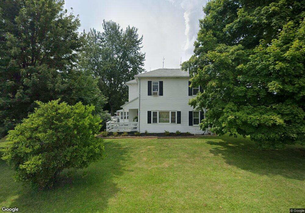
1860 Brindle Rd Ostrander, OH 43061
Scioto NeighborhoodEstimated Value: $371,000 - $400,000
4
Beds
2
Baths
2,182
Sq Ft
$175/Sq Ft
Est. Value
About This Home
This home is located at 1860 Brindle Rd, Ostrander, OH 43061 and is currently estimated at $381,272, approximately $174 per square foot. 1860 Brindle Rd is a home located in Delaware County with nearby schools including Buckeye Valley High School.
Ownership History
Date
Name
Owned For
Owner Type
Purchase Details
Closed on
Jun 16, 2017
Sold by
Alexander John R and Alexander Betty L
Bought by
Streicher Reggie D and Streicher Danielle R
Current Estimated Value
Home Financials for this Owner
Home Financials are based on the most recent Mortgage that was taken out on this home.
Original Mortgage
$220,390
Outstanding Balance
$183,469
Interest Rate
4.05%
Mortgage Type
New Conventional
Estimated Equity
$197,803
Purchase Details
Closed on
Jul 30, 2007
Sold by
Alexander Betty L and Alexander John R
Bought by
Alexander John R and Alexander Betty L
Purchase Details
Closed on
Jan 30, 2007
Sold by
Estate Of Charles R Robinson
Bought by
Alexander Betty L and Dowell Carolyn S
Create a Home Valuation Report for This Property
The Home Valuation Report is an in-depth analysis detailing your home's value as well as a comparison with similar homes in the area
Home Values in the Area
Average Home Value in this Area
Purchase History
| Date | Buyer | Sale Price | Title Company |
|---|---|---|---|
| Streicher Reggie D | -- | None Available | |
| Alexander John R | -- | Attorney | |
| Alexander Betty L | $62,500 | Attorney | |
| Alexander Betty L | -- | None Available |
Source: Public Records
Mortgage History
| Date | Status | Borrower | Loan Amount |
|---|---|---|---|
| Open | Streicher Reggie D | $220,390 |
Source: Public Records
Tax History
| Year | Tax Paid | Tax Assessment Tax Assessment Total Assessment is a certain percentage of the fair market value that is determined by local assessors to be the total taxable value of land and additions on the property. | Land | Improvement |
|---|---|---|---|---|
| 2024 | $3,106 | $93,700 | $18,270 | $75,430 |
| 2023 | $3,106 | $93,700 | $18,270 | $75,430 |
| 2022 | $2,705 | $72,700 | $13,370 | $59,330 |
| 2021 | $2,632 | $72,700 | $13,370 | $59,330 |
| 2020 | $2,647 | $72,700 | $13,370 | $59,330 |
| 2019 | $2,267 | $56,770 | $11,130 | $45,640 |
| 2018 | $2,309 | $56,770 | $11,130 | $45,640 |
| 2017 | $2,122 | $53,420 | $10,050 | $43,370 |
| 2016 | $2,042 | $53,420 | $10,050 | $43,370 |
| 2015 | $2,115 | $52,440 | $10,050 | $42,390 |
| 2014 | $1,987 | $52,440 | $10,050 | $42,390 |
| 2013 | $1,989 | $50,410 | $10,050 | $40,360 |
Source: Public Records
Map
Nearby Homes
- 0 Carr Rd Unit 225016840
- 535 Brayshaw Dr
- 3480 Ostrander Rd
- 0 Burnt Pond Rd Unit Tract 2
- 0 Burnt Pond Rd Unit Tract 4
- 0 Burnt Pond Rd Unit Tract 3
- 0 Burnt Pond Rd Unit Tract 5
- 231 Bluegrass Way
- 311 Ben Curtis Dr
- 0 E High St Unit Tract 1 225034753
- 0 E High St Unit Tract 4 225034758
- 0 E High St Unit Tract 3 225034757
- 6685 State Route 37 W
- 101 S Main St
- 0 Dean Rd Unit 225032132
- 0 Dean Rd Unit 225032131
- 0 Delaware County Line Rd
- 20478 Delaware County Line Rd
- 0 Ohio 257 Unit Lot 2
- 0 Ohio 257 Unit Lot 1
- 1916 Brindle Rd
- 1730 Brindle Rd
- 1885 Ostrander Rd
- 2035 Ostrander Rd
- 1644 Brindle Rd
- 1729 Ostrander Rd
- 1539 Brindle Rd
- 1452 Brindle Rd
- 1423 Brindle Rd
- 2122 Ostrander Rd
- 1750 Smart Rd
- 1790 Smart Rd
- 2108 Smart Rd
- 2338 Ostrander Rd
- 1600 Ostrander Rd
- 1549 Ostrander Rd
- 0 Smart Rd Unit Tract 9 218001774
- 0 Smart Rd Unit Tract 9 219044705
- 0 Smart Rd Unit Tract 8B 219044704
- 0 Smart Rd Unit 10A 218029747
Your Personal Tour Guide
Ask me questions while you tour the home.