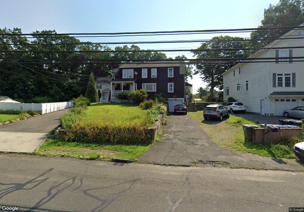
1860 Chopsey Hill Rd Unit 1862 Bridgeport, CT 06606
Reservoir-Whiskey Hill NeighborhoodEstimated Value: $450,845 - $627,000
4
Beds
2
Baths
2,314
Sq Ft
$227/Sq Ft
Est. Value
About This Home
This home is located at 1860 Chopsey Hill Rd Unit 1862, Bridgeport, CT 06606 and is currently estimated at $524,461, approximately $226 per square foot. 1860 Chopsey Hill Rd Unit 1862 is a home located in Fairfield County with nearby schools including Wilbur L. Cross Elementary School, Central High School, and Northeastern Adventist Academy - Fairfield County.
Ownership History
Date
Name
Owned For
Owner Type
Purchase Details
Closed on
Oct 6, 2006
Sold by
Wynter Laurence and Wilson Samuel
Bought by
Christie Noel
Current Estimated Value
Home Financials for this Owner
Home Financials are based on the most recent Mortgage that was taken out on this home.
Original Mortgage
$337,600
Outstanding Balance
$205,979
Interest Rate
6.87%
Estimated Equity
$318,482
Purchase Details
Closed on
Jul 22, 1998
Sold by
Kowalski William M
Bought by
Phillips Laurene and Wilson Sanuel
Create a Home Valuation Report for This Property
The Home Valuation Report is an in-depth analysis detailing your home's value as well as a comparison with similar homes in the area
Home Values in the Area
Average Home Value in this Area
Purchase History
| Date | Buyer | Sale Price | Title Company |
|---|---|---|---|
| Christie Noel | $422,000 | -- | |
| Christie Noel | $422,000 | -- | |
| Phillips Laurene | $112,800 | -- | |
| Phillips Laurene | $112,800 | -- |
Source: Public Records
Mortgage History
| Date | Status | Borrower | Loan Amount |
|---|---|---|---|
| Open | Phillips Laurene | $337,600 | |
| Closed | Phillips Laurene | $84,400 | |
| Closed | Phillips Laurene | $337,600 | |
| Previous Owner | Phillips Laurene | $133,000 |
Source: Public Records
Tax History Compared to Growth
Tax History
| Year | Tax Paid | Tax Assessment Tax Assessment Total Assessment is a certain percentage of the fair market value that is determined by local assessors to be the total taxable value of land and additions on the property. | Land | Improvement |
|---|---|---|---|---|
| 2025 | $7,316 | $168,371 | $62,821 | $105,550 |
| 2024 | $7,316 | $168,371 | $62,821 | $105,550 |
| 2023 | $7,316 | $168,371 | $62,821 | $105,550 |
| 2022 | $7,316 | $168,371 | $62,821 | $105,550 |
| 2021 | $7,316 | $168,371 | $62,821 | $105,550 |
| 2020 | $7,023 | $130,080 | $43,830 | $86,250 |
| 2019 | $7,023 | $130,080 | $43,830 | $86,250 |
| 2018 | $7,072 | $130,080 | $43,830 | $86,250 |
| 2017 | $7,072 | $130,080 | $43,830 | $86,250 |
| 2016 | $7,072 | $130,080 | $43,830 | $86,250 |
| 2015 | $7,334 | $173,780 | $55,800 | $117,980 |
| 2014 | $7,334 | $173,780 | $55,800 | $117,980 |
Source: Public Records
Map
Nearby Homes
- 1800 Chopsey Hill Rd
- 135 Grey Rock Rd
- 45 Rogerson Cir
- 1675 Old Town Rd
- 32 Karen Ct Unit b
- 715 Frenchtown Rd Unit 31
- 26 Karen Ct Unit A
- 165 Yaremich Dr
- 238 Griffin Ave
- 65 Clearview Dr
- 7 Stone Ridge Rd
- 182 Trumbull Ave
- 45 Frenchtown Rd
- 181 Cityview Ave
- 291 Frenchtown Rd
- 365 Platt St
- 539 Old Town Rd
- 410 Alba Ave
- 36 Platt St
- 54 Agnes St
- 1860 Chopsey Hill Rd Unit 2
- 1860 Chopsey Hill Rd Unit 1
- 1862 Chopsey Hill Rd
- 1862 Chopsey Hill Rd Unit 2
- 1864 Chopsey Hill Rd
- 1826 Chopsey Hill Rd Unit 1862
- 266 Red Oak Rd
- 306 Red Oak Rd
- 248 Red Oak Rd
- 1820 Chopsey Hill Rd
- 290 Red Oak Rd
- 1882 Chopsey Hill Rd
- 55 Memory Ln
- 320 Red Oak Rd
- 85 Memory Ln
- 234 Red Oak Rd
- 97 Memory Ln
- 1845 Chopsey Hill Rd
- 1855 Chopsey Hill Rd
- 1835 Chopsey Hill Rd