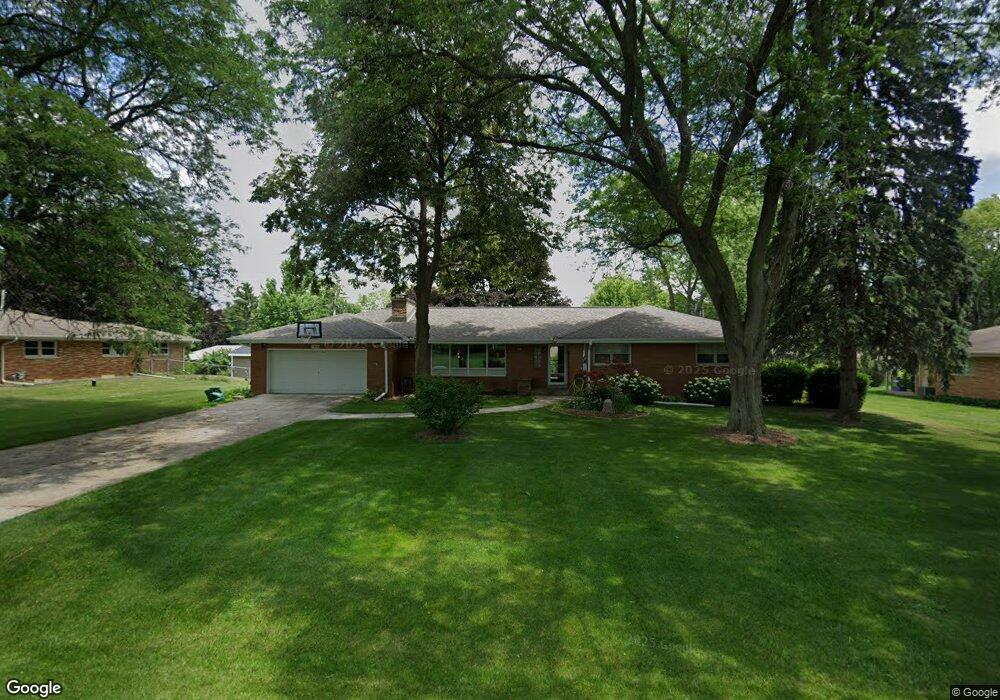
1860 Lone Oak Cir W Brookfield, WI 53045
Estimated Value: $463,000 - $546,007
3
Beds
3
Baths
2,053
Sq Ft
$243/Sq Ft
Est. Value
About This Home
This home is located at 1860 Lone Oak Cir W, Brookfield, WI 53045 and is currently estimated at $499,502, approximately $243 per square foot. 1860 Lone Oak Cir W is a home located in Waukesha County with nearby schools including Brookfield Elementary School, Wisconsin Hills Middle School, and Brookfield Central High School.
Ownership History
Date
Name
Owned For
Owner Type
Purchase Details
Closed on
Nov 7, 2013
Sold by
Price James Robertson and Price Wilma
Bought by
Foster David R and Foster Denise A
Current Estimated Value
Home Financials for this Owner
Home Financials are based on the most recent Mortgage that was taken out on this home.
Original Mortgage
$185,000
Outstanding Balance
$137,964
Interest Rate
4.23%
Mortgage Type
New Conventional
Estimated Equity
$361,538
Create a Home Valuation Report for This Property
The Home Valuation Report is an in-depth analysis detailing your home's value as well as a comparison with similar homes in the area
Home Values in the Area
Average Home Value in this Area
Purchase History
| Date | Buyer | Sale Price | Title Company |
|---|---|---|---|
| Foster David R | $245,000 | None Available |
Source: Public Records
Mortgage History
| Date | Status | Borrower | Loan Amount |
|---|---|---|---|
| Open | Foster David R | $185,000 |
Source: Public Records
Tax History Compared to Growth
Tax History
| Year | Tax Paid | Tax Assessment Tax Assessment Total Assessment is a certain percentage of the fair market value that is determined by local assessors to be the total taxable value of land and additions on the property. | Land | Improvement |
|---|---|---|---|---|
| 2024 | $4,409 | $399,100 | $125,000 | $274,100 |
| 2023 | $4,406 | $399,100 | $125,000 | $274,100 |
| 2022 | $4,197 | $298,400 | $110,000 | $188,400 |
| 2021 | $4,441 | $298,400 | $110,000 | $188,400 |
| 2020 | $4,651 | $298,400 | $110,000 | $188,400 |
| 2019 | $4,461 | $298,400 | $110,000 | $188,400 |
| 2018 | $3,899 | $254,800 | $110,000 | $144,800 |
| 2017 | $3,913 | $254,800 | $110,000 | $144,800 |
| 2016 | $3,970 | $254,800 | $110,000 | $144,800 |
| 2015 | $3,952 | $254,800 | $110,000 | $144,800 |
| 2014 | $4,766 | $254,800 | $110,000 | $144,800 |
| 2013 | $4,766 | $287,800 | $110,000 | $177,800 |
Source: Public Records
Map
Nearby Homes
- 1940 Elm Terrace Cir
- 1980 Lone Oak Cir E
- 17835 Gebhardt Rd
- 17360 Patricia Ln
- 18660 Bonnie Ln
- 1485 N Brookfield Rd
- 2550 Coach House Dr
- 16570 W North Ave
- 2660 N Calhoun Rd
- 1280 Spring Dr
- 19250 Benington Dr
- 920 Oakwood Ln Unit B
- 1035 Oakwood Ln
- 845 Lake Rd Unit D
- 2891 Nassau Dr Unit A2891
- 17725 Nassau Dr Unit 17725
- 1820 Melody Ln
- 2975 River Birch Dr Unit C
- 17020 Lake Rd Unit A
- 18415 W Wisconsin Ave Unit 18415
- 1880 Lone Oak Cir W
- 1840 Lone Oak Cir W
- 1845 Lone Oak Cir E
- 1865 Lone Oak Cir E
- 1825 Lone Oak Cir E
- 1865 Lone Oak Cir W
- 1885 Lone Oak Cir W
- 1920 Lone Oak Cir W
- 1820 Lone Oak Cir W
- 1835 Lone Oak Cir W
- 1815 Lone Oak Cir E
- 1915 Lone Oak Cir E
- 1925 Lone Oak Cir W
- 1840 Lone Oak Cir E
- 1860 Lone Oak Cir E
- 1940 Lone Oak Cir W
- 1825 Lone Oak Cir W
- 17820 Hickory Ct
- 17840 Hickory Ct
- 1935 Lone Oak Cir E