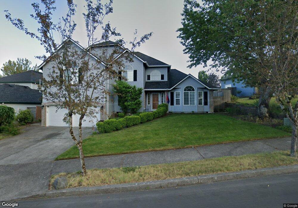
1860 SW Haskins Ct Troutdale, OR 97060
Sunrise NeighborhoodEstimated Value: $569,000 - $675,000
4
Beds
3
Baths
2,602
Sq Ft
$237/Sq Ft
Est. Value
About This Home
This home is located at 1860 SW Haskins Ct, Troutdale, OR 97060 and is currently estimated at $616,045, approximately $236 per square foot. 1860 SW Haskins Ct is a home located in Multnomah County with nearby schools including Troutdale Elementary School, Walt Morey Middle School, and Reynolds High School.
Ownership History
Date
Name
Owned For
Owner Type
Purchase Details
Closed on
Aug 19, 2009
Sold by
The Bank Of New York Mellon Trust Compan
Bought by
Oliver Todd L and Oliver Victoria M
Current Estimated Value
Home Financials for this Owner
Home Financials are based on the most recent Mortgage that was taken out on this home.
Original Mortgage
$263,415
Outstanding Balance
$170,958
Interest Rate
5.2%
Mortgage Type
VA
Estimated Equity
$445,087
Purchase Details
Closed on
Jun 12, 2009
Sold by
Sirstad Daniel R
Bought by
The Bank Of New York Mellon Trust Compan and The Bank Of New York Trust Company Na
Purchase Details
Closed on
Nov 16, 2006
Sold by
Gordy Barbara I
Bought by
Sirstad Ida Jean and Sirstad Daniel R
Home Financials for this Owner
Home Financials are based on the most recent Mortgage that was taken out on this home.
Original Mortgage
$276,000
Interest Rate
6.36%
Mortgage Type
Purchase Money Mortgage
Purchase Details
Closed on
Nov 15, 2006
Sold by
Hutchins Michael B
Bought by
Gordy Barbara I
Home Financials for this Owner
Home Financials are based on the most recent Mortgage that was taken out on this home.
Original Mortgage
$276,000
Interest Rate
6.36%
Mortgage Type
Purchase Money Mortgage
Purchase Details
Closed on
Nov 11, 2003
Sold by
Gordy Barbara I
Bought by
Gordy Barbara I and Hutchins Michael B
Home Financials for this Owner
Home Financials are based on the most recent Mortgage that was taken out on this home.
Original Mortgage
$202,400
Interest Rate
5.98%
Mortgage Type
Purchase Money Mortgage
Purchase Details
Closed on
Oct 1, 2003
Sold by
King Joseph B
Bought by
Gordy Barbara I
Home Financials for this Owner
Home Financials are based on the most recent Mortgage that was taken out on this home.
Original Mortgage
$202,400
Interest Rate
5.98%
Mortgage Type
Purchase Money Mortgage
Purchase Details
Closed on
Dec 15, 2000
Sold by
Hart Bryce D
Bought by
King Joseph B and King Jean A
Home Financials for this Owner
Home Financials are based on the most recent Mortgage that was taken out on this home.
Original Mortgage
$205,000
Interest Rate
7.67%
Mortgage Type
Stand Alone First
Create a Home Valuation Report for This Property
The Home Valuation Report is an in-depth analysis detailing your home's value as well as a comparison with similar homes in the area
Home Values in the Area
Average Home Value in this Area
Purchase History
| Date | Buyer | Sale Price | Title Company |
|---|---|---|---|
| Oliver Todd L | $255,000 | Fidelity Natl Title Co Of Or | |
| The Bank Of New York Mellon Trust Compan | $223,002 | Fatco | |
| Sirstad Ida Jean | $345,000 | Lawyers Title Ins | |
| Gordy Barbara I | -- | Lawyers Title Ins | |
| Gordy Barbara I | -- | -- | |
| Gordy Barbara I | $253,000 | Pacific Nw Title | |
| King Joseph B | $205,000 | First American |
Source: Public Records
Mortgage History
| Date | Status | Borrower | Loan Amount |
|---|---|---|---|
| Open | Oliver Todd L | $263,415 | |
| Previous Owner | Sirstad Ida Jean | $276,000 | |
| Previous Owner | Gordy Barbara I | $202,400 | |
| Previous Owner | King Joseph B | $205,000 |
Source: Public Records
Tax History Compared to Growth
Tax History
| Year | Tax Paid | Tax Assessment Tax Assessment Total Assessment is a certain percentage of the fair market value that is determined by local assessors to be the total taxable value of land and additions on the property. | Land | Improvement |
|---|---|---|---|---|
| 2025 | $7,006 | $381,280 | -- | -- |
| 2024 | $6,619 | $370,180 | -- | -- |
| 2023 | $6,619 | $359,400 | $0 | $0 |
| 2022 | $6,289 | $348,940 | $0 | $0 |
| 2021 | $6,144 | $338,780 | $0 | $0 |
| 2020 | $5,748 | $328,920 | $0 | $0 |
| 2019 | $5,517 | $319,340 | $0 | $0 |
| 2018 | $5,480 | $310,040 | $0 | $0 |
| 2017 | $5,467 | $301,010 | $0 | $0 |
| 2016 | $5,284 | $292,250 | $0 | $0 |
| 2015 | $5,151 | $283,740 | $0 | $0 |
| 2014 | $4,922 | $275,480 | $0 | $0 |
Source: Public Records
Map
Nearby Homes
- 2020 SW Laura Ct
- 2154 SE Sandy Ct
- 839 SW Grant Way
- 665 SW 24th St
- 1226 SW Hensley Rd
- 821 SW 14th St
- 1021 SW 24th St
- 2511 S Troutdale Rd
- 809 SW Crestview Way
- 735 SW Sunset Way
- 621 SE 11th Cir
- 724 SW 28th St
- 1212 SW Edgefield Ave
- 2505 SE Clark Ct
- 1427 SW 24th St
- 2521 SE Clark Ct
- 2326 SW Mcginnis Ave
- 1019 SE 27th St
- 2846 SW Faith Ct
- 1648 SE Lewellyn Ave
- 1872 SW Haskins Ct
- 1858 SW Haskins Ct
- 2040 SW Sunrise Cir
- 2052 SW Sunrise Cir
- 1846 SW Haskins Ct
- 1863 SW Haskins Ct
- 2064 SW Sunrise Cir
- 1884 SW Haskins Ct
- 2038 SW Sunrise Cir
- 1875 SW Haskins Ct
- 1834 SW Haskins Ct
- 1882 SW Spence Ave
- 1896 SW Haskins Ct
- 2076 SW Sunrise Cir
- 1885 SW Spence Ave
- 1887 SW Haskins Ct
- 1899 SW Haskins Ct
- 1899 SW Haskins Ct Reduced
- 2026 SW Sunrise Cir
- 1822 SW Haskins Ct