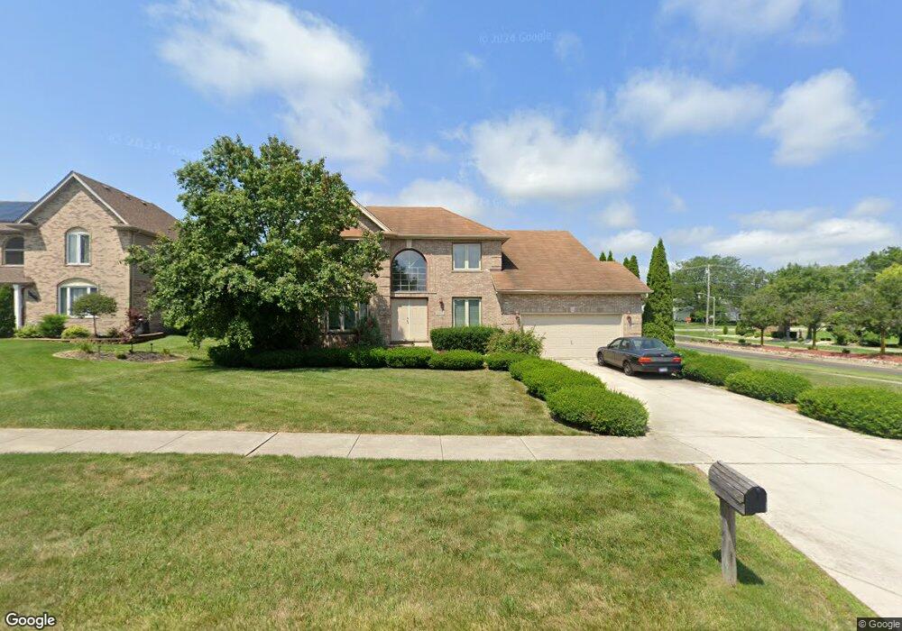
18600 Michael Dr Hazel Crest, IL 60429
Village West NeighborhoodEstimated Value: $366,000 - $438,000
4
Beds
3
Baths
2,393
Sq Ft
$168/Sq Ft
Est. Value
About This Home
This home is located at 18600 Michael Dr, Hazel Crest, IL 60429 and is currently estimated at $400,850, approximately $167 per square foot. 18600 Michael Dr is a home located in Cook County with nearby schools including Flossmoor Hills Elementary School, Parker Junior High School, and Homewood-Flossmoor High School.
Ownership History
Date
Name
Owned For
Owner Type
Purchase Details
Closed on
Feb 20, 2014
Sold by
Raybon Carrie and Owens Yolanda Denise
Bought by
Raybon Thomas J and Owens Raybon Yolanda D
Current Estimated Value
Purchase Details
Closed on
Feb 23, 2001
Sold by
Alexis Development Inc
Bought by
Owens Yolanda Denise and Raybon Carrie
Home Financials for this Owner
Home Financials are based on the most recent Mortgage that was taken out on this home.
Original Mortgage
$227,950
Outstanding Balance
$79,792
Interest Rate
7.18%
Estimated Equity
$321,058
Purchase Details
Closed on
Jan 12, 2001
Sold by
Old Kent Bank
Bought by
Alexis Development Inc
Home Financials for this Owner
Home Financials are based on the most recent Mortgage that was taken out on this home.
Original Mortgage
$227,950
Outstanding Balance
$79,792
Interest Rate
7.18%
Estimated Equity
$321,058
Create a Home Valuation Report for This Property
The Home Valuation Report is an in-depth analysis detailing your home's value as well as a comparison with similar homes in the area
Home Values in the Area
Average Home Value in this Area
Purchase History
| Date | Buyer | Sale Price | Title Company |
|---|---|---|---|
| Raybon Thomas J | -- | Title First Agency | |
| Owens Yolanda Denise | $240,000 | Chicago Title Insurance Co | |
| Alexis Development Inc | -- | First American Title |
Source: Public Records
Mortgage History
| Date | Status | Borrower | Loan Amount |
|---|---|---|---|
| Open | Owens Yolanda Denise | $227,950 |
Source: Public Records
Tax History Compared to Growth
Tax History
| Year | Tax Paid | Tax Assessment Tax Assessment Total Assessment is a certain percentage of the fair market value that is determined by local assessors to be the total taxable value of land and additions on the property. | Land | Improvement |
|---|---|---|---|---|
| 2025 | $15,633 | $32,952 | $9,954 | $22,998 |
| 2024 | $15,633 | $32,952 | $9,954 | $22,998 |
| 2023 | $12,500 | $32,952 | $9,954 | $22,998 |
| 2022 | $12,500 | $20,653 | $8,759 | $11,894 |
| 2021 | $13,611 | $22,322 | $8,759 | $13,563 |
| 2020 | $12,885 | $22,322 | $8,759 | $13,563 |
| 2019 | $12,648 | $21,645 | $7,963 | $13,682 |
| 2018 | $12,156 | $21,645 | $7,963 | $13,682 |
| 2017 | $11,594 | $21,645 | $7,963 | $13,682 |
| 2016 | $10,540 | $19,635 | $7,166 | $12,469 |
| 2015 | $10,310 | $19,635 | $7,166 | $12,469 |
| 2014 | $10,983 | $21,298 | $7,166 | $14,132 |
| 2013 | $9,991 | $21,620 | $7,166 | $14,454 |
Source: Public Records
Map
Nearby Homes
- 4445 Provincetown Dr
- 3800 River Rd
- 2323 Windsor Ln
- 2295 Windsor Ln
- 3710 Briar Ln
- 2271 Windsor Ln Unit 2
- 1135 Williamsburg Rd Unit 1
- 3742 Beech St
- 18840 Harding Ave
- 4240 188th St
- 4215 188th St
- 3712 Beech St
- 3641 Beech St
- 4300 188th St
- 835 Maple Rd
- 18941 Cypress Ave Unit 2
- 4331 187th Place
- 754 Central Park Ave
- 18951 Chestnut Ave
- 19002 Springfield Ave
- 18602 Michael Dr
- 18604 Michael Dr
- 3911 Edgewater Dr Unit 1
- 18606 Michael Dr
- 3906 Streamwood Dr
- 3904 Edgewater Dr
- 3909 Edgewater Dr
- 3904 Streamwood Dr
- 4441 Provincetown Dr
- 18511 Michael Ct
- 3902 Edgewater Dr
- 4442 Provincetown Dr
- 4443 Provincetown Dr
- 3907 Edgewater Dr
- 3907 Edgewater Dr
- 3907 Edgewater Dr
- 3902 Streamwood Dr
- 4444 Provincetown Dr
- 18509 Michael Ct
- 18627 Oakwood Ave