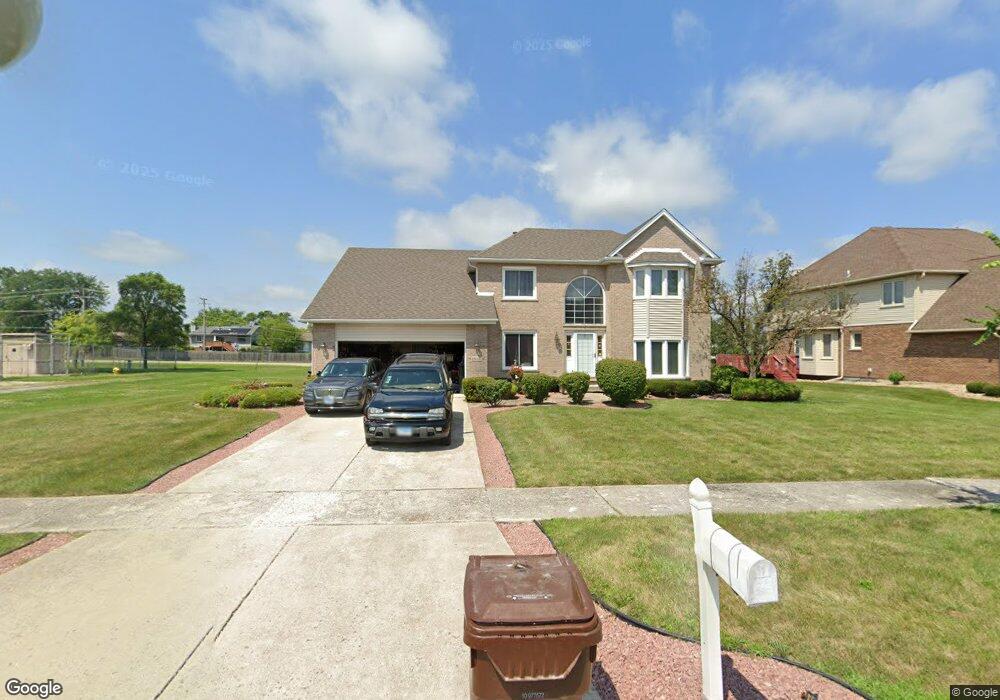
18606 Michael Dr Hazel Crest, IL 60429
Village West NeighborhoodEstimated Value: $355,295 - $517,000
4
Beds
3
Baths
2,393
Sq Ft
$177/Sq Ft
Est. Value
About This Home
This home is located at 18606 Michael Dr, Hazel Crest, IL 60429 and is currently estimated at $422,574, approximately $176 per square foot. 18606 Michael Dr is a home located in Cook County with nearby schools including Flossmoor Hills Elementary School, Parker Junior High School, and Homewood-Flossmoor High School.
Ownership History
Date
Name
Owned For
Owner Type
Purchase Details
Closed on
Jul 1, 2020
Sold by
Walker Michael
Bought by
Atg Trust Company and Trust Number L020 061
Current Estimated Value
Purchase Details
Closed on
Oct 11, 1995
Sold by
Grand National Bank
Bought by
Walker Michael and Walker Linda
Home Financials for this Owner
Home Financials are based on the most recent Mortgage that was taken out on this home.
Original Mortgage
$203,000
Interest Rate
7.52%
Create a Home Valuation Report for This Property
The Home Valuation Report is an in-depth analysis detailing your home's value as well as a comparison with similar homes in the area
Home Values in the Area
Average Home Value in this Area
Purchase History
| Date | Buyer | Sale Price | Title Company |
|---|---|---|---|
| Atg Trust Company | -- | Atg Trust Company | |
| Walker Michael | $226,000 | -- |
Source: Public Records
Mortgage History
| Date | Status | Borrower | Loan Amount |
|---|---|---|---|
| Previous Owner | Walker Michael | $203,000 |
Source: Public Records
Tax History
| Year | Tax Paid | Tax Assessment Tax Assessment Total Assessment is a certain percentage of the fair market value that is determined by local assessors to be the total taxable value of land and additions on the property. | Land | Improvement |
|---|---|---|---|---|
| 2025 | $14,787 | $34,000 | $10,044 | $23,956 |
| 2024 | $14,787 | $34,000 | $10,044 | $23,956 |
| 2023 | $11,243 | $34,000 | $10,044 | $23,956 |
| 2022 | $11,243 | $21,655 | $8,839 | $12,816 |
| 2021 | $11,223 | $21,655 | $8,839 | $12,816 |
| 2020 | $10,774 | $21,655 | $8,839 | $12,816 |
| 2019 | $9,905 | $20,438 | $8,035 | $12,403 |
| 2018 | $9,516 | $20,438 | $8,035 | $12,403 |
| 2017 | $9,114 | $20,438 | $8,035 | $12,403 |
| 2016 | $12,115 | $19,700 | $7,231 | $12,469 |
| 2015 | $9,214 | $19,700 | $7,231 | $12,469 |
| 2014 | $11,553 | $19,700 | $7,231 | $12,469 |
| 2013 | $9,697 | $22,941 | $7,231 | $15,710 |
Source: Public Records
Map
Nearby Homes
- 4036 W 187th St
- 3902 Edgewater Dr
- 4445 Provincetown Dr
- 4521 Provincetown Dr
- 3800 River Rd
- 4041 187th Place
- 2323 Windsor Ln
- 3710 Briar Ln
- 173 Williamsburg Rd Unit 1
- 2295 Windsor Ln
- 1115 Williamsburg Rd Unit 1
- 18840 Harding Ave
- 1101 Williamsburg Rd Unit 1
- 2271 Windsor Ln Unit 2
- 18900 Oakwood Ct
- 18710 Walnut Ave
- 3712 Beech St
- 800 Elm St
- 3641 Beech St
- 835 Maple Rd
- 18604 Michael Dr
- 18602 Michael Dr
- 3906 Streamwood Dr
- 3907 Streamwood Dr
- 18600 Michael Dr
- 3904 Streamwood Dr
- 18627 Oakwood Ave
- 3911 Edgewater Dr Unit 1
- 18612 Michael Dr
- 3905 Streamwood Dr
- 18633 Oakwood Ave
- 4016 186th Place
- 3902 Streamwood Dr
- 18637 Oakwood Ave
- 3909 Edgewater Dr
- 3903 Streamwood Dr
- 18614 Michael Dr
- 18649 Oakwood Ave
- 3900 Streamwood Dr
- 3907 River Rd
Your Personal Tour Guide
Ask me questions while you tour the home.