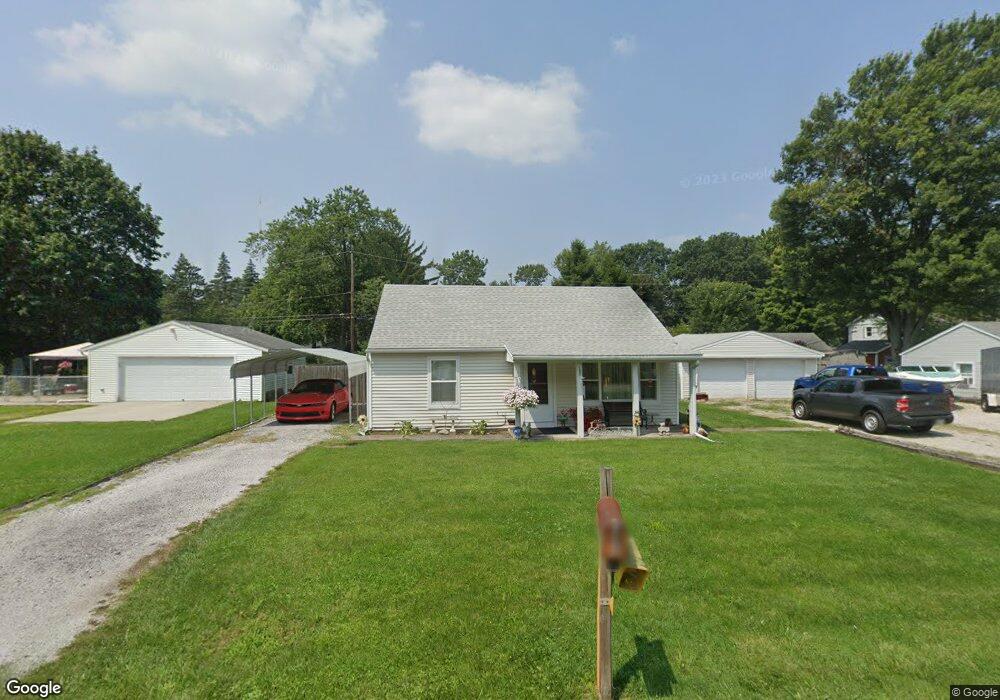
1861 Lagundovie Rd Oregon, OH 43616
Estimated Value: $119,334 - $131,000
2
Beds
1
Bath
750
Sq Ft
$167/Sq Ft
Est. Value
About This Home
This home is located at 1861 Lagundovie Rd, Oregon, OH 43616 and is currently estimated at $125,084, approximately $166 per square foot. 1861 Lagundovie Rd is a home located in Lucas County.
Ownership History
Date
Name
Owned For
Owner Type
Purchase Details
Closed on
Apr 20, 2005
Sold by
Downs David A and Downs Jackie L
Bought by
Downs David A and Downs Jackie L
Current Estimated Value
Purchase Details
Closed on
Jul 15, 2004
Sold by
Akers Adam A and Akers Lisa S
Bought by
Downs David A
Home Financials for this Owner
Home Financials are based on the most recent Mortgage that was taken out on this home.
Original Mortgage
$91,730
Interest Rate
6.37%
Mortgage Type
VA
Purchase Details
Closed on
Mar 2, 2004
Sold by
Bank Of New York
Bought by
Akers Adam A and Akers Lisa S
Home Financials for this Owner
Home Financials are based on the most recent Mortgage that was taken out on this home.
Original Mortgage
$60,000
Interest Rate
5.78%
Mortgage Type
Purchase Money Mortgage
Purchase Details
Closed on
Nov 9, 2003
Sold by
Henning Margaret and Henning Earl
Bought by
The Bank Of New York
Create a Home Valuation Report for This Property
The Home Valuation Report is an in-depth analysis detailing your home's value as well as a comparison with similar homes in the area
Home Values in the Area
Average Home Value in this Area
Purchase History
| Date | Buyer | Sale Price | Title Company |
|---|---|---|---|
| Downs David A | -- | -- | |
| Downs David A | $88,800 | Northwest Title Agency Of Oh | |
| Akers Adam A | $36,800 | Title First Agency Inc | |
| The Bank Of New York | $42,000 | Title First Agency Inc |
Source: Public Records
Mortgage History
| Date | Status | Borrower | Loan Amount |
|---|---|---|---|
| Previous Owner | Downs David A | $98,000 | |
| Previous Owner | Downs David A | $91,730 | |
| Previous Owner | Akers Adam A | $60,000 | |
| Previous Owner | Henning Earl | $12,359 |
Source: Public Records
Tax History Compared to Growth
Tax History
| Year | Tax Paid | Tax Assessment Tax Assessment Total Assessment is a certain percentage of the fair market value that is determined by local assessors to be the total taxable value of land and additions on the property. | Land | Improvement |
|---|---|---|---|---|
| 2024 | $762 | $31,780 | $9,660 | $22,120 |
| 2023 | $1,414 | $25,095 | $8,925 | $16,170 |
| 2022 | $1,424 | $25,095 | $8,925 | $16,170 |
| 2021 | $1,436 | $25,095 | $8,925 | $16,170 |
| 2020 | $1,455 | $22,610 | $8,120 | $14,490 |
| 2019 | $1,414 | $22,610 | $8,120 | $14,490 |
| 2018 | $1,348 | $22,610 | $8,120 | $14,490 |
| 2017 | $1,314 | $19,670 | $5,565 | $14,105 |
| 2016 | $1,297 | $56,200 | $15,900 | $40,300 |
| 2015 | $1,289 | $56,200 | $15,900 | $40,300 |
| 2014 | $1,176 | $19,290 | $5,460 | $13,830 |
| 2013 | $1,176 | $19,290 | $5,460 | $13,830 |
Source: Public Records
Map
Nearby Homes
- 1830 Lilias Dr
- 5911 Plympton Cir
- 2057 Blanche Dr
- 5243 Eagles Landing Dr
- 5305 Cedar Point Rd
- 1633 Grand Bay Dr
- 8800 Cedar Point Rd
- 6530 Corduroy Rd
- 2079 Arkansas St
- 140 N Wynn Rd
- 234 Avilyn Ln
- 4263 Corduroy Rd
- 5054 Magnolia Dr
- 5065 Magnolia Dr
- 5047 Noah Ln
- 5037 Easton Dr
- 5033 Easton Dr
- 5029 Easton Dr
- 5040 Easton Dr
- 5025 Easton Dr
- 1907 Lagundovie Rd
- 1862 Seaford Dr
- 1851 Lagundovie Rd
- 1852 Seaford Dr
- 1906 Seaford Dr
- 1902 Lagundovie Rd
- 1900 Lagundovie Rd
- 1856 Lagundovie Rd
- 1916 Seaford Dr
- 1917 Lagundovie Rd
- 1912 Lagundovie Rd
- 1846 Lagundovie Rd
- 6121 James Rd
- 1926 Seaford Dr
- 1922 Lagundovie Rd
- 1903 Seaford Dr
- 1861 Seaford Dr
- 1927 Lagundovie Rd
- 1853 Seaford Dr
- 6109 James Rd