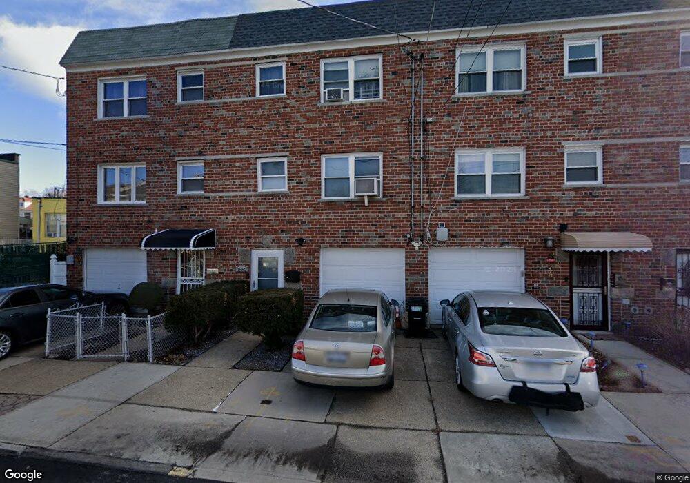
1862 Muliner Ave Bronx, NY 10462
Van Nest NeighborhoodEstimated Value: $620,687 - $688,000
--
Bed
--
Bath
1,528
Sq Ft
$437/Sq Ft
Est. Value
About This Home
This home is located at 1862 Muliner Ave, Bronx, NY 10462 and is currently estimated at $668,172, approximately $437 per square foot. 1862 Muliner Ave is a home located in Bronx County with nearby schools including P.S. 083 The Donald Hertz School, Icahn Charter School 2, and Bronx Excellence 2.
Ownership History
Date
Name
Owned For
Owner Type
Purchase Details
Closed on
Apr 12, 2017
Sold by
Massa Jo Ann and Massa Josephine A
Bought by
Lopez Lisandra
Current Estimated Value
Home Financials for this Owner
Home Financials are based on the most recent Mortgage that was taken out on this home.
Original Mortgage
$183,900
Outstanding Balance
$152,569
Interest Rate
4.1%
Mortgage Type
Purchase Money Mortgage
Estimated Equity
$515,603
Create a Home Valuation Report for This Property
The Home Valuation Report is an in-depth analysis detailing your home's value as well as a comparison with similar homes in the area
Home Values in the Area
Average Home Value in this Area
Purchase History
| Date | Buyer | Sale Price | Title Company |
|---|---|---|---|
| Lopez Lisandra | $210,000 | -- |
Source: Public Records
Mortgage History
| Date | Status | Borrower | Loan Amount |
|---|---|---|---|
| Open | Lopez Lisandra | $183,900 |
Source: Public Records
Tax History Compared to Growth
Tax History
| Year | Tax Paid | Tax Assessment Tax Assessment Total Assessment is a certain percentage of the fair market value that is determined by local assessors to be the total taxable value of land and additions on the property. | Land | Improvement |
|---|---|---|---|---|
| 2025 | $5,378 | $27,475 | $5,667 | $21,808 |
| 2024 | $5,378 | $26,777 | $5,003 | $21,774 |
| 2023 | $5,130 | $25,261 | $5,444 | $19,817 |
| 2022 | $4,758 | $29,220 | $7,500 | $21,720 |
| 2021 | $4,818 | $30,660 | $7,500 | $23,160 |
| 2020 | $4,846 | $28,680 | $7,500 | $21,180 |
| 2019 | $4,668 | $23,880 | $7,500 | $16,380 |
| 2018 | $4,291 | $21,051 | $7,131 | $13,920 |
| 2017 | $3,402 | $19,860 | $7,500 | $12,360 |
| 2016 | $2,430 | $19,080 | $7,500 | $11,580 |
| 2015 | $1,835 | $20,280 | $8,340 | $11,940 |
| 2014 | $1,835 | $20,280 | $8,340 | $11,940 |
Source: Public Records
Map
Nearby Homes
- 1869 Muliner Ave
- 1904 Bronxdale Ave
- 928 Rhinelander Ave
- 1925 Bogart Ave
- 1916 Barnes Ave
- 953 Rhinelander Ave
- - Morris Park Ave
- 1907 Barnes Ave
- 1858 Wallace Ave
- 868 Morris Park Ave
- 848 Morris Park Ave
- 845 Kinsella St
- 930 Morris Park Ave
- 1914 Holland Ave
- 867 van Nest Ave
- 1004 Rhinelander Ave
- 1961 Wallace Ave
- 856 van Nest Ave
- 874 van Nest Ave
- 1831 Paulding Ave
- 1860 Muliner Ave
- 1858 Muliner Ave
- 1864 Muliner Ave
- 1856 Muliner Ave
- 1854 Muliner Ave
- 1873 Bronxdale Ave
- 1869 Bronxdale Ave
- 1879 Bronxdale Ave
- 1875 Bronxdale Ave
- 1867 Bronxdale Ave
- 1852 Muliner Ave
- 1865 Bronxdale Ave
- 1881 Muliner Ave
- 1848 Muliner Ave
- 1848 Muliner Ave Unit 2nd Floor
- 1848 Muliner Ave Unit 1
- 1863 Bronxdale Ave
- 852 Rhinelander Ave
- 850 Rhinelander Ave
- 1846 Muliner Ave