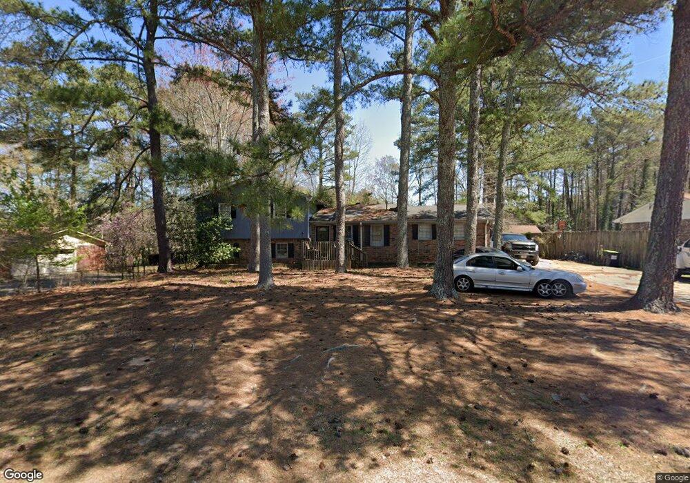
1862 S Gordon Rd Austell, GA 30168
Estimated Value: $229,000 - $318,000
3
Beds
2
Baths
1,587
Sq Ft
$178/Sq Ft
Est. Value
About This Home
This home is located at 1862 S Gordon Rd, Austell, GA 30168 and is currently estimated at $282,766, approximately $178 per square foot. 1862 S Gordon Rd is a home located in Cobb County with nearby schools including Bryant Elementary School, Lindley Middle School, and Pebblebrook High School.
Ownership History
Date
Name
Owned For
Owner Type
Purchase Details
Closed on
Sep 1, 1994
Sold by
Ingram Darius E Kellie
Bought by
Martin Bernard E
Current Estimated Value
Home Financials for this Owner
Home Financials are based on the most recent Mortgage that was taken out on this home.
Original Mortgage
$55,688
Interest Rate
10.5%
Mortgage Type
FHA
Create a Home Valuation Report for This Property
The Home Valuation Report is an in-depth analysis detailing your home's value as well as a comparison with similar homes in the area
Home Values in the Area
Average Home Value in this Area
Purchase History
| Date | Buyer | Sale Price | Title Company |
|---|---|---|---|
| Martin Bernard E | $75,000 | -- |
Source: Public Records
Mortgage History
| Date | Status | Borrower | Loan Amount |
|---|---|---|---|
| Closed | Martin Bernard E | $55,688 | |
| Closed | Martin Bernard E | $8,933 |
Source: Public Records
Tax History Compared to Growth
Tax History
| Year | Tax Paid | Tax Assessment Tax Assessment Total Assessment is a certain percentage of the fair market value that is determined by local assessors to be the total taxable value of land and additions on the property. | Land | Improvement |
|---|---|---|---|---|
| 2025 | $2,363 | $111,172 | $28,000 | $83,172 |
| 2024 | $2,366 | $111,172 | $28,000 | $83,172 |
| 2023 | $1,092 | $76,980 | $16,000 | $60,980 |
| 2022 | $1,637 | $76,980 | $16,000 | $60,980 |
| 2021 | $1,386 | $65,488 | $16,000 | $49,488 |
| 2020 | $1,386 | $65,488 | $16,000 | $49,488 |
| 2019 | $1,247 | $59,132 | $11,200 | $47,932 |
| 2018 | $823 | $39,776 | $11,400 | $28,376 |
| 2017 | $799 | $39,776 | $11,400 | $28,376 |
| 2016 | $801 | $39,776 | $11,400 | $28,376 |
| 2015 | $818 | $39,776 | $11,400 | $28,376 |
| 2014 | $824 | $39,776 | $0 | $0 |
Source: Public Records
Map
Nearby Homes
- 1151 S Gordon Rd
- 1784 Brandemere Dr Unit 3
- 1972 Cox Dr Unit 5
- 6445 Sherwood Trail
- 6581 Coventry Point Unit 1
- 1576 S Gordon Rd
- 2072 Woodbine Cir
- 6718 Roscommon Dr
- 6627 Coventry Point
- 6651 Malvin Dr
- 2023 Lee Dr
- 6084 S Gordon Rd
- 1550 Greenbrook Dr
- 0 Maxham Rd Unit 10652291
- 6083 Oak Hill Dr
- 6992 Ivy Pointe Row
- 6243 David Ln SW
- 1766 Blossom Ln
- 1852 S Gordon Rd
- 1872 S Gordon Rd Unit 1
- 6306 Milo Dr
- 6310 Milo Dr
- 1842 S Gordon Rd
- 0 Milo Dr Unit 7359395
- 6470 S Gordon Rd
- 6314 Milo Dr
- 6463 Wanda Ln
- 6440 S Gordon Rd
- 1832 S Gordon Rd
- 6453 Wanda Ln
- 6315 Milo Dr
- 6318 Milo Dr
- 6430 S Gordon Rd
- 1822 S Gordon Rd
- 6322 Milo Dr
- 6323 Milo Dr
- 0 Wanda Ln Unit 7556031
- 6443 Wanda Ln