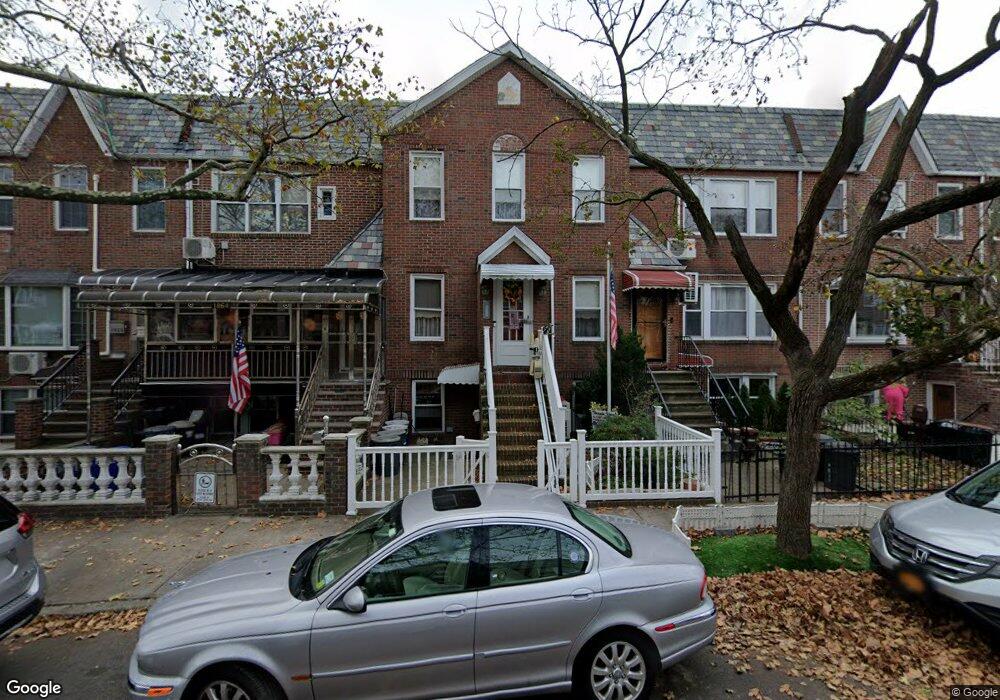
1862 Stuart St Brooklyn, NY 11229
Marine Park NeighborhoodEstimated Value: $952,000 - $1,259,963
--
Bed
--
Bath
2,460
Sq Ft
$429/Sq Ft
Est. Value
About This Home
This home is located at 1862 Stuart St, Brooklyn, NY 11229 and is currently estimated at $1,055,241, approximately $428 per square foot. 1862 Stuart St is a home located in Kings County with nearby schools including PS 222 Katherine R Snyder, J.H.S. 278 Marine Park, and James Madison High School.
Ownership History
Date
Name
Owned For
Owner Type
Purchase Details
Closed on
Nov 5, 2006
Sold by
Billeci Julia
Bought by
Berger Patricia and Bosco Julie Ann
Current Estimated Value
Create a Home Valuation Report for This Property
The Home Valuation Report is an in-depth analysis detailing your home's value as well as a comparison with similar homes in the area
Home Values in the Area
Average Home Value in this Area
Purchase History
| Date | Buyer | Sale Price | Title Company |
|---|---|---|---|
| Berger Patricia | -- | -- | |
| Berger Patricia | -- | -- |
Source: Public Records
Tax History Compared to Growth
Tax History
| Year | Tax Paid | Tax Assessment Tax Assessment Total Assessment is a certain percentage of the fair market value that is determined by local assessors to be the total taxable value of land and additions on the property. | Land | Improvement |
|---|---|---|---|---|
| 2025 | $3,675 | $69,780 | $13,260 | $56,520 |
| 2024 | $3,675 | $62,880 | $13,260 | $49,620 |
| 2023 | $3,828 | $66,240 | $13,260 | $52,980 |
| 2022 | $3,672 | $59,160 | $13,260 | $45,900 |
| 2021 | $3,652 | $50,820 | $13,260 | $37,560 |
| 2020 | $1,692 | $55,740 | $13,260 | $42,480 |
| 2019 | $3,193 | $49,140 | $13,260 | $35,880 |
| 2018 | $3,094 | $36,825 | $10,751 | $26,074 |
| 2017 | $3,047 | $36,162 | $10,993 | $25,169 |
| 2016 | $2,791 | $34,140 | $12,702 | $21,438 |
| 2015 | $1,618 | $32,209 | $13,605 | $18,604 |
| 2014 | $1,618 | $30,688 | $11,024 | $19,664 |
Source: Public Records
Map
Nearby Homes
- 2622 Fillmore Ave
- 1837 Burnett St
- 1908 Gerritsen Ave
- 2913 Fillmore Ave
- 1882 Batchelder St
- 1817 Madison Place
- 1848 Haring St
- 3165 Nostrand Ave Unit 1N
- 3165 Nostrand Ave Unit 2L
- 3165 Nostrand Ave Unit 4P
- 3165 Nostrand Ave Unit 4V
- 3165 Nostrand Ave Unit 1H
- 3165 Nostrand Ave Unit 1G
- 3165 Nostrand Ave Unit 1S
- 3165 Nostrand Ave Unit 1P
- 1746 Gerritsen Ave
- 3203 Nostrand Ave Unit 4H
- 3203 Nostrand Ave Unit LB
- 1927 Batchelder St
- 1747 Stuart St
- 1860 Stuart St
- 1864 Stuart St
- 1858 Stuart St
- 1866 Stuart St
- 1856 Stuart St
- 1868 Stuart St
- 1854 Stuart St
- 1870 Stuart St
- 1872 Stuart St
- 1850 Stuart St
- 1861 Gerritsen Ave
- 1857 Gerritsen Ave
- 1865 Gerritsen Ave
- 1855 Gerritsen Ave
- 1876 Stuart St
- 1848 Stuart St
- 1853 Gerritsen Ave
- 1871 Gerritsen Ave
- 1846 Stuart St
- 1878 Stuart St